

In this post, I’ll describe an eventful two days (Nov 25-26) I spent in Mexico city. If you are interested in learning about:
- What to do in Mexico City over a weekend
- How to visit Teotihuacan for less than $15
- Why does Mexico City metro use rubber wheels
- How easy is it to use public transportation in Mexico City?
- Is it true that Mexico City is slowly sinking? If so, why?
- Who were the Mayas and Aztecs and how were they different from each other?
And much, much more, read on! 🙂
I flew to Mexico city from Cancun on Sat morning, arriving in Mexico City around 12:30 PM. The flight time is around 2 hr 30 min, but Mexico City is in a different time zone, 1 hr behind Cancun, so the effective flight time ends up being 1 hr less. I was originally scheduled to fly Friday evening, but missed my flight due to traffic delays and had to spend an extra night in Cancun. Informing my hotel in Mexico City that I missed my flight and would be arriving the next day wasn’t trivial. The hotel concierge wasn’t answering the phone. I sent the hotel a message via Expedia, and they finally acknowledged and confirmed that they’d keep my reservation.
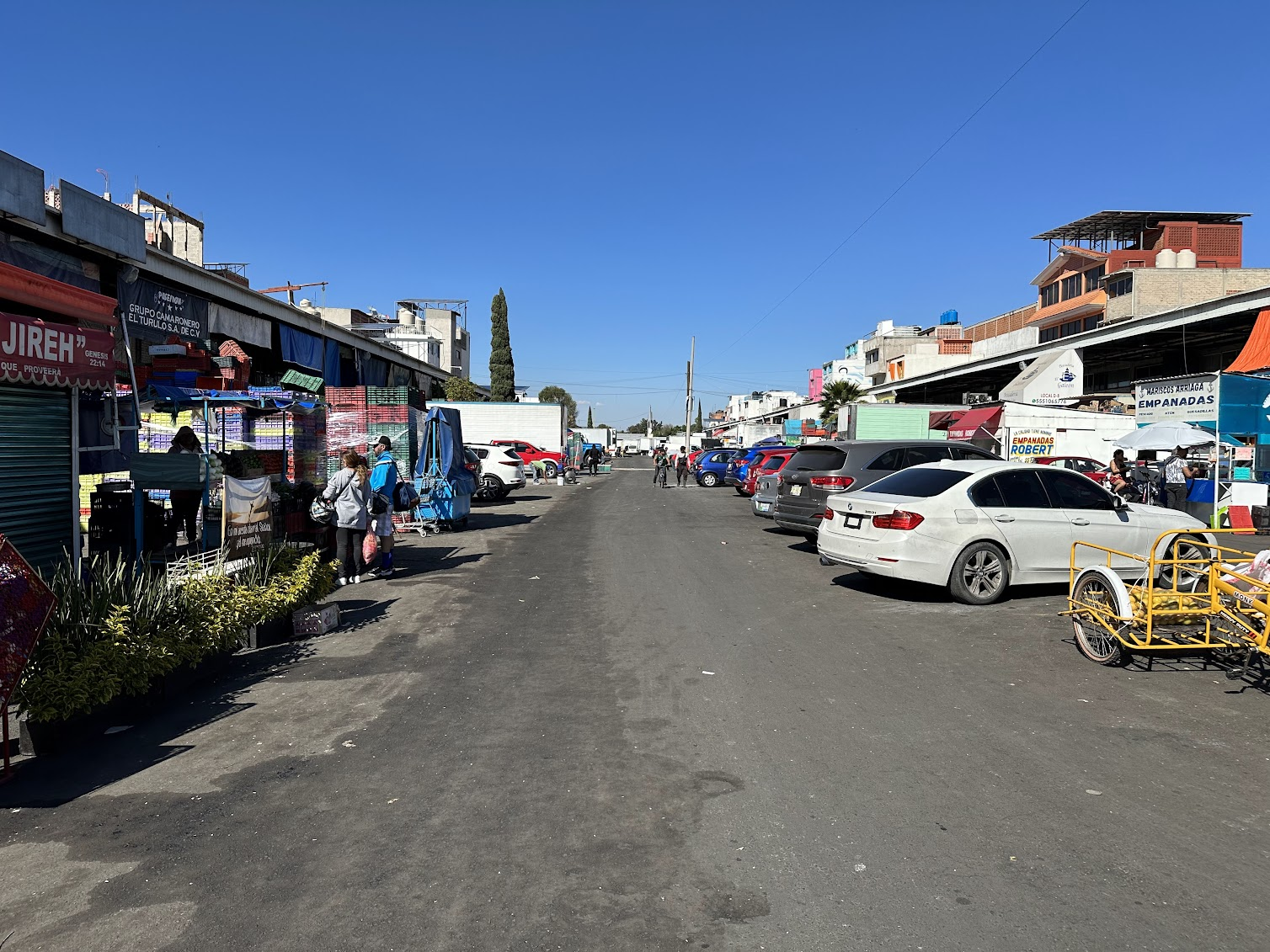
Unlike Cancun airport, which was swarming with spammers, Mexico city airport was much easier to navigate. I was easily able to get an Uber to my hotel, about a 40 min drive to the airport. The Uber cost ~10$. Mexico City is very spread out, but quite clean and orderly. By the time I settled in my room, it was already around 2 PM. I hadn’t eaten all day, so I walked over to a nearby fish market. There were several small stalls serving food, but given my poor Spanish and unsure about the food quality, I ate at a more respectable looking restaurant near the entrance to the fish market. The restaurant staff spoke almost no English so we communicated via Google translate, which is always fun! 🙂
History of Central Mexico and Yucatan
If you have read my other travel blogs, you may be wondering where is the history lesson about Mexico City.. well here goes. I’ll focus on the two regions I visited on this trip–the Yucatan peninsula and Central Mexico, the area around Mexico City. For a detailed history of Mesoamerica (Mexico and Central America), I refer you to this Britannica article.
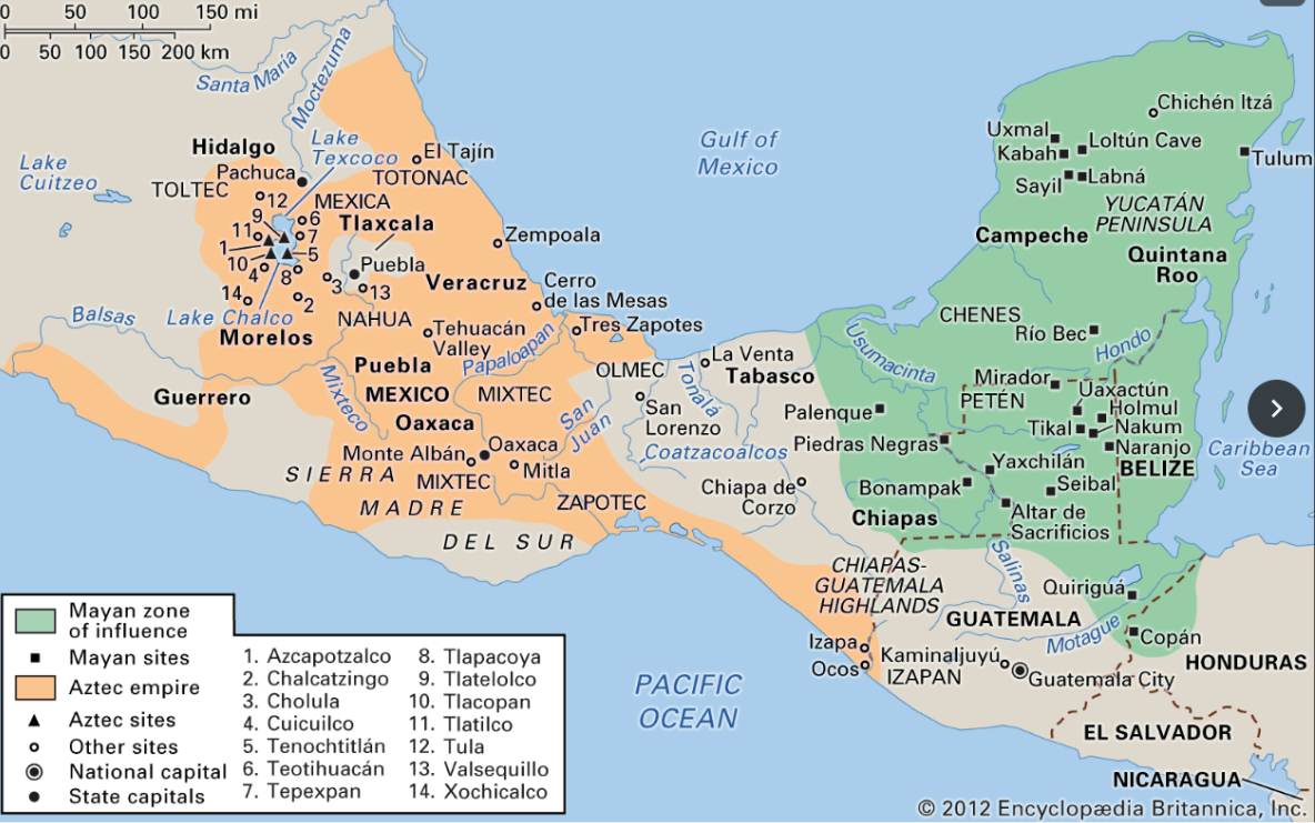
As shown in the map above, the Yucatan peninsula and northern Central America was populated by the Mayas, a literate people who built several city states (eg., Chichen Itza and Coba) that traded with each other but spoke different languages and were never dominated by one state for an extended period of time. There was no Mayan empire, just a common culture shared across a large region (similar to European Union of present day). The shared culture included food crops–maize, corn, beans, squash; sports (a ball game described in more detail below), human sacrifice (sad but true), and architectural style (massive Pyramids).
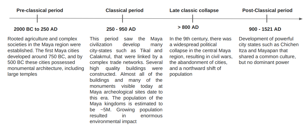
A very brief timeline of the Mayas is shown below.
Let’s now turn to Central Mexico. From ~200 BC to 550 AD, this region was under the influence of the city state of Teotihuacan. The people of Teotihuacan built the most architecturally significant Mesoamerican pyramids built in the pre-Columbian Americas, namely the Pyramid of the Sun and the Pyramid of the Moon. At its zenith, (1 AD to 500 AD), Teotihuacan was the largest city in the Americas, with a population estimated at 125,000 or more. Its influence was felt throughout Mesoamerica including in the Maya region. Teotihuacan collapsed in the mid 6th century, probably due to weather changes caused by massive volcanic eruptions that lowered temperatures by ~3C all over the world. The fall of Teotihuacan was followed by the rise of several small political centers such as Xochicalco and Tula that competed for control.
Ultimately, Central Mexico came to be dominated by the Aztec state founded by the Mexicas, a nomadic people from Northern Mexico who settled around lake Texcoco (where modern day Mexico city is located today) and rose to prominence as fierce warriors. After a period of inter-fighting and complex dynastic alliances, a triple alliance of the city states surrounding lake Texooco–Tenochtitlan, Texcoco, and Tlacopan emerged, which eventually became dominated by Tenochtitlan, ruled by the Mexicas. The Aztec empire slowly dominated the entire region, including the Mayan region
So, to recap–three important things to remember about the Mayas and Aztecs are:
- The Mayas lived in the Yucatan peninsula and northern Central America, while the Aztecs lived in Central Mexico, centered around today’s Mexico City
- The Mayan civilization existed for thousands of years, with ups and downs. The Aztecs were relative newcomers, and became dominant much later ~1200 AD
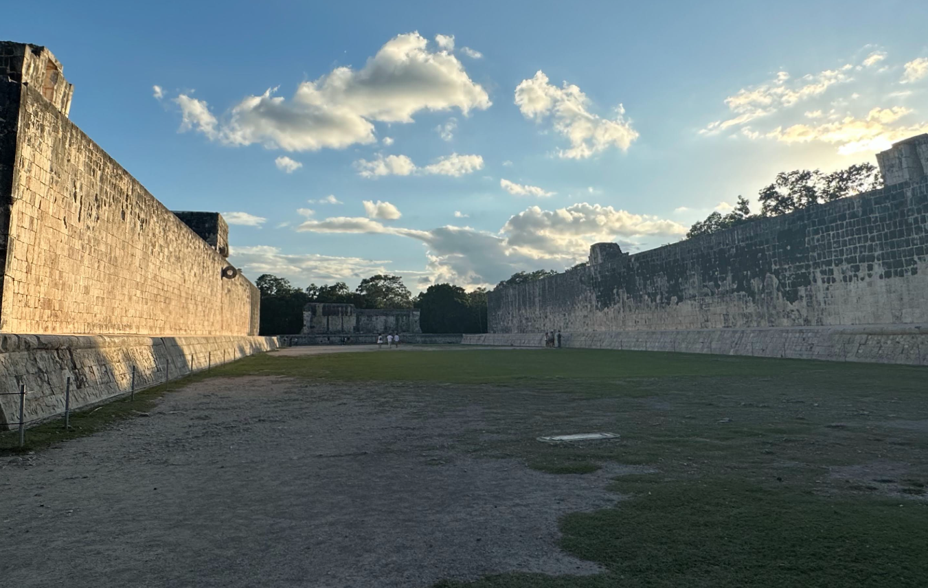
- Mayan civilization was never a fully consolidated empire, rather a collection of city states with a common culture. The Aztecs were an empire ruled from their capital Tenochtitlan (modern day Mexico City), that dominated kingdoms around Mexico City to various degrees and demanded tribute. The Aztecs and the Mayas shared cultural elements as well–eg., sports (the ball game described in more detail below), pyramid building, ritual human sacrifice etc.
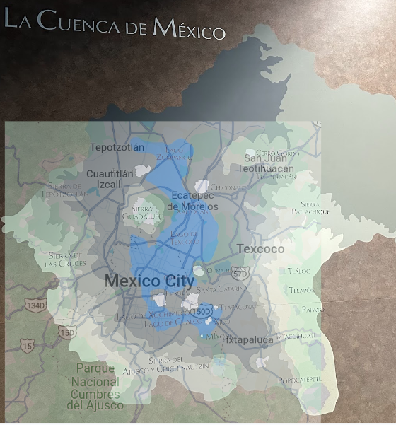
Another important thing to know about Mexico City is that it sits on a dried up bed of a series of interconnecting lakes, the largest of which was lake Texcoco in pre-Columbian times. In fact, Tenochtitlan, the Aztec capital was a water-bound city, located on several islands on this lake. After the Spanish conquest in 1521, the lake was slowly drained. As a result, the ground under Mexico City is mostly soft clay, subject to subsidence. This explains the lack of tall buildings and rubber wheels on Mexico City metro trains (as you’ll read later). Below, I present an overlay of modern Mexico City on a picture of the pre-Columbian lake from the National Museum of Anthropology (described below). I created the overlay by matching the location of certain geographical features between the two pictures–eg., Mount Cerro Gordo, to the north of Teotihuacan, and Xochimilco, and making the map of modern Mexico City 50% transparent, so the layer underneath is visible.
Hopefully this historical context is interesting. I’m astonished by how little I knew about the history of the region and how much I learnt during this visit. Back to my trip now.
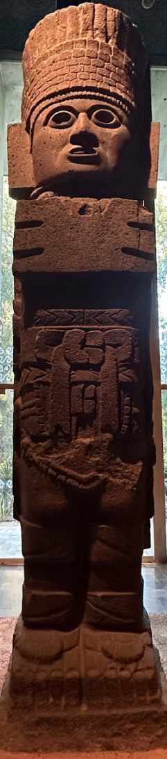
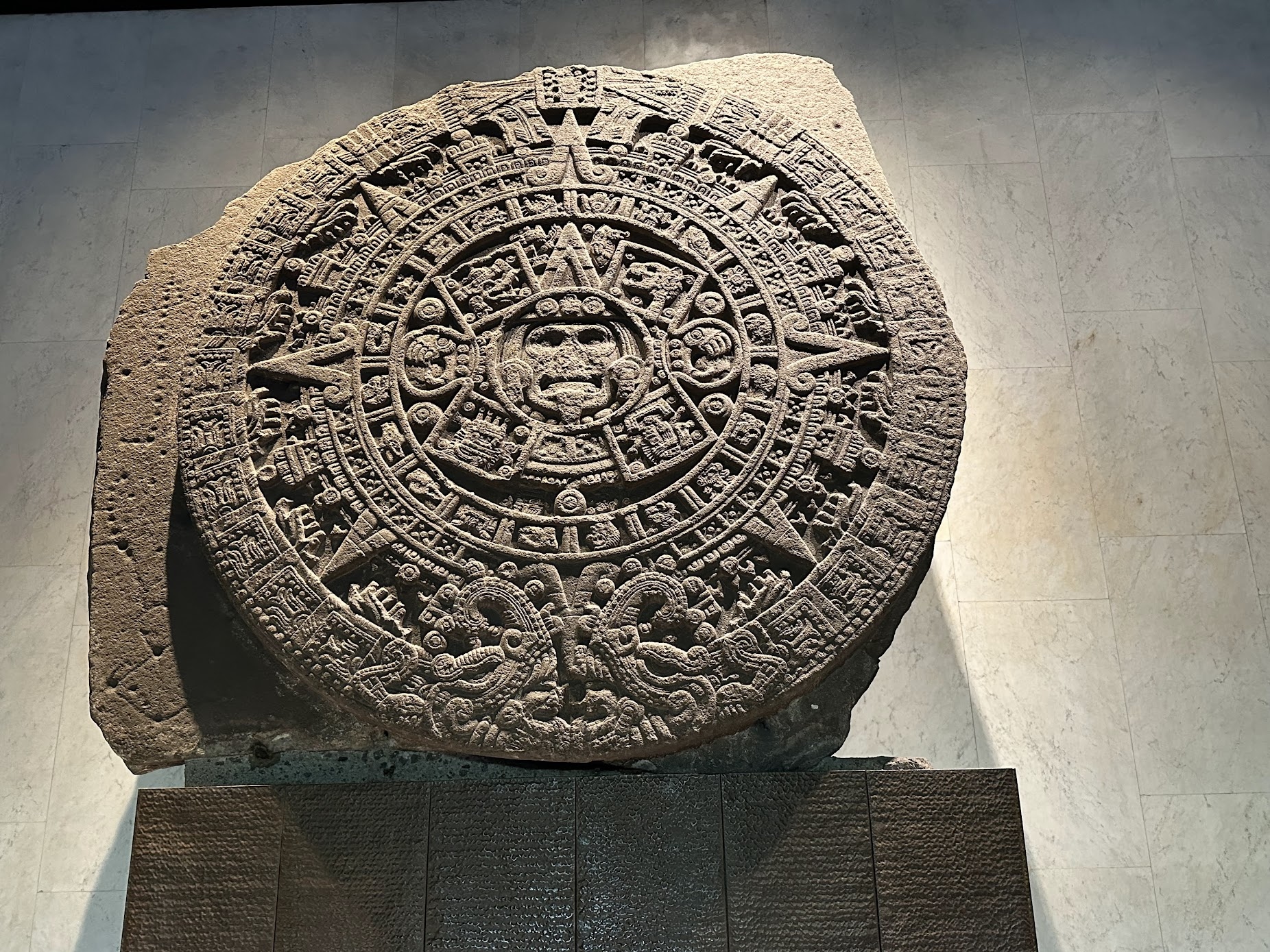
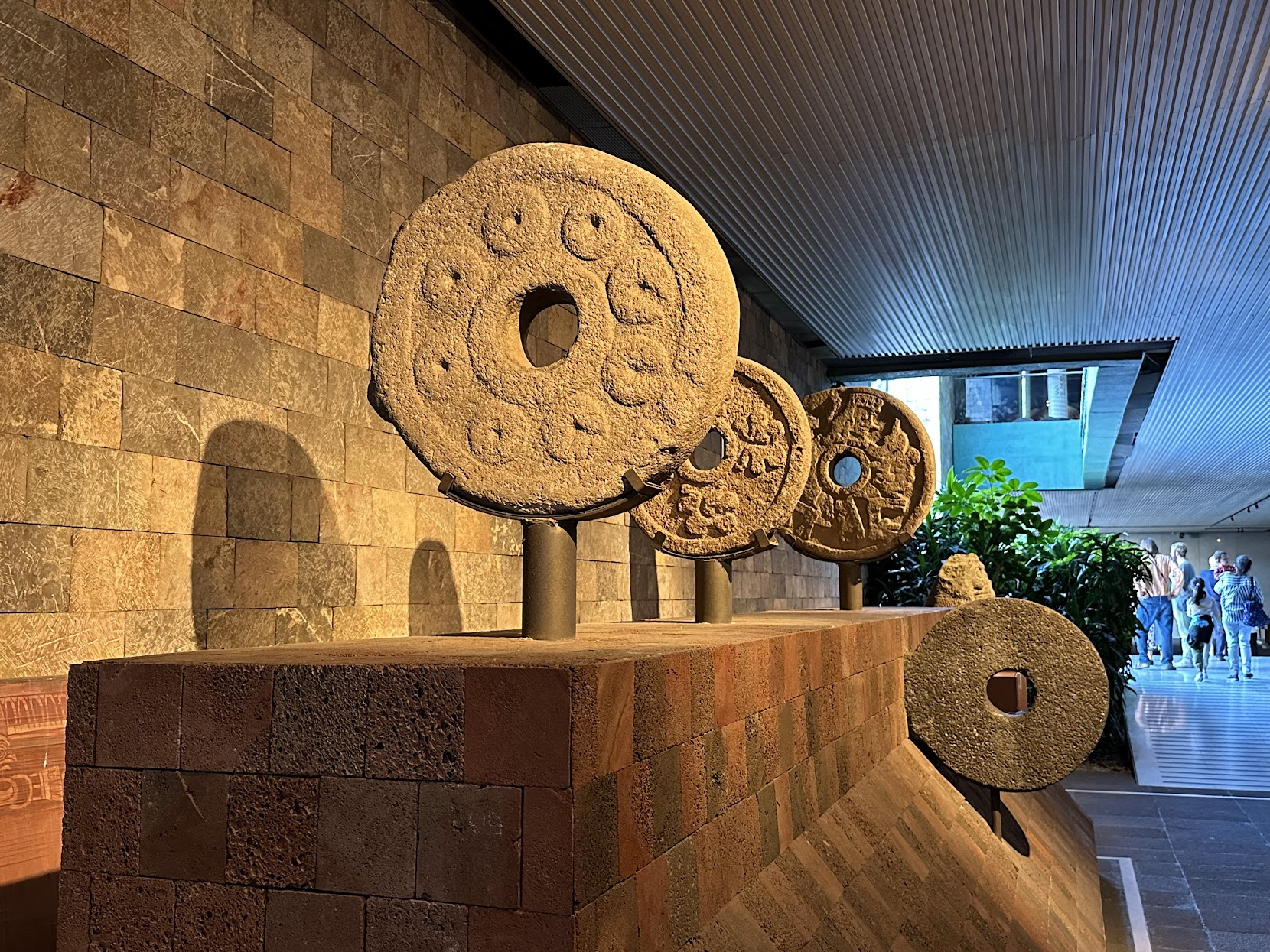
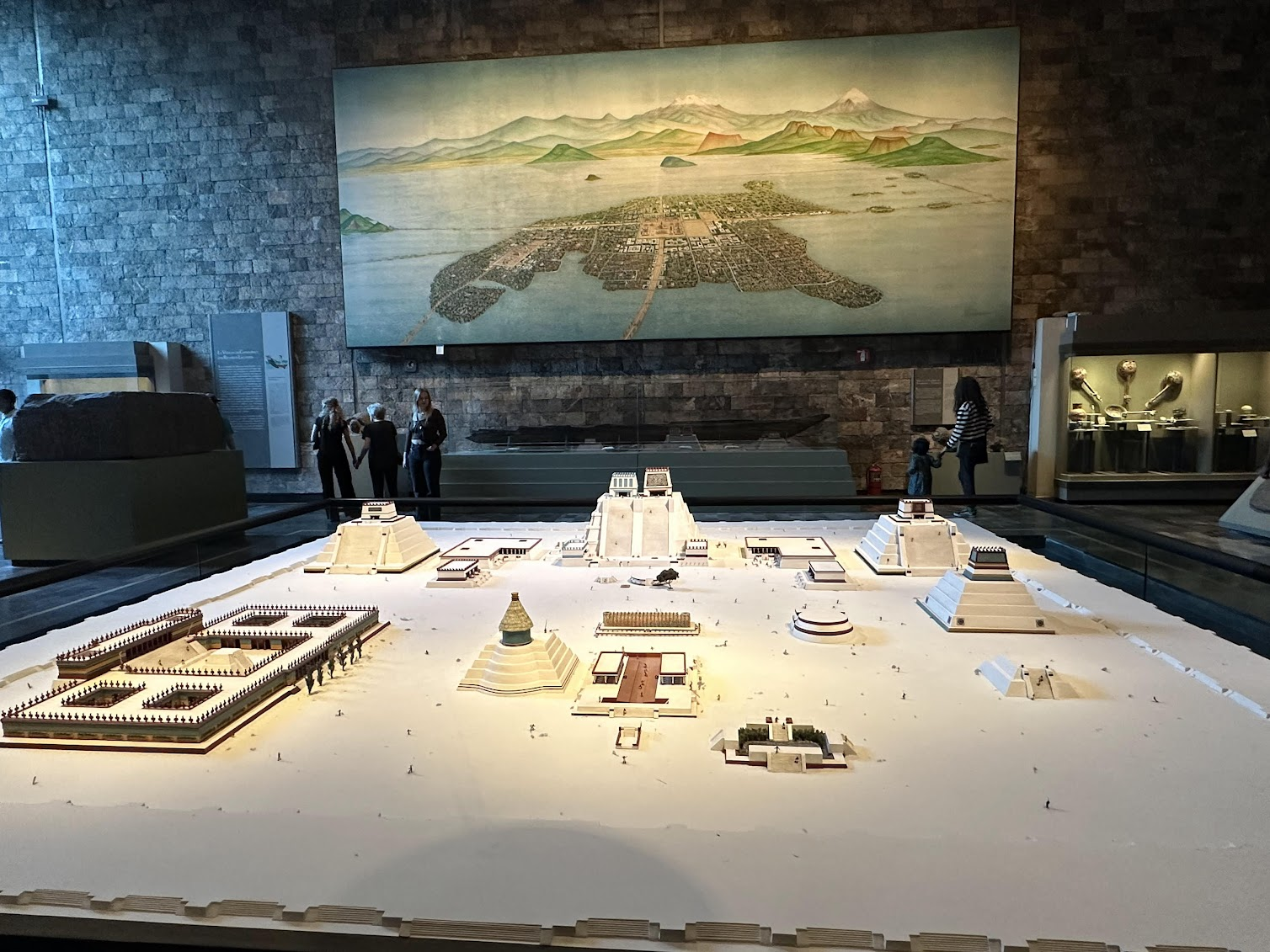
National Museum of Anthropology Visit
Since there wasn’t that much time left in the day, I decided to visit the National Museum of Anthropology, the world’s largest collection of ancient Mexican art. The museum is built around a large courtyard; the rooms to the right show the cultures that developed in Central Mexico and are organized in chronological order. As you make your way around counter-clockwise you get a feel for how the cultures changed over time, starting from bronze and iron age cultures, through the empires of Teotihuacan and Toltecs and culminating in the Mexica (Aztec) exhibit. On the left of the courtyard are halls devoted to other cultural areas of Mexico. The Oaxaca and Maya halls are particularly impressive. The museum is quite extensive, so you should devote at least an hour and half for it. A history buff like me should plan for more. A tour of the museum is a great way to get acquainted with the broad sweep of pre-Columbian history of Mexico.
I found it interesting that almost the entire museum is devoted to pre-Columbian history of Mexico. I saw only one information display about Hernan Cortez’s defeat of Montezuma, the last Aztec emperor. The display briefly describes the events that led to the unlikely victory of a small band of Spanish sailors, merchants and mercenaries over the mighty Aztec empire in a neutral and factual way, neither rejoicing in the victory of the Spanish, nor portraying them as greedy, marauding invaders who vanquished an awestruck people, equipped only with bronze age weaponry, with deceit and guile. This seems to be the way present day Mexicans many of who are of mixed European and Indigenous American ancestry, consider their history. The Spanish came, defeated the native Americans and settled here. Eventually in 1821, Mexico gained independence from Spain and went its own way. The native Americans are not treated as victims, nor are the Spanish demonized as rapacious conquerors. There are no native American reservations in Mexico.
This is quite in contrast with how things turned out in North America. British and French colonization of modern day United States and Canada started nearly 100 years after the Spanish and Portuguese were already established in Central and South America. In Central and South America, a relatively small number of Spanish and Portuguese settlers were able to defeat the Incas, Aztecs and other native American kingdoms and quickly established themselves at the apex of an exploitative system, where most of the native American population worked as laborers for the Spanish overlords. In North America, the English and the French had a much more difficult time establishing themselves and were never able to exploit the native American tribes for labor on a large scale. This meant that the European rulers had to induce poor Europeans to immigrate to provide the labor pool (before importation of slaves from Africa began on a large scale). The inducement was generally a free plot of land with ownership rights in exchange for a transatlantic voyage ticket and few years of indentured labor. While also exploitative, this system did eventually result in the emergence of a large class of scrappy, land-owning free Europeans who began advocating for a representative, constitutional, rules-based system that guaranteed their property rights, ensured representation in the government and protected against arbitrary taxation. It likely helped that the British already had some level of representative government through an elected parliament when the colonization of North American began, while the Spanish and Portuguese were firmly entrenched monarchies with no history of representative government. This fundamental difference in their origin led to diverging trajectories for the Spanish and English speaking parts of the American continent, which is quite evident today.
After the museum tour, I took a taxi to a restaurant in the Hipodromo Condesa neighborhood, which I had passed through on the way to the museum and that looked hip. The food was ok and a bit overpriced. The neighborhood was a very nice part of town, clean, green, full of young people.. After dinner, I walked around a bit and ducked into a grocery store to buy some yogurt, protein bar (proved quite hard to find!) and other items.
Templo Mayor and Teotihuacan
The next day (Sunday) was my only full day in Mexico City, as I was flying back to NYC early Monday morning, and I wanted to make the most of it. I started with a tour of Templo Mayor, one of the most important religious and public buildings in Teochtitlan.
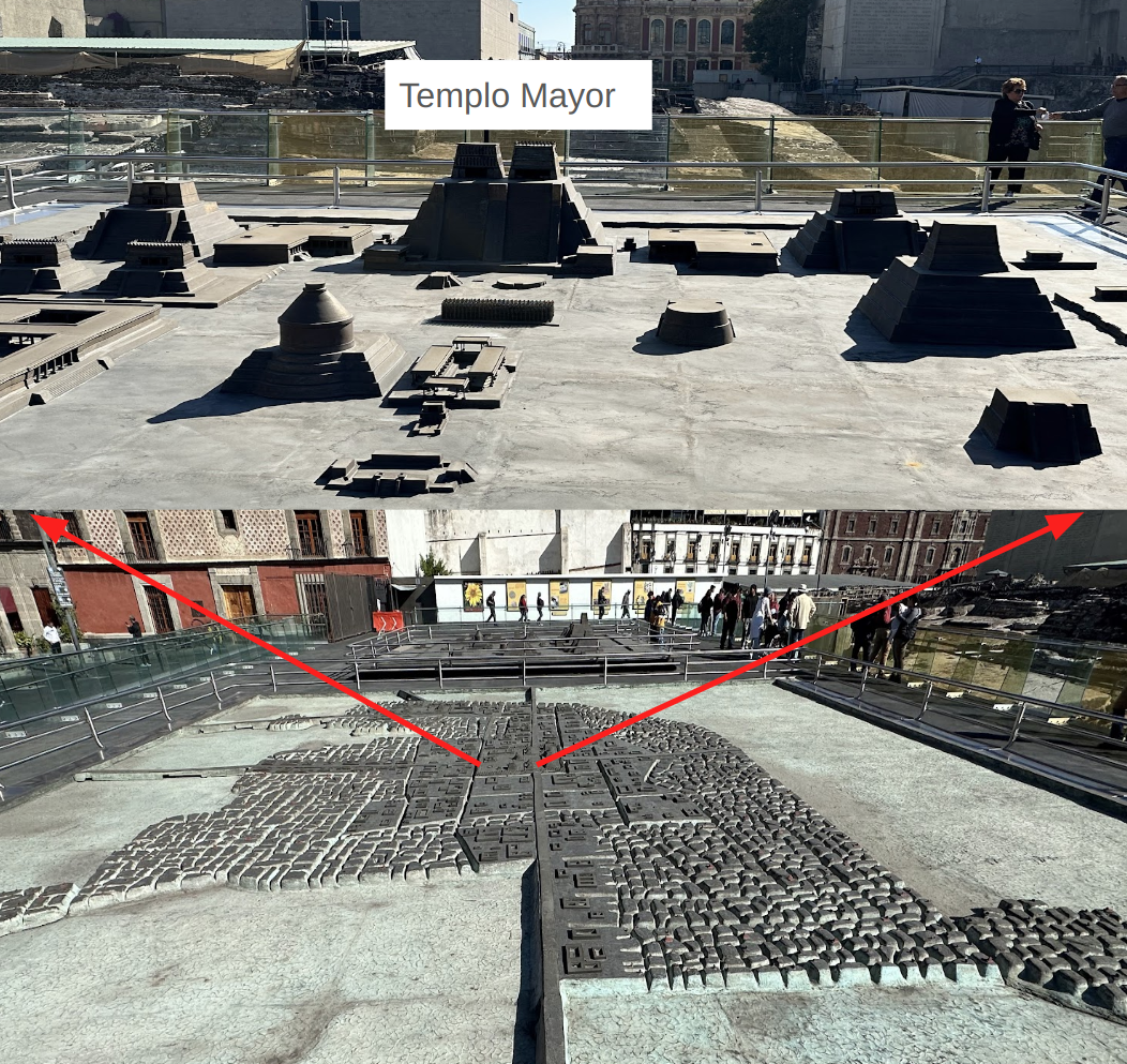
As mentioned above, Mexico City of today is the successor of Tenochtitlan, the Aztec capital which was located on a group of islands on Lake Texcoco. It was almost completely destroyed by the Spanish in the 1521 siege of Tenochtitlan and subsequently redesigned and rebuilt in accordance with the Spanish urban standards. Unlike in Cusco, Peru, where many of the Spanish buildings were built on top of the previous Inca structures, and the original Inca foundations can still be seen, hardly any of the original Aztec architecture survives in Mexico city today, because most of it was dismantled and used as building material for Spanish buildings.
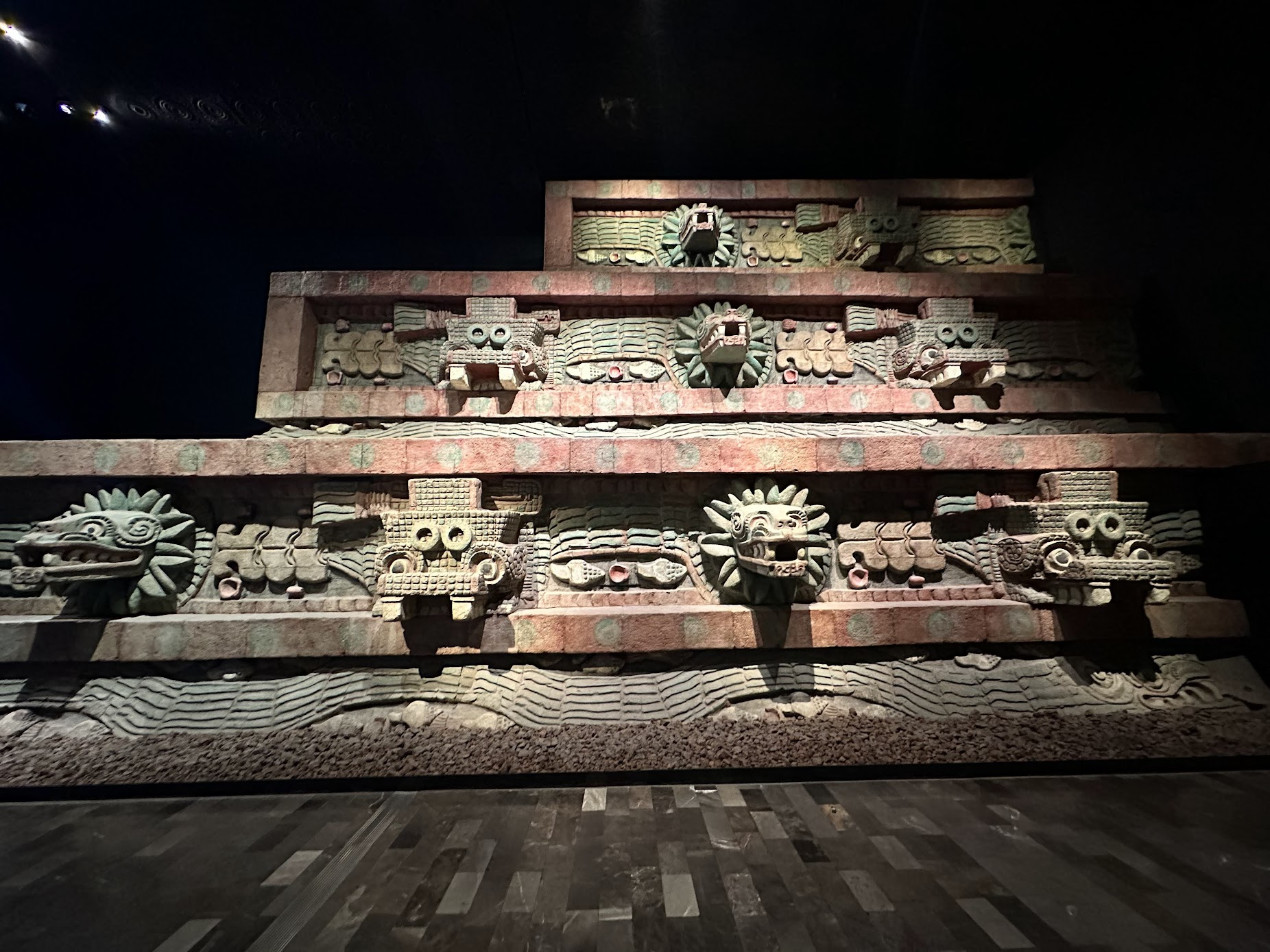
The Templo Mayor (Main Temple) is one site where the remains of the Main Temple, one of the most prominent buildings in Tenochtitlan, can be seen. The temple is dedicated simultaneously to Huitzilopochtli, god of war, and Tlaloc, god of rain and agriculture, each of which had a shrine at the top of the pyramid with separate staircases leading up to each shrine. As was customary throughout central American cultures, the temple was expanded in layers 6 times, to reflect the expanding Aztec empire. Each new layer were built over the previous ones. The first layer was built sometime around 1325.
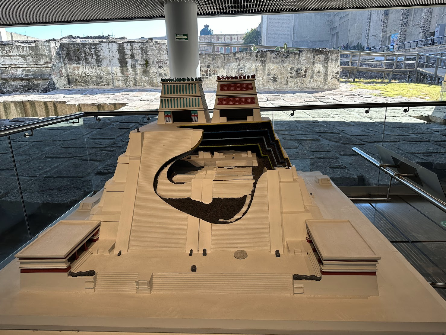
The site of the temple is right next to the Mexico City Cathedral built in sections from 1573 to 1813 shortly after the Spanish conquest of Tenochtitlan. Initially it was thought that the Cathedral was built over the ruins of the temple. However excavation work in the late 19th and early 20th century revealed that the temple was actually located next to the cathedral, under some colonial and upper-class residential buildings. Over time, more of the temple was excavated and the residential buildings were eventually demolished. Today, large parts of the temple have been excavated and open for public viewing. Many of the delicate artifacts uncovered during the excavation are now housed in the Templo Mayor Museum, located next to the temple site. The museum also has interesting information about how the temple was built, and where the building material came from. The temple was built of earth, lime, sand and volcanic stone, Most of this material came from places near the city and transported via canoes to the island where the temple stood. The lime used in the mortar to bind the building stones and to plaster the floor and walls didn’t come from a volcanic context, and must have been obtained from other places. Studies have confirmed that the lime came from Tula, in modern day state of Hidalgo. The Aztecs summoned surrounding tributary towns to contribute materials and labor for remodeling the temple.
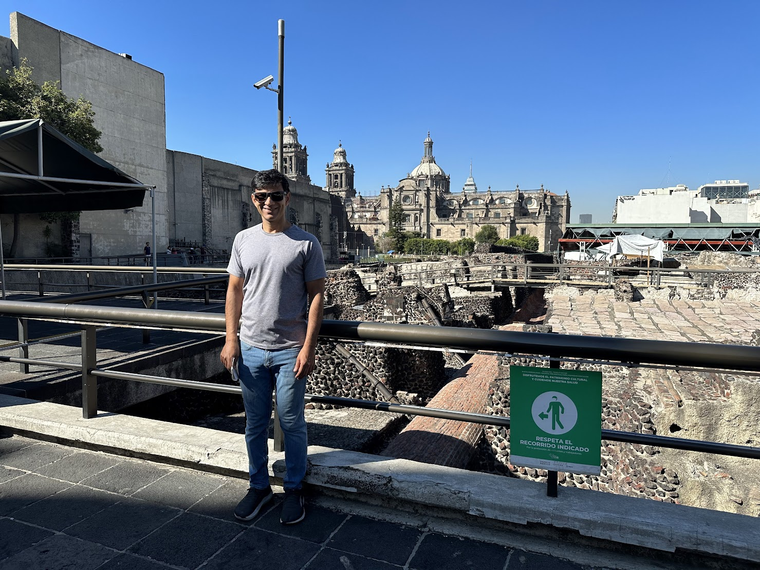
I stood by the railing overlooking the temple ruins with the cathedral in the background, struck by the significance of the site–a crossroad of history where the old world met the new and was brought to a sudden, dramatic end. Coincidentally, I had been listening to a series about the fall of the Aztecs on “The Rest is History”, one of my favorite history podcasts and just learnt about Hernan Cortes’s daring journey to the heart of the Aztec empire and how he and his gang of rag tag Spanish mercenaries overpowered one of the mightiest empire in Mesoamerica. It felt quite poignant to be standing on the ground where all those events played out and changed the course of history.
On the way to Templo Mayor, I took the Mexico City metro. A friend who has been living in Mexico for the last month or so, mentioned that the metro in Mexico city is clean, efficient and tourist friendly. I was a bit reluctant to use the subway because my Spanish is very poor, but decided to try it on the way to Templo Mayor. The metro turned out to be just the way my friend described it. Buying a metro card and putting money on it was easy, the stations are clean (specially compared with NYC) and easy to navigate and the trains run frequently (every 3-4 minutes, even on a Sunday!).

Some facts about Mexico City metro: The system has 12 lines, serving 195 stations (~400 for NYC metro). Ten of the lines are rubber-tired. Instead of traditional steel wheels, they use pneumatic traction, which is quieter and rides smoother in Mexico City’s unstable soils. I definitely noticed that the trains are a lot quieter than NYC subway trains!
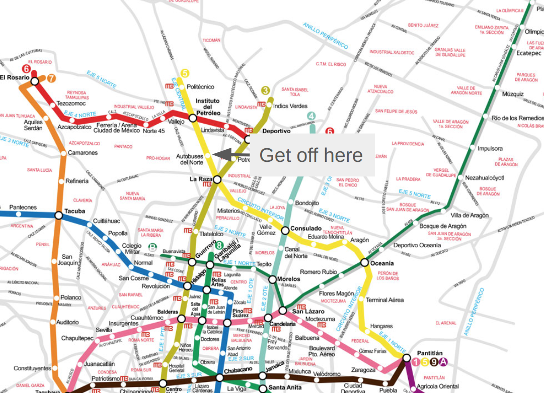
The next stop on my itinerary was Teotihuacan, one of the most popular sites near Mexico City. As mentioned above, Teotihuacan flourished as one of the first urban societies in the Americas for nearly a millennium until its decline in the 6th century AD. Its influence was felt all over central Mexico, including in the Maya world. Scholars estimate that close to 200,000 people lived in the city at its peak. The site’s primary monuments include the Pyramid of the Sun, the Pyramid of the Moon, Temple of Quetzalcoatl and the ancient avenue that connects them, called the Avenue of the Dead. The site is located about 50 Km from Mexico City, and a round trup taxi ride would have cost me 1900 pesos (~110$). With my newfound confidence in using the metro, I decided to take public transportation instead.
From the Zocalo station, I took the metro to Autobuses del Norte station on the yellow line (see map below). From the station, I walked through an underpass to a bus station across the street. From there, I had to take a bus to Teotihuacan. I asked a security guard where to buy the ticket and he pointed me to the ticket counter. I bought a round trip ticket for 120 pesos and walked over to the platform, where the bus was already boarding. The whole process was pretty easy. The buses leave every hour (I think), so you should plan accordingly.

The bus stopped at a few stops along the way, and it took about 45 min to get to Teotihuacan. From the bus stop (Puerta 2 on the map below), it was a 10 min walk to the ticket counter for Teotihuacan. Many people approached me to sell tickets for various random things, don’t pay any heed, only buy tickets from the official ticket counter. The total journey time from Zocalo to Teotihuacan was about 1 hr 20 min. I arrived around 1 PM and the sun was beating down hard. I cursed myself for again forgetting to bring a hat, which is a pattern for me.. I have 4 hats now at home, each bought on a different trip. I keep forgetting to bring them along when I travel!
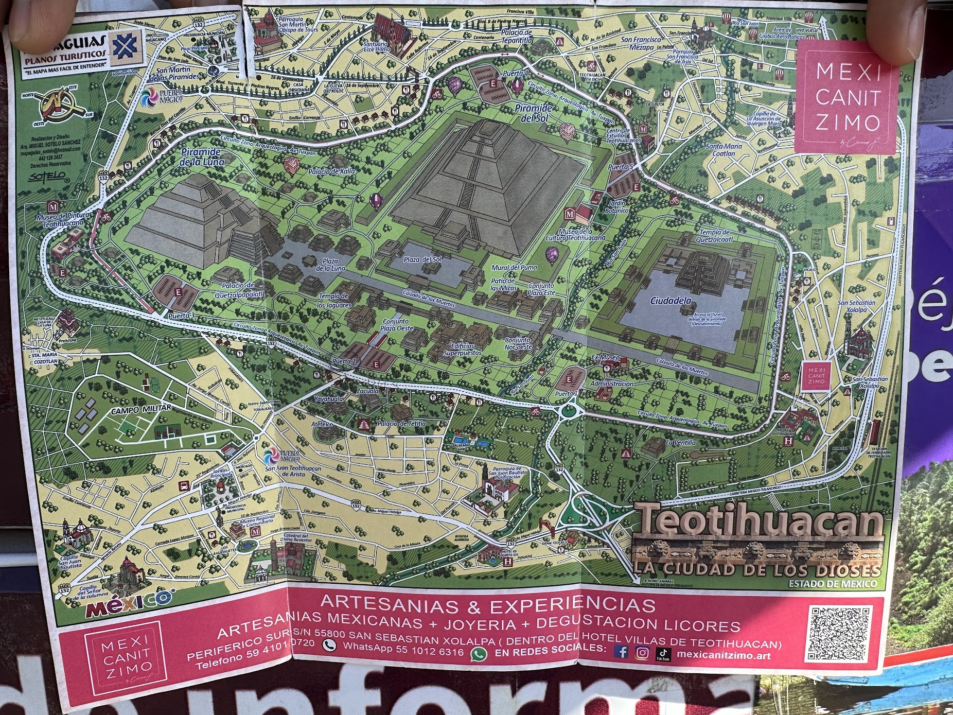
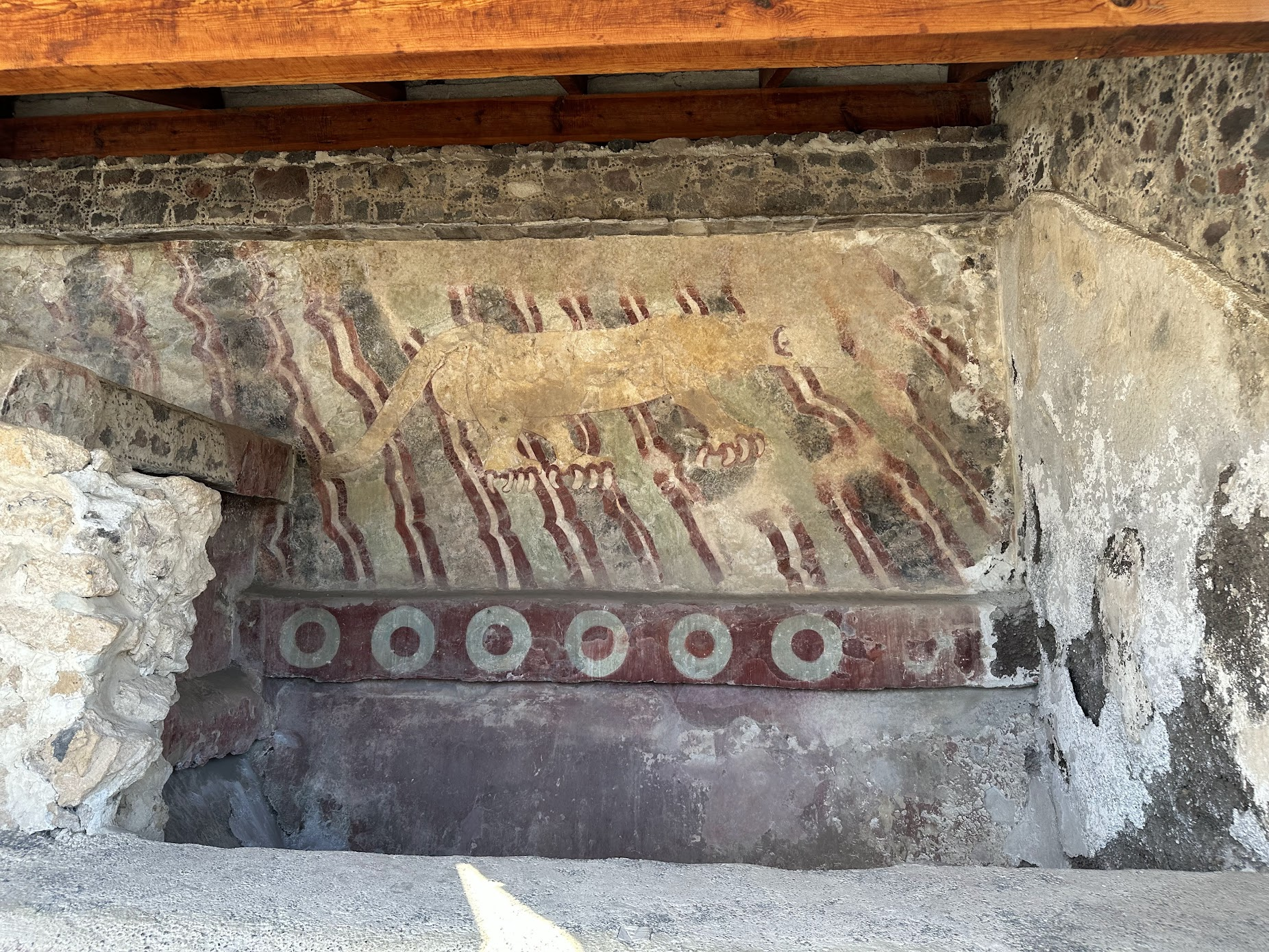
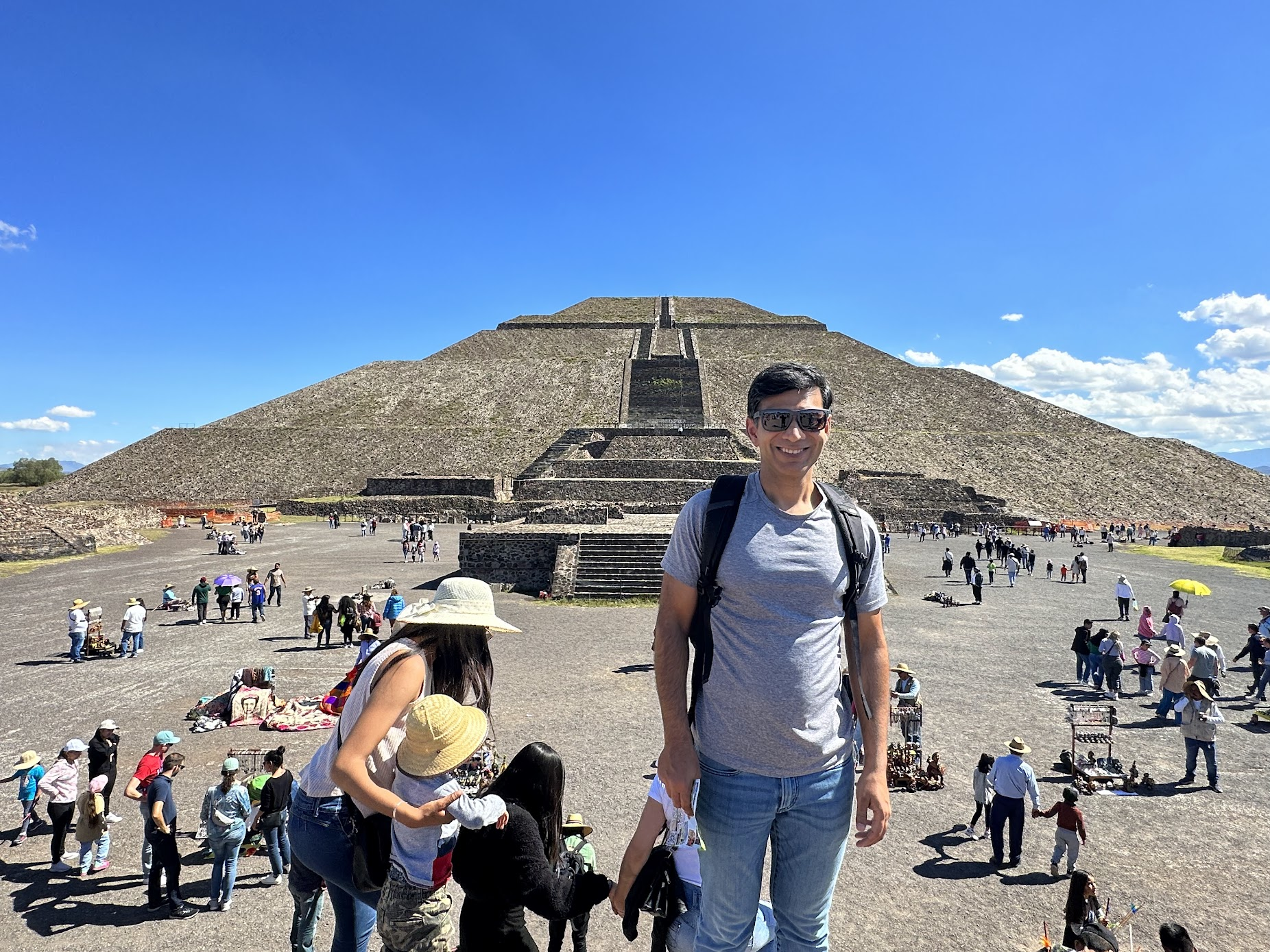
The first building I saw was the Pyramid of the Sun, the largest building in the complex. The pyramid is split into 4 sections each separated by a large terrace. A central staircase runs along the middle of each side from top to bottom. The top is flat, and (according to wikipedia) used to host an altar, which no longer survives. The pyramid was built around 200 AD. It stands about 225 m across and 75 m high (just about half the height of the great pyramid at Giza). The Teotihuacans finished the pyramid with lime plaster imported from surrounding areas, on which they painted brilliantly colored murals. The plaster and murals on the pyramids are no longer visible, however mural remnants can be found on some of the structures nearby (see picture below). This reminded me of the pyramids at Giza that I visited in May this year. They were also originally covered by a layer of white limestone which was stripped away over time to be used as construction material for other projects. The top of the pyramid of Khafre still retains the limestone casing.
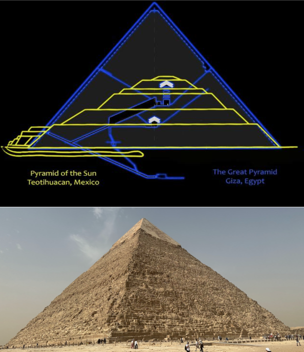
It is interesting that the ancient Egyptians and the Mesoamericans, civilizations separated by ~1500 years and who never knew about each other, chose the same basic shape–a pyramid to build massive monuments. Perhaps the simplicity and beauty of the perfect symmetry of a pyramid appeals to all humans! The Mesoamerican pyramids, while impressive, also shine a light on the achievement of the ancient Egyptians. Their pyramids were twice as tall, built out of solid granite, nearly 2000 years earlier!
The name Pyramid of the Sun comes from the Aztecs, who visited the city of Teotihuacan centuries after it was abandoned; the name given to the pyramid by the Teotihuacanos themselves is unknown. After staring at the pyramid for a few min and being amazed at its size and the sheer amount of work it must have taken to build it, I walked around the pyramid. There are several ruins around the pyramid as well, which likely had a religious purpose, but isn’t known for sure. We don’t even know for sure the purpose of the pyramid itself–the people who built it haven’t left any written records. According to wikipedia, some tunnels have been found underneath the temple, but their purpose isn’t clear either.
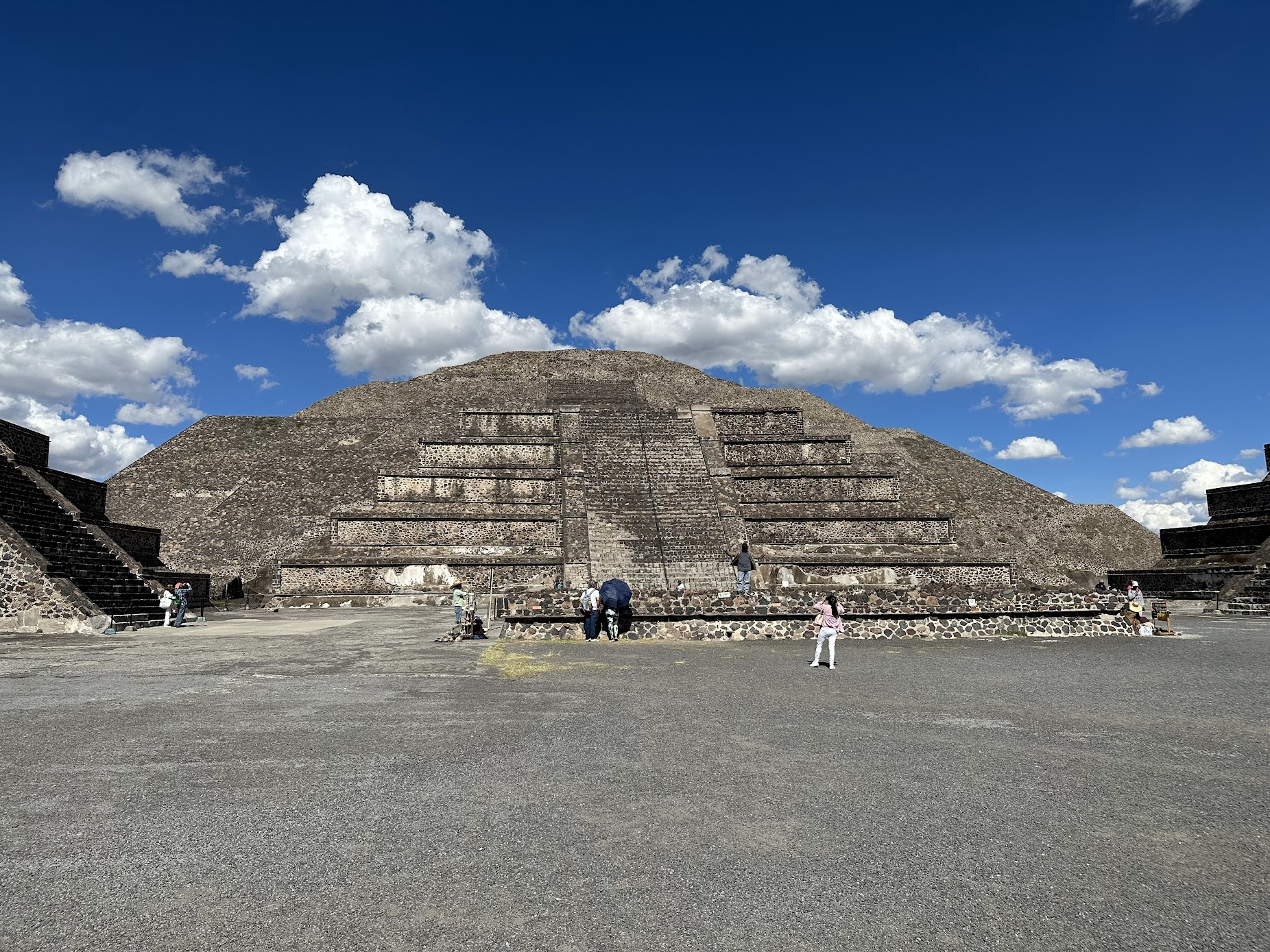
Next up, I walked over to the Pyramid of Moon, located about 1/3 Km to the north from the Sun Pyramid along the avenue of the dead. The Pyramid of the Moon was likely built around 250 AD and is smaller than Pyramid of the Sun. The pyramid may have been used for ritual worship, recent excavations near the base of the pyramid staircase have uncovered the tomb of a male skeleton with numerous grave goods of obsidian and greenstone, as well as sacrificial animals
There are smaller raised structures around the Pyramid of the Moon and all along the avenue of the dead. It was allowed to climb up on one of these structures. I did so an recorded the video below, that provides a nice overview of the area.
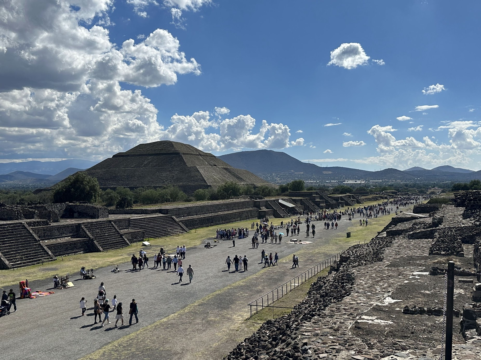
Next, I walked along the avenue of the dead to “The Citadel”, the administrative nerve center of the city of Teotihuacan. This site was the location of the city’s main marketplace, where production and local and external commercial and trading activities were carried out. Teotihuacan’s administrative buildings were likely located here as well. The video below is taken from a raised platform near one end of this site and shows how the area looks like. You can also see the Pyramid of the Sun in the distance.
It is about a 1.2 km walk from the Pyramid of the Sun to the Citadel and you have to go up and down several steps along the way, so carry plenty of water. While there are lots of hawkers selling various souvenirs along the way, I didn’t see anyone selling water or refreshments.
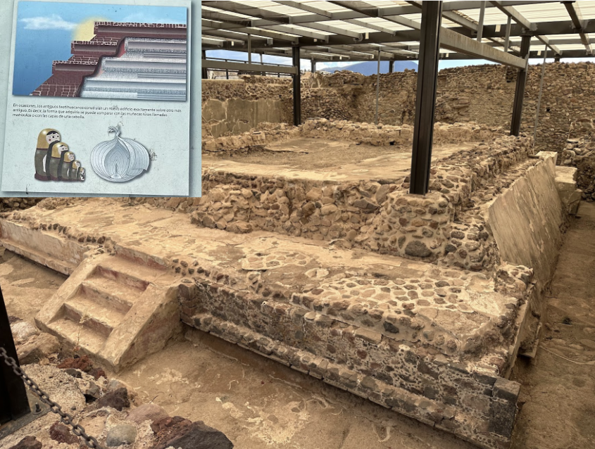
Like many other Mesoamerican buildings, the structures at Teotihuacan were also built like nested doll with previous construction covered with dirt and stone and a new layer added on top. On the way back, I toured one of the buildings that was excavated to reveal some of the underlying layers and architectural elements that comprised the previous construction phases.
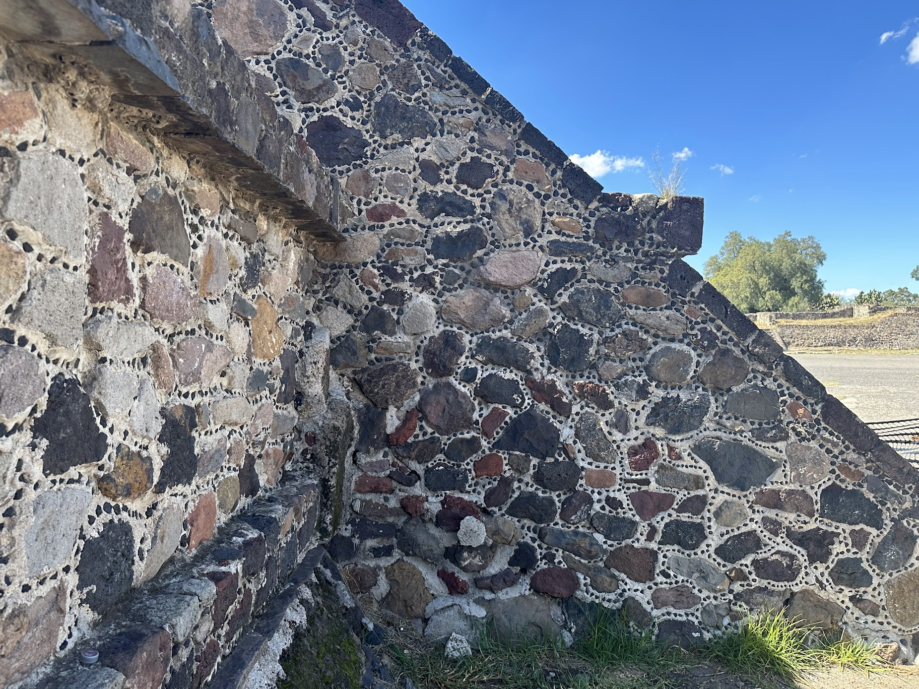
I noticed small stones embedded into the plaster between stones that form most of the structures at Teotihuacan. Its not clear if these stones were added as an aesthetic element or had some other purpose–perhaps to add strength and stability to the structure. A web search is not revealing anything that sheds light on the purpose of these stones. If anyone knows, let me know!
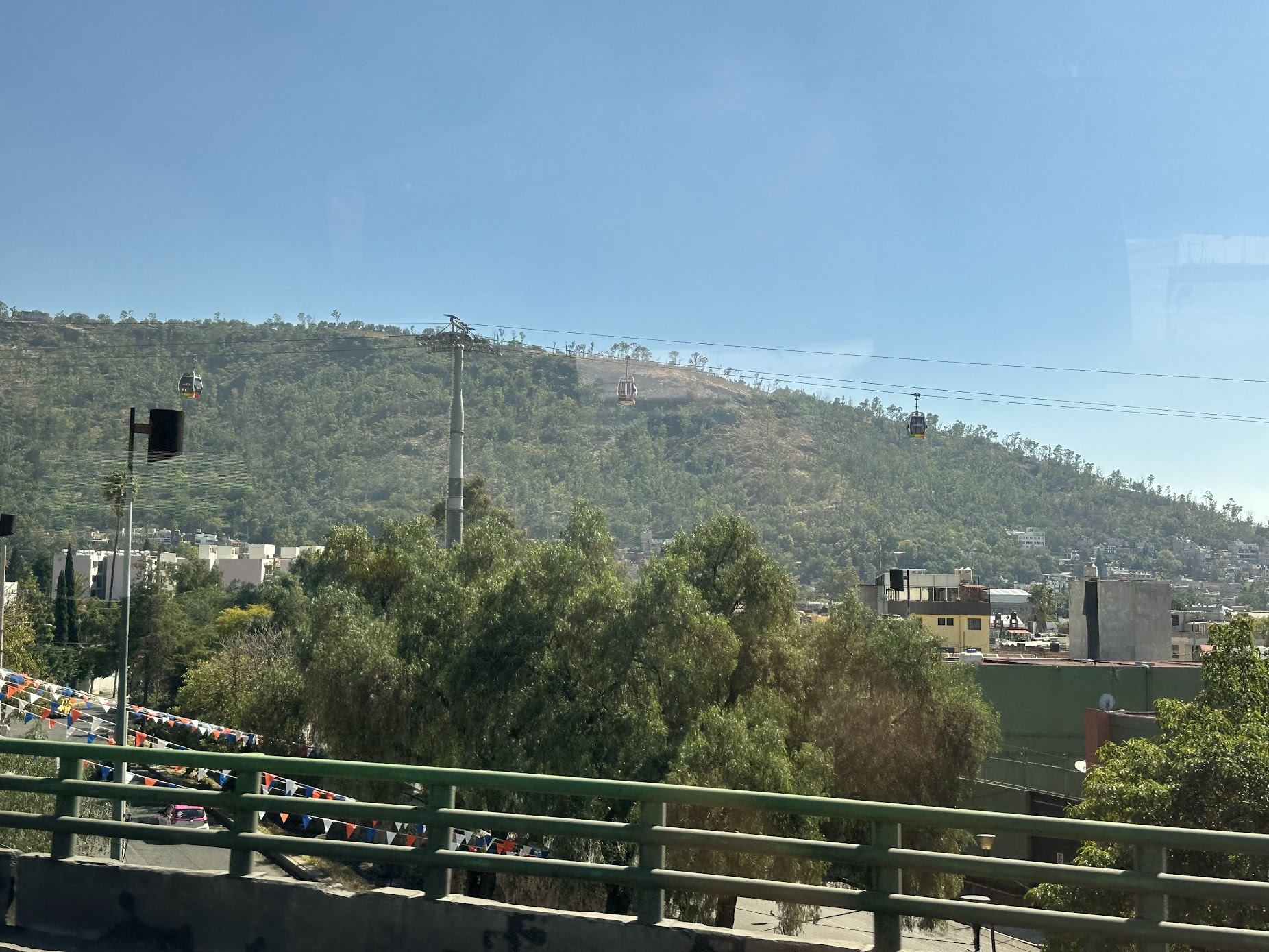
I left Teotihuacan around 3:30 PM and took the bus back to Mexico City. Along the way, I saw the cable cars of Mexicable which is used for public transportation and has lowered commute times and led to some urbal renewal in the areas it serves. Something to try on the next visit to Mexico City!
I was about 4:30 by the time I got back into Mexico City. I was a bit tired, but wanted to pack one more activity during the day. It was too late to visit any more museums and plus I wanted to try something different than visiting historical sites. I decided to go to Xochimilco known for its floating canals and gardens and ride a traditional boat.
Xochimilco’ canals and floating gardens harken back to pre-hispanic times, when an extensive lake filled the Valley of Mexico and canal systems connected most of the pre-hispanic settlements on the lake. While the lake and most of the canals are long gone, some in Xochimilco remain. These canals are fed by fresh water springs, which is artificially supplemented by treated water. These canals, along with artificial islands called chinampas, draw tourists and city residents to ride on colorful gondola-like boats called trajineras around the 170 km (110 mi) of canals. This canal and chinampa system, as a vestige of the area’s precolonial past, has made Xochimilco a World Heritage Site. The wikipedia article on Xochimilco is a good read. It describes the pressures the delicate canal ecosystem faces from expanding human settlements and also a really cool but endangered amphibious animal axolotl that can regrow limbs and reaches sexual maturity as a larvae!
Most boat rides stop running by around 6 PM, and Xochimilco is a bit out of the way.. Mexico City metro doesn’t go all the way to Xochmilco. One must take the blue line to the last stop (Tasquena) and then an overground train to Xochimilco. The total journey time from where the bus dropped me to Xochimilco was about an hour and 20 min. I considered taking a taxi, but with the rush hour traffic the travel time was similar. It was cutting it close because it was already 4:30 PM when I started my journey, but I decided to go anyway. The journey was fine, though the overground train stops at 17 stops along the way and is quite slow.
I arrived at the Xochimilco station around 5:50 PM. Several blogs suggested that it is a 9-10 min walk from the station to Embarcaderos, where the boats leave. This isn’t true! It is a good 20-25 min walk, and I was running part of the way to make it to the pier in time. I strongly suggest taking a taxi from the station to Embarcaderos, if you are short on time.
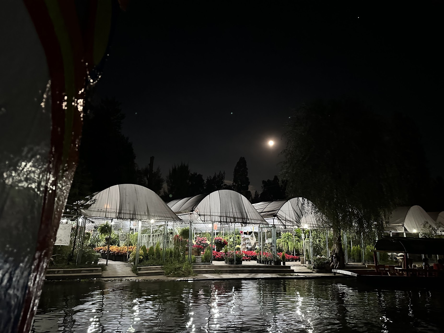
It was around 6:10 by the time I arrived at the piers, and many boats were coming in after finishing their tours. I thought I had missed my chance, but decided to ask the boat drivers anyway if someone would take me on. After asking several (most of who barely spoke English), I finally found one who was willing to take me for a 45 min ride for 500 pesos. I jumped right in and had a nice, relaxing time on the boat. We floated past several other boats full of revelers, beautiful gardens and charming houses on the shores all illuminated in the soft light of a full moon.
After the boat ride, I had a nice dinner at a local restaurant, and took a bus back to my hotel. I packed and went to bed early to catch my early morning flight back to NYC.
Hope you enjoyed reading this blog! Please leave a comment if you did.
Leave a Reply