

A friend and I visited Zion, Bryce Canyon and Antelope national parks from May 9 to May 14th 2025.
We flew Spirit airlines from Newark to Las Vegas on Friday afternoon. Our flight was delayed by about 2 hrs, which was concerning because recently Newark airport had been having lots of cancelations due to issues with air traffic control.
We arrived in Vegas around 5:30 PM local time. The pilot had to abort his first landing attempt due to too much tail wind. He took the plane around to land from another direction.. We got a nice view of Las Vegas and the dry, barren hills surrounding it. From the airport, we took the shuttle to the rental car place. There was a long line and it took us around 45 minutes to pick up the car.. picking up a rental car is annoyingly slow. Technology moves with such different speeds across industries. AI can write poems and generate amazing art, but renting a car still requires lengthy back and forth with an agent and providing the same info you already provided while making the reservation..
Considering that we’ll be driving a lot in the next few days, I got an upgrade–a nice Volvo S60 Hybrid. We picked up the car and were able to drive it, but couldn’t locate the key.. we knew the key had to be somewhere in the car as we could drive the car. After 15-20 minutes of deep searching–looking under the seats, lifting up the floor mats etc., I finally spotted something shiny stuck between the driver seat and center console. Phew!
Due to all these delays, we arrived at our hotel (hotel Paris) around 8:30 PM. I had booked the Cirque Du Soleil show– Michael Jackson One starting at 9:30 PM. We got a quick dinner and took an Uber to Mandalay bay to catch the last 30 minutes of the show.. The show was ok. I’ve seen two Cirque Du Soleil shows, and both were better.
Geology of the area
Let me digress and go through the timeline of the region’s geology and important processes that shape the landscape. With this knowledge, we can hear the amazing geological story the beautiful canyons, gorges and rock formations in Utah are telling. The material below comes from a mix of ChapGPT summaries, Google searches and information displays at the parks I visited on the trip.
During the Early Jurassic (~190 M years ago), much of what is now the American Southwest was covered by a vast, dry, Sahara-like desert, consisting of wind blown sand dunes. Over time, the deeper layers got compressed into rock, creating the Navajo Sandstone, which dominates the landscape of Utah, eastern Nevada and northern Arizona. You’ll see stripe patterns of varying angles stacked on top of each other on the sandstone today. These patterns reflect the prevailing wind patterns when those sand dunes were formed!
Next, around 150 M years ago, due to the westward drift of the North American tectonic plate and interior uplift of this region, the climate of the region began to change. Rainfall and humidity increased, deserts receded and water began to accumulate. The landscape shifted from desert to a mix of shallow lakes, seasonal flood plains and meandering rivers. These new environments deposited mudstone, siltstone and limestone rock. These wetter environments supported diverse ecosystems with dinosaurs, fish, amphibians, and lush vegetation. This is when the trees of the petrified forest we visited on our trip thrived. This is also the reason why the region is so rich in fossils.
About 13 M years ago, the entire Colorado Plateau (including the area around present day Zion) started to uplift. This raised the region thousands of feet above sea level, exposing deep rock layers and creating a steep gradient for rivers to flow more rapidly and increasing the rate of downward erosion. The increased water volume due to ending of the ice age amplified the effect. So this is the reason why relatively small rivers such as the Virgin river in Zion and the Colorado have created such massive gorges! At ~10 M years, these gorges are babies on a geological timescale.
Some other processes shaping the landscape are: Flash floods that carve deep, winding gorges such as Antelope Canyon. The walls of these canyons are further polished smooth by swirling sand and water.. Freeze-Thaw Weathering where water seeps into cracks in the rock, freezes, and expands. This freeze-thaw cycle breaks the rock apart, contributing to the canyon’s widening over time. This freeze-thaw cycle was the main driver in weakening the rock that led to the creation of the hoodoos of Bryce Canyon. As we saw above, the rock column contains layers of different rock types. Softer layers such as Mudstone erode more easily, while harder layers such as Limestone are more resistant. The forces of nature are like a blind sculptor indiscriminately chiseling away at the rock.. the softer rock wears away while the harder rock hangs on.. This is how the hoodoos acquire a sculpted columnar shape.
Final one is Weeping Rock formed when ancient rainwater filters through porous sandstone, hits an impermeable rock layer, and seeps out at a cliff edge, creating the iconic dripping effect. These mineral rich seeps feed hanging gardens of diverse types of plants.. which can be seen on the weeping rock trail in Zion.
Back to the trip..
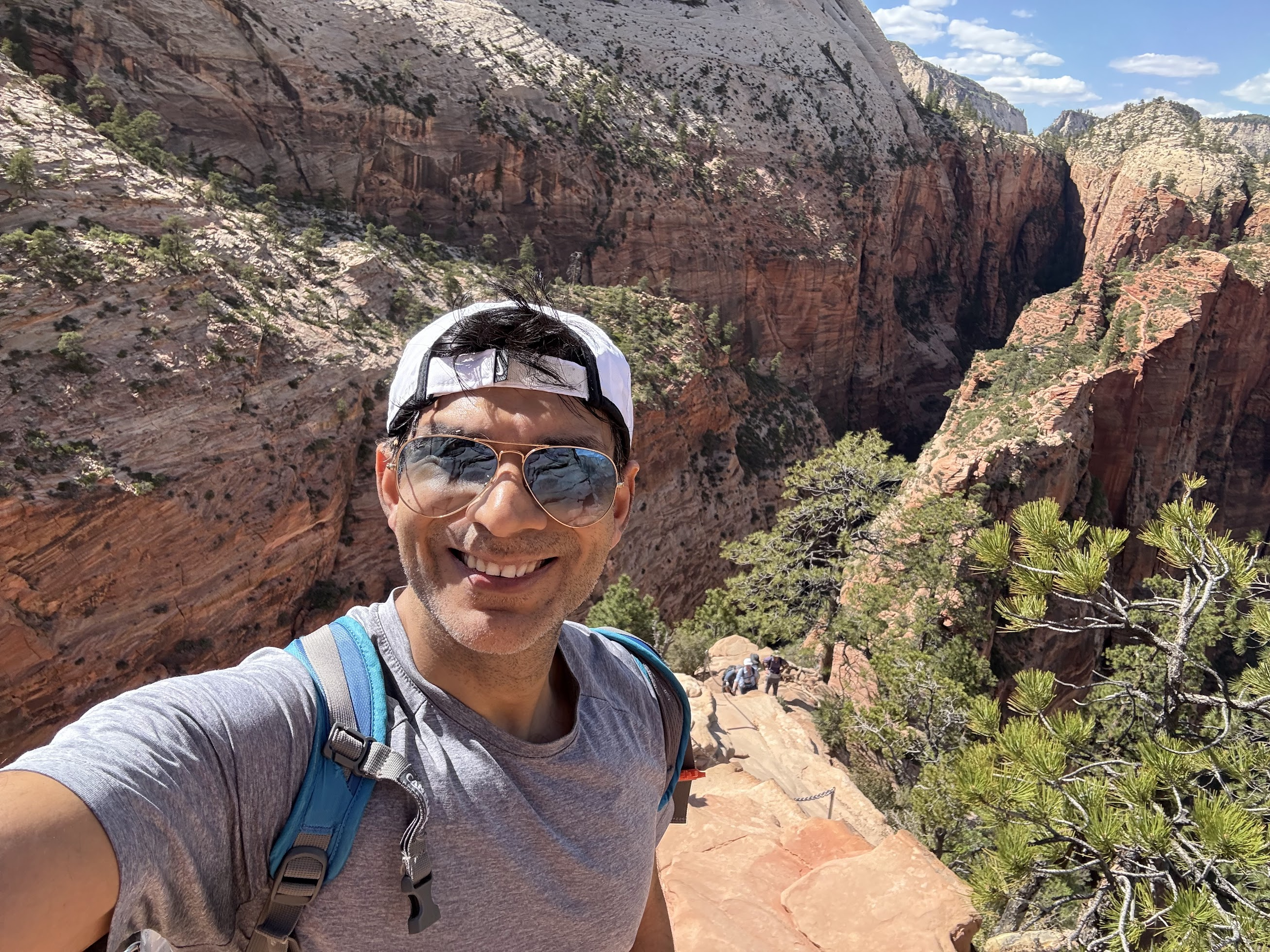
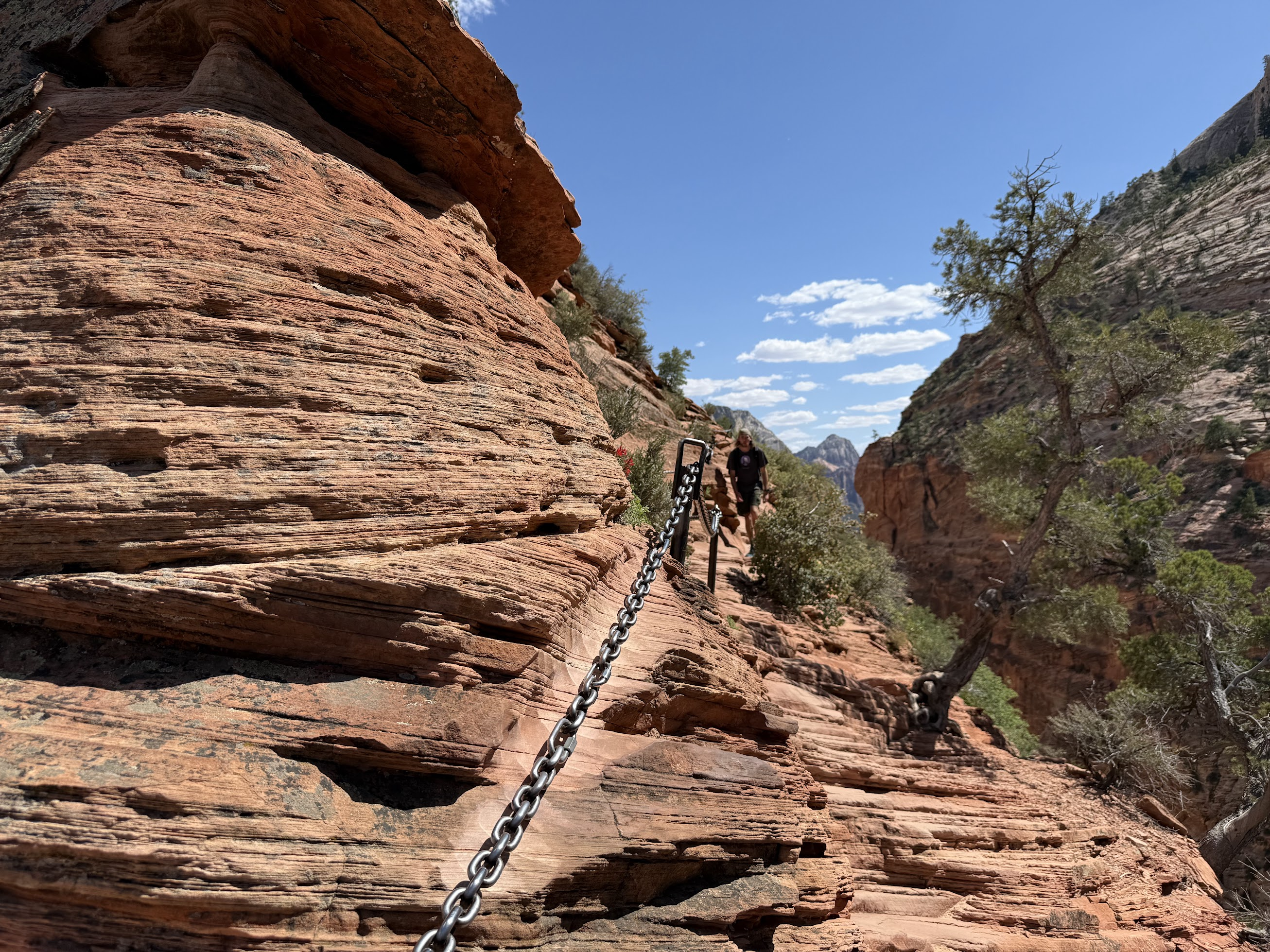
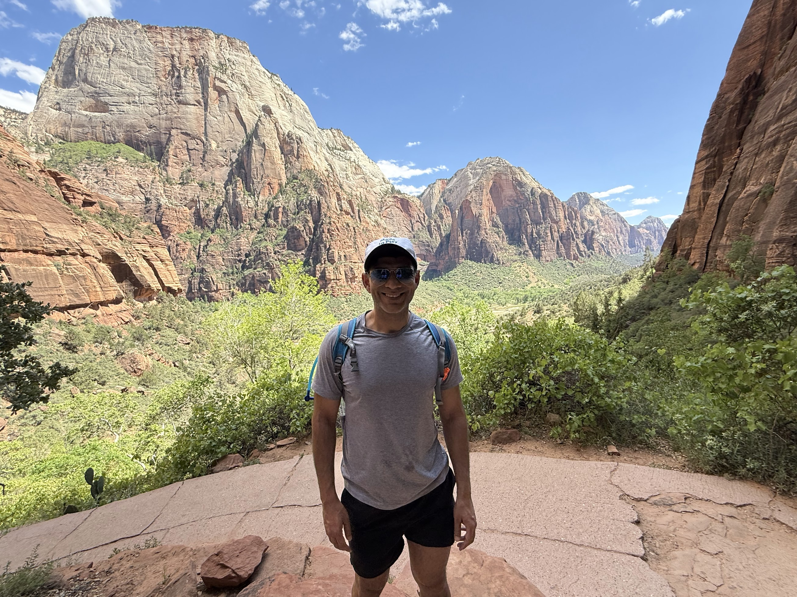
Next day, we drove out to Zion, about a 2.5 hr drive. We wanted to hike either Angels Landing or the Narrows, two of the most popular hikes in Zion. Hiking Angels landing requires a permit, obtainable via an online lottery. I had entered and won the lottery the day before. This provided us a pass to commence the hike from 9AM – 12PM. Because we started a bit later than planned and the one hour time change between Zion and Las Vegas, we arrived at the park around 1PM (with a stop at Free Love cafe, a highly recommended food/coffee place). We weren’t sure if we’ll be allowed to hike Angels landing, but decided to try any way. We parked our car at the visitor center parking lot and boarded the shuttle to the Angels landing trailhead. Angels landing is a 5.4-mile round-trip trail with an elevation gain of about 1,500 feet. The hike proceeds along numerous switch backs up to a high ridge. Then it proceeds along the narrow ridge flanked by steep drops on either side. There is a bolted chain most of the way along the ridge for safety. We were a bit apprehensive about walking along the high ridge, but felt totally safe. There are some steep climbs and rock scrambling involved, but it is all safe and fun. The views are gorgeous! From the top, you get to enjoy panoramic view of the gorge and the Virgin river that created it. We weren’t asked for the email confirmation of our permit anywhere. This is not to imply that you should tempt fate and attempt the hike without a permit.. the fines if you get caught are steep!
One the way down, we saw this.. if you know what these squirrels are doing (aggressive play, territorial display..?) , please let me know!
Next up was Bryce Canyon state park.. we drove out through the East facing exit of Zion.. which offers amazing views of the rock formations..
Along the way, we had great fun uploading pics of Zion on ChatGPT and asking how those rocks were formed.
We arrived at our hotel–Best Western Plus Ruby’s Inn around 8:45 PM. The only decent restaurant in the area, located in the hotel closed at 9 PM.. however we had no problems getting seated and enjoyed a lovely, healthy dinner buffet. I try to eat as healthy as possible and was happy with the selection offered in the buffet. After dinner, I soaked in the jacuzzi for a bit, but didn’t last too long as the water was a bit too hot and chlorine too strong.
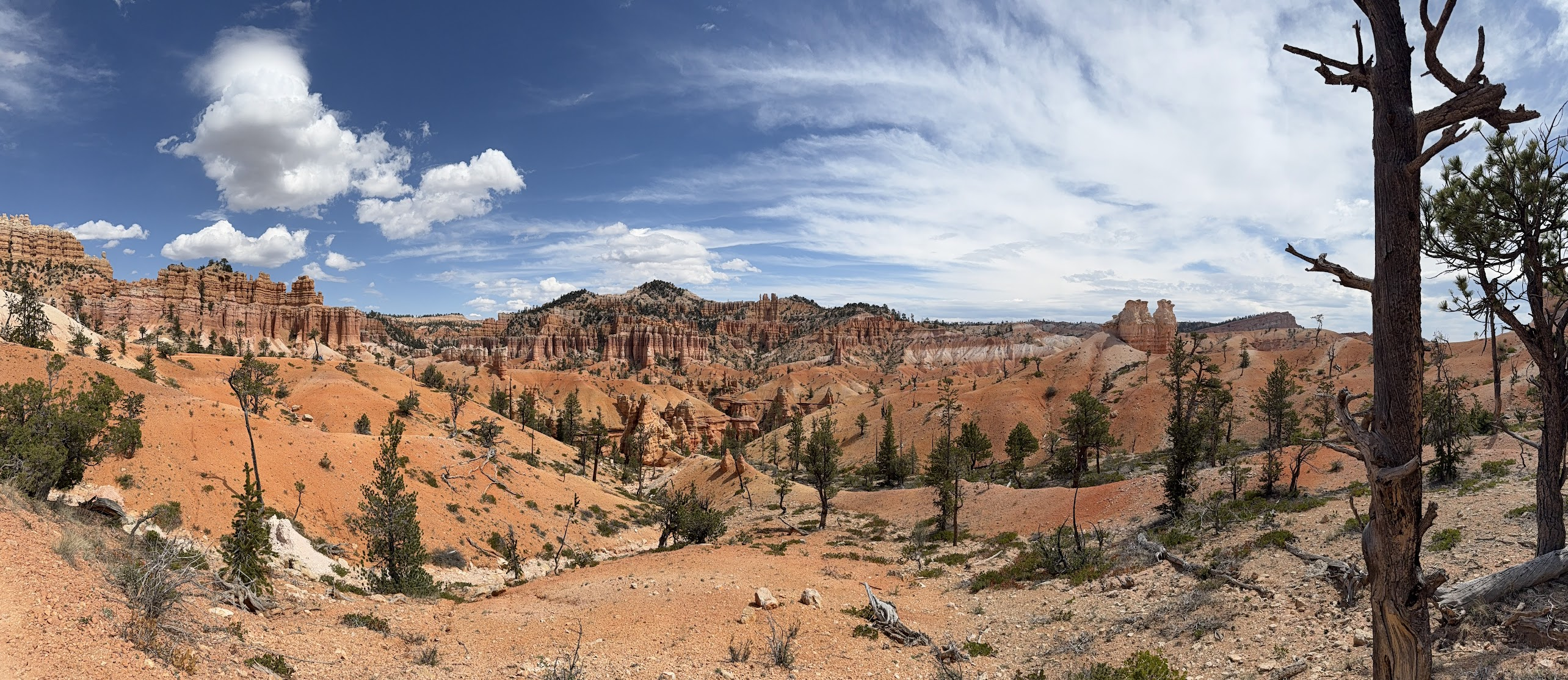
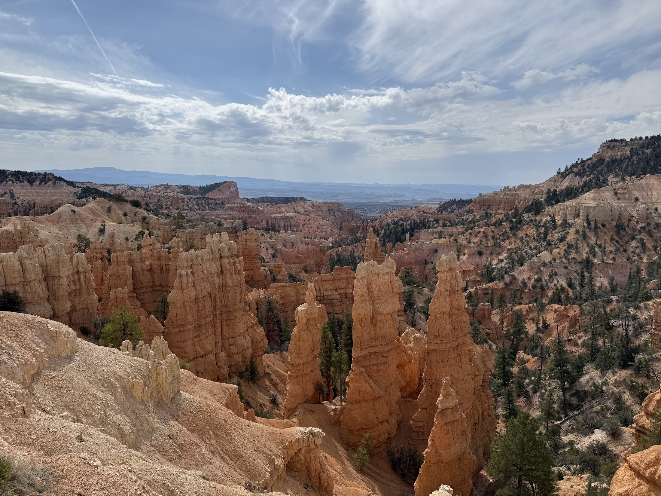
Next morning, we got breakfast and drove to Bryce Canyon park, a 10 min drive from the hotel. We hiked Fairyland, a 8 mile loop. The hike offers incredible views of Bryce Canyon’s landmark feature, hoodoos. We also took a short detour to visit Sunrise point, that offers amazing views of the amphitheater, a massive, bowl shaped formation dotted with hoodoos. The view is just spectacular.. enough to turn an atheist into a believer! We hiked 8.51 miles with an elevation gain of 1650 feet in just over 3 hrs!
From Bryce Canyon, we wanted to drive to Antelope Canyon, going south west through Grand Staircase Escalante national monument area. We drove about an hour west along highway 12 to the town of Escalante and had lunch at Magnolia’ kitchen. There when I looked at the map, I realized that there was no way to drive south to Antelope Canyon from Escalante. We’d have to drive back East along HW 12, and then south along HW 89 to reach Antelope Canyon, a ~3.25 hrs drive. Looking for some interesting sights along the way, we stopped at the Petrified Forest State Park that offers SUP and kayaking on a reservoir and couple of hikes leading up to some petrified wood.
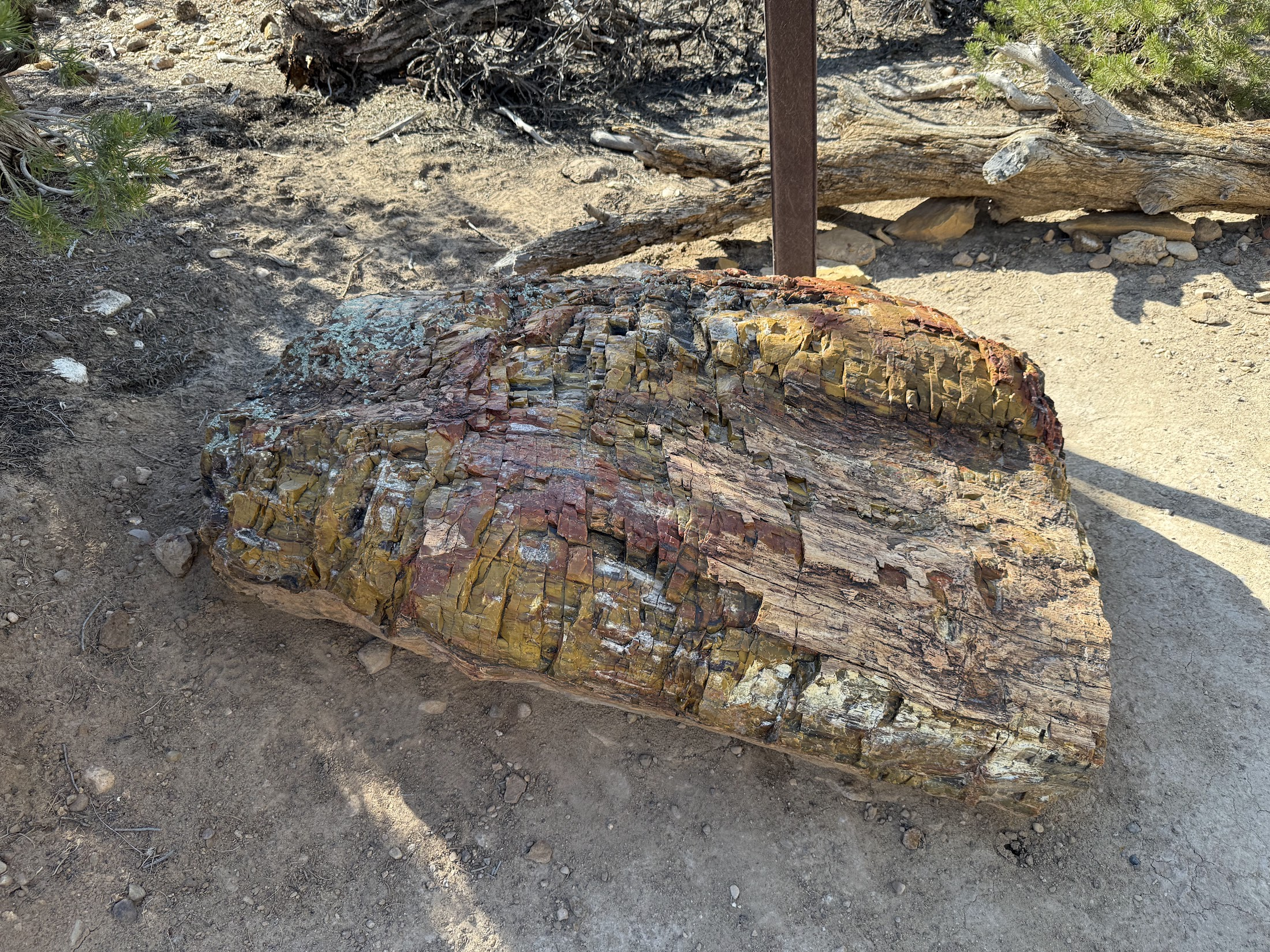
How was the petrified wood formed? As mentioned abvoe, during the late Jurassic and early Cretaceous periods (roughly 150 to 100 million years ago), the North American plate was much closer to the equator than today, and the Escalante area was home to lush forests. Trees like conifers grew near rivers and floodplains. When these trees died, they were buried rapidly under volcanic ash, mud, or sediment—crucial for protecting them from decay. Groundwater rich in dissolved silica (from volcanic ash or nearby rock) seeped into the buried logs. Over time, this water penetrated the wood’s cellular structure. As the organic wood decomposed slowly, the silica (and also other minerals like calcite, iron, or manganese) replaced the wood cell by cell, creating a stone replica of the original tree. This is what we call petrified wood. Erosion of overlying rock layers by wind and water has exposed the petrified wood we see today. So when you are looking at a piece of petrified wood, you are looking at a tree that grew ~150 Million years ago, when dinosaurs roamed the land!
I was tempted to pick up a small piece of petrified wood, but ultimately didn’t.. Later we saw a sign that said something similar to “a little bit here and little bit there and soon there will be no petrified wood left” 🙂
After the petrified wood stop, we continued our drive to the Antelope canyon area, stopping in Kanab along the way for dinner at Wild Thyme cafe.
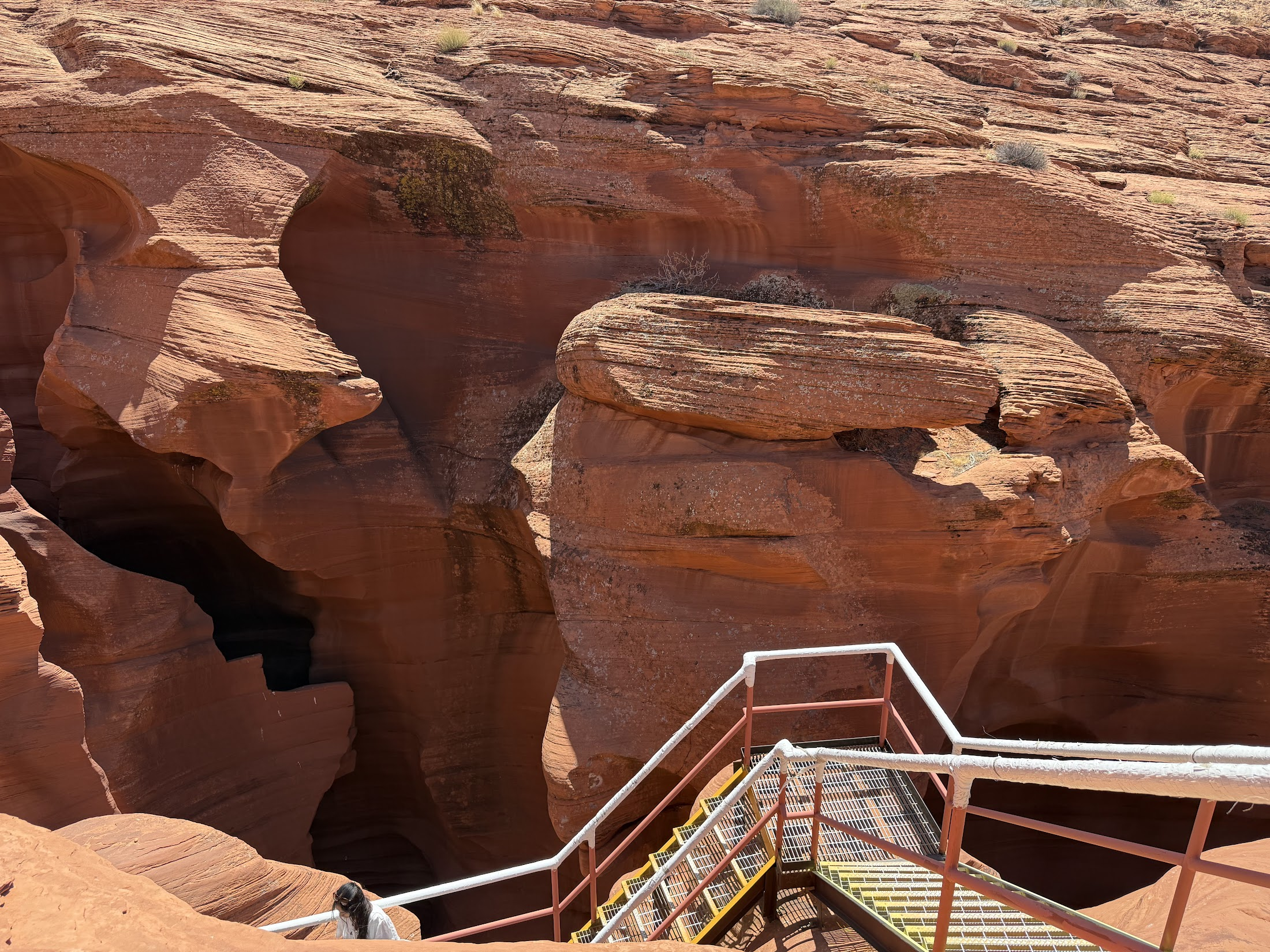
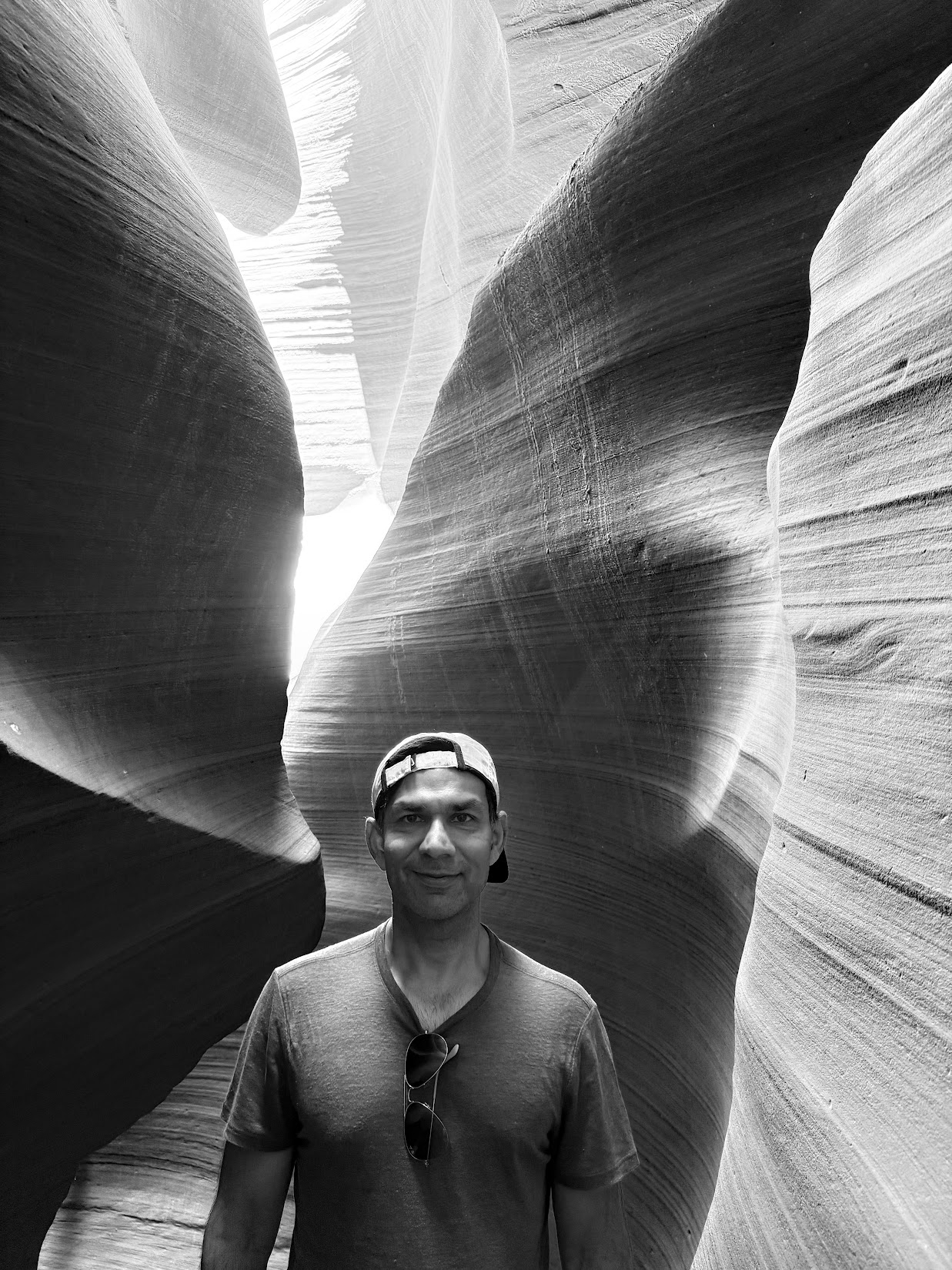
Next day, we did a guided tour of lower Antelope canyon. Because the canyon is on an Navajo nation reservation, one must be part of a tour to visit the canyon. We booked our tour with Ken’s tours who I would not recommend. One must descend 4-5 flights of steep steps to get down to the canyon and then walk about half a mile on the canyon floor surrounded by sinuous, winding red sandstone canyon walls. Sand particles falling from the canyon roof shimmer in the light beams that fill the interior. It is difficult to stop taking pictures. I expected the guide to tell us more about the geology of the canyon, but he seemed much more interested in pointing at how various rock shapes resemble different animals..he did tell us one interesting thing–the exact spot where the picture of Antelope canyon in the Windows 7 wall paper was taken! We later asked ChatGPT how the canyon was formed, and here’s what we learnt.
Antelope Canyon was sculpted by millions of years of flash floods and sand-laden wind eroding the Navajo Sandstone, creating the narrow, flowing corridors and light-filled chambers we see today. These flash floods still happen today! According to our guide, sometimes these floods can wash away the sand on the canyon floor, leaving the ground uneven and difficult to walk on. The Navajo nation tour companies pour in sand from the top to replenish and restore the sand floor.. somehow I found this story difficult to believe..
Because it is quite narrow on the top, the canyon can be hard to see from the outside. You can easily walk right by it, and not realize that a natural wonder lies beneath an ordinary looking crack in the desert.. indeed, Antelope Canyon was discovered by the outside world only in 1931, although it had been known and used by the Navajo people for generations before that. I wonder how many such wonders still lie undiscovered!
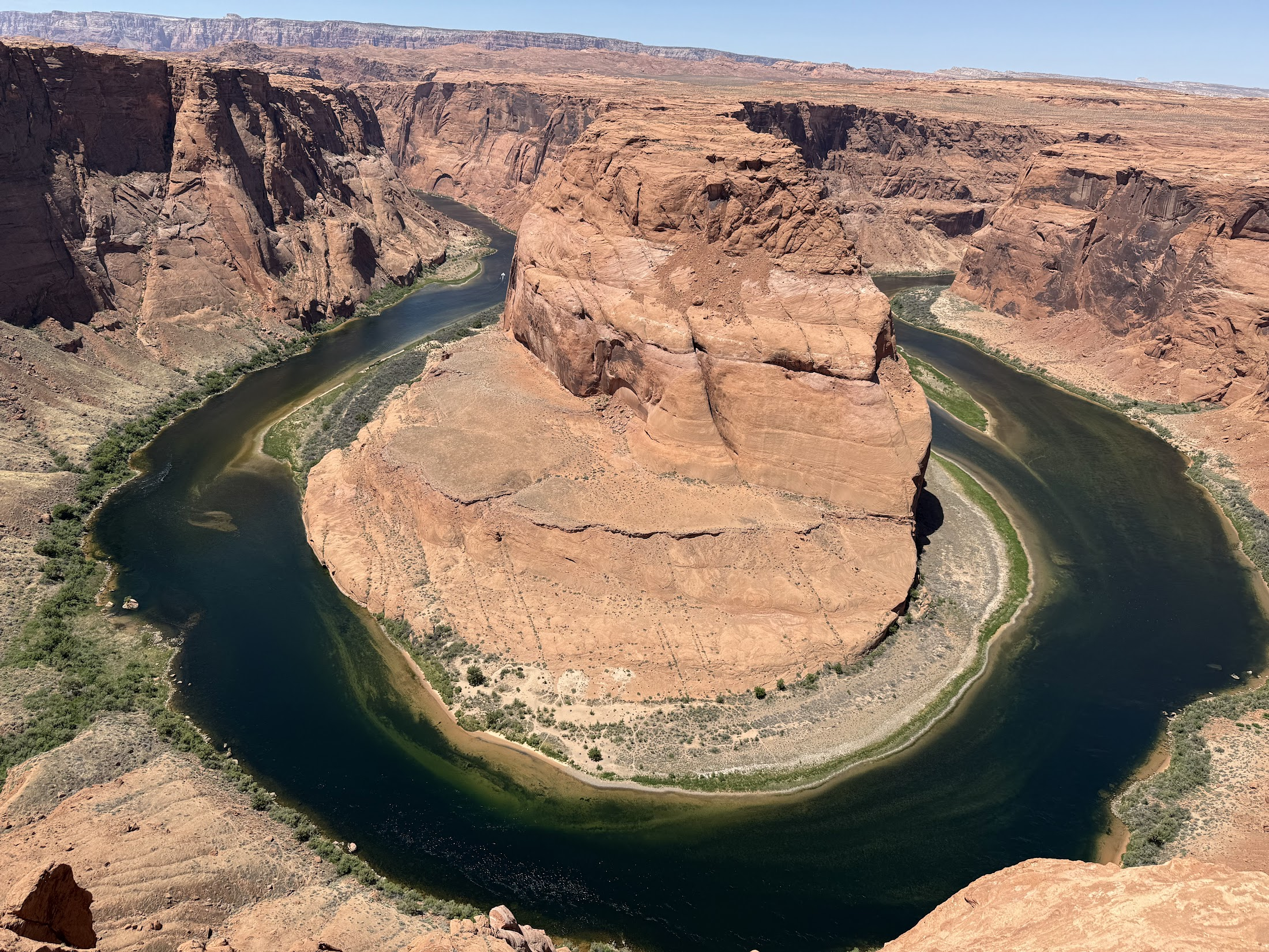
From Antelope canyon, we drove about 10 minutes to see horse shoe bend, another natural wonder where the Colorado River makes a sharp, horseshoe-shaped meander around a massive rock formation. Up from the rim., we could see boats going up and down the river. This reminded me of the 7 day rafting trip through the Grand Canyon I did in 2020..
From horse shoe bend, we headed back to Las Vegas, passing through Kanab. Almost as soon as we entered Kanab, I drove over a rock, and got a flat tire. Fortunately this happened in a town and in late afternoon when auto repair shops were still open. I slowly drove the car to a repair shop and they quickly replaced the tire. It only cost a couple hundred dollars.. best case outcome!
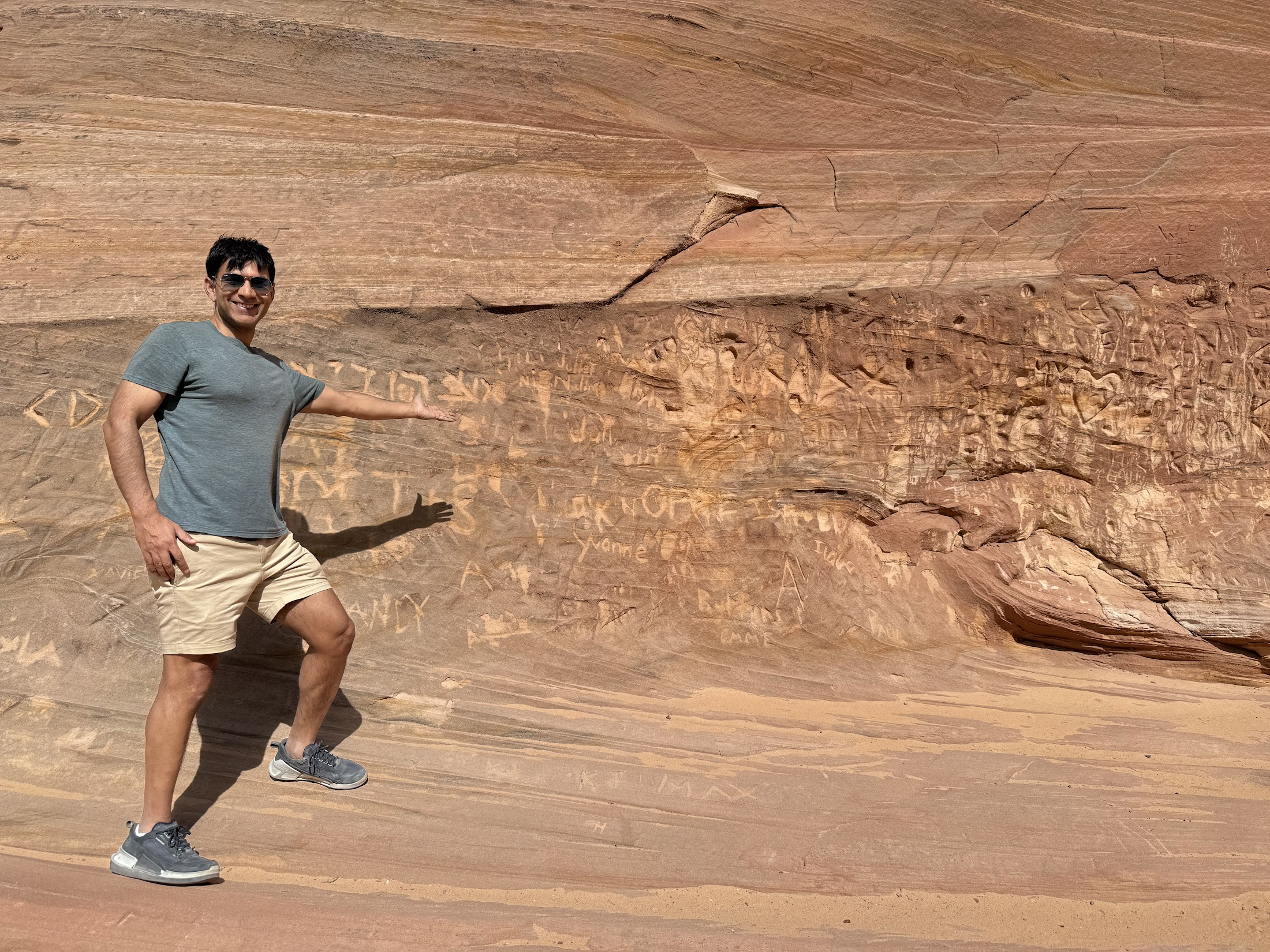
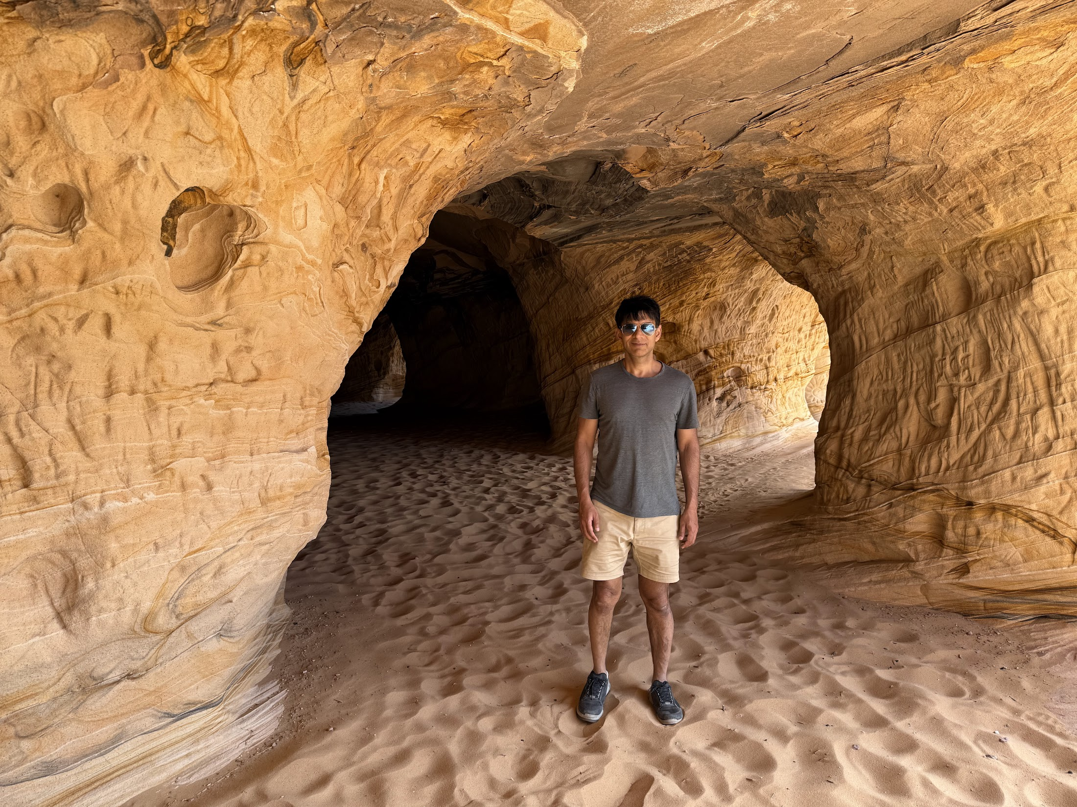
We got a sandwich in Kanab and then stopped at Sand Caves located about 5 miles north of Kanab. The caves are about a 0.5 mile hike from the parking lot. The caves were carved out in the 1920s by sandstone miners. The mining process was short lived and now we have these spectacular caves to explore! The walls are covered by graffiti the edges of which have weathered over time..It is a cool experience and I recommend a short trip to the caves.
After the cave tour, we drove straight back to Las Vegas with a stop at Free Love coffee along the way. We arrived back in Vegas around 9PM.. walked around the Mandalay bay hotel where we were staying, walked over to Luxor and another hotel nearby.. so kitschy!
I worked the next day (Tuesday) and we flew back to NYC late in the afternoon..
Leave a Reply