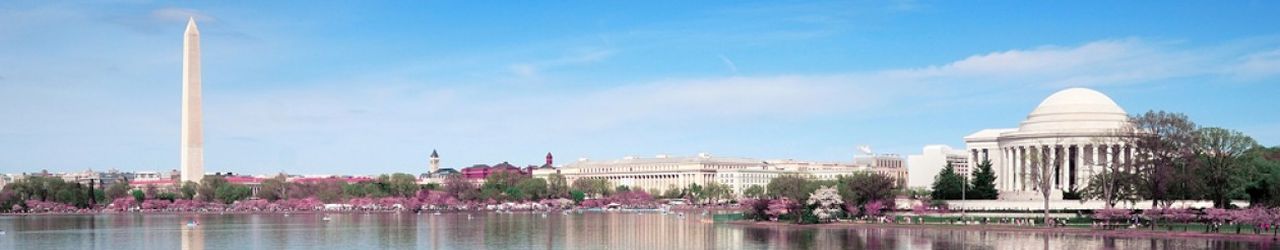

I visited Machu Picchu, a longstanding bucket list item, over this thanksgiving break. November has been a very busy month for me, because I also relocated from my longtime home city of Washington DC to New York city on Nov 11. I had been toying with the idea of going somewhere over Thanksgiving (which ends up being a lonely week for me, since I don’t have close family in the US). Doing a cruise on the Nile river in Egypt and traveling to Machu Picchu were the top contenders for potential trips.
There were several permutations with each of those trips with different number of days, sites visited etc. Ultimately, I decided to go to Peru to visit Machu Picchu, because it was cheaper (about $3500, including flight tickets), and didn’t involve a time change. There were several choices to be made, such as:
- Choice of tour group. There are several that offer fully organized trips to Machu Picchu, such as Intrepid, Alpaca expeditions, IncaExpert, and many, many others. I went with Intrepid, because I had communicated with them last year when I went to the Galapagos islands and they were quite responsive in answering my questions
- How to get to Machu Picchu. Again, there are several options. Three of the most popular ones are:
- The classic Inca trail: This is probably the most common, but quite challenging way to arrive at Machu Picchu. You start near the town of Ollantaytambo and trek about 42 km over 4 days along the trail laid down by the Incas
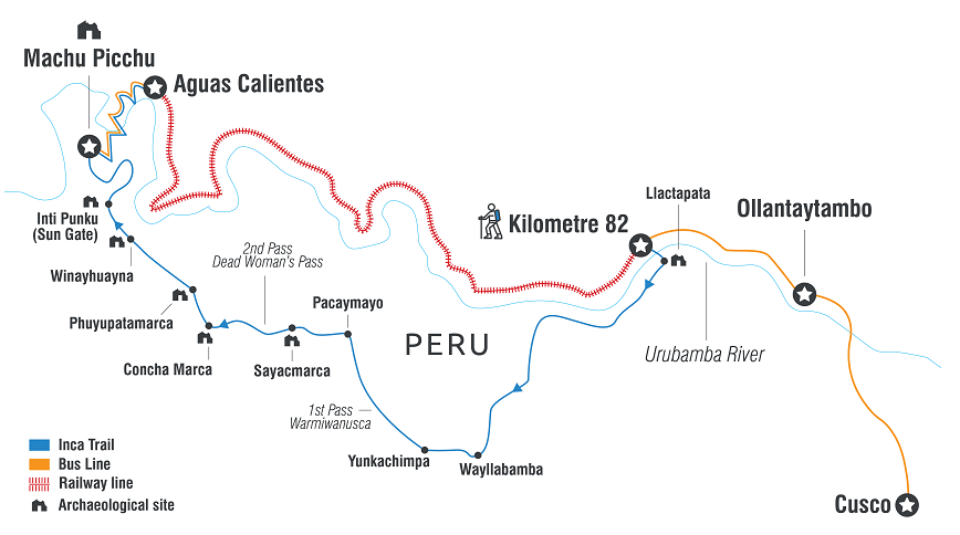
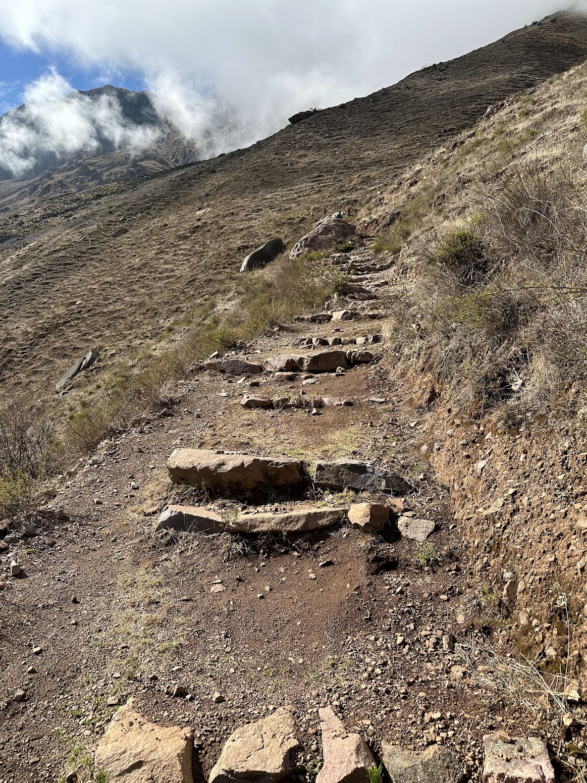
- The Quarry trail: This trail doesn’t go directly to Machu Picchu, instead you hike along the Andean peaks around the town of Ollantaytambo. It involves trekking about 31 Km over 3 days. Although it doesn’t travel directly to Machu Picchu, the highest point on this trail is at a higher elevation than that on the Inca trail. It is also challenging, but a bit less so than the Inca trail.

- No hiking: If you aren’t the hiker type, you can take the train to Aguas Calientes (a town on the base of the mountain on which Machu Picchu is located) and then take the bus to Machu Picchu. Alternatively, you can hike about 2 hours from Aguas Calientes to Machu Picchu, rather than taking the bus.
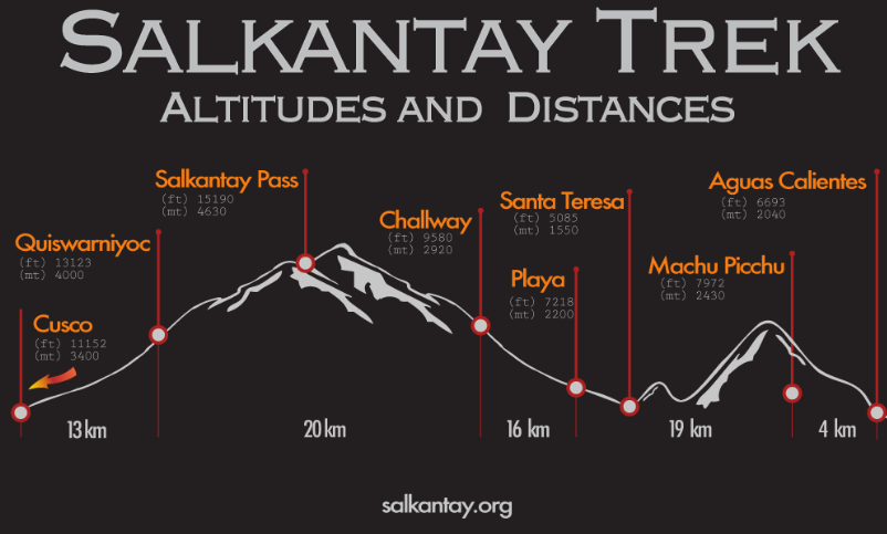
- The Salkantay trail: Interestingly, I learnt about this option on a girl’s Hinge profile 🙂 This one covers a distance of 60 Km over 5 days and would be interesting to consider at some point.
- The classic Inca trail: This is probably the most common, but quite challenging way to arrive at Machu Picchu. You start near the town of Ollantaytambo and trek about 42 km over 4 days along the trail laid down by the Incas
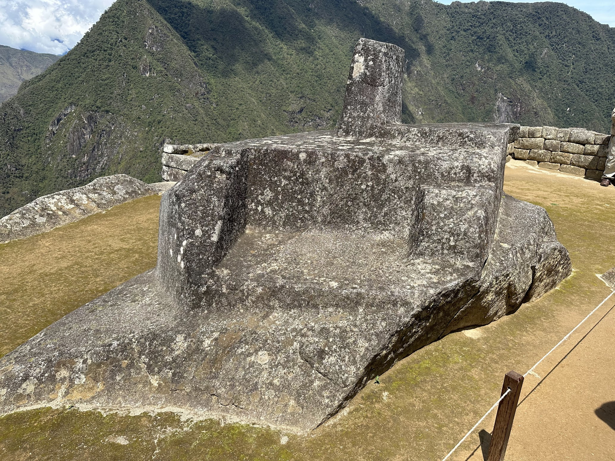
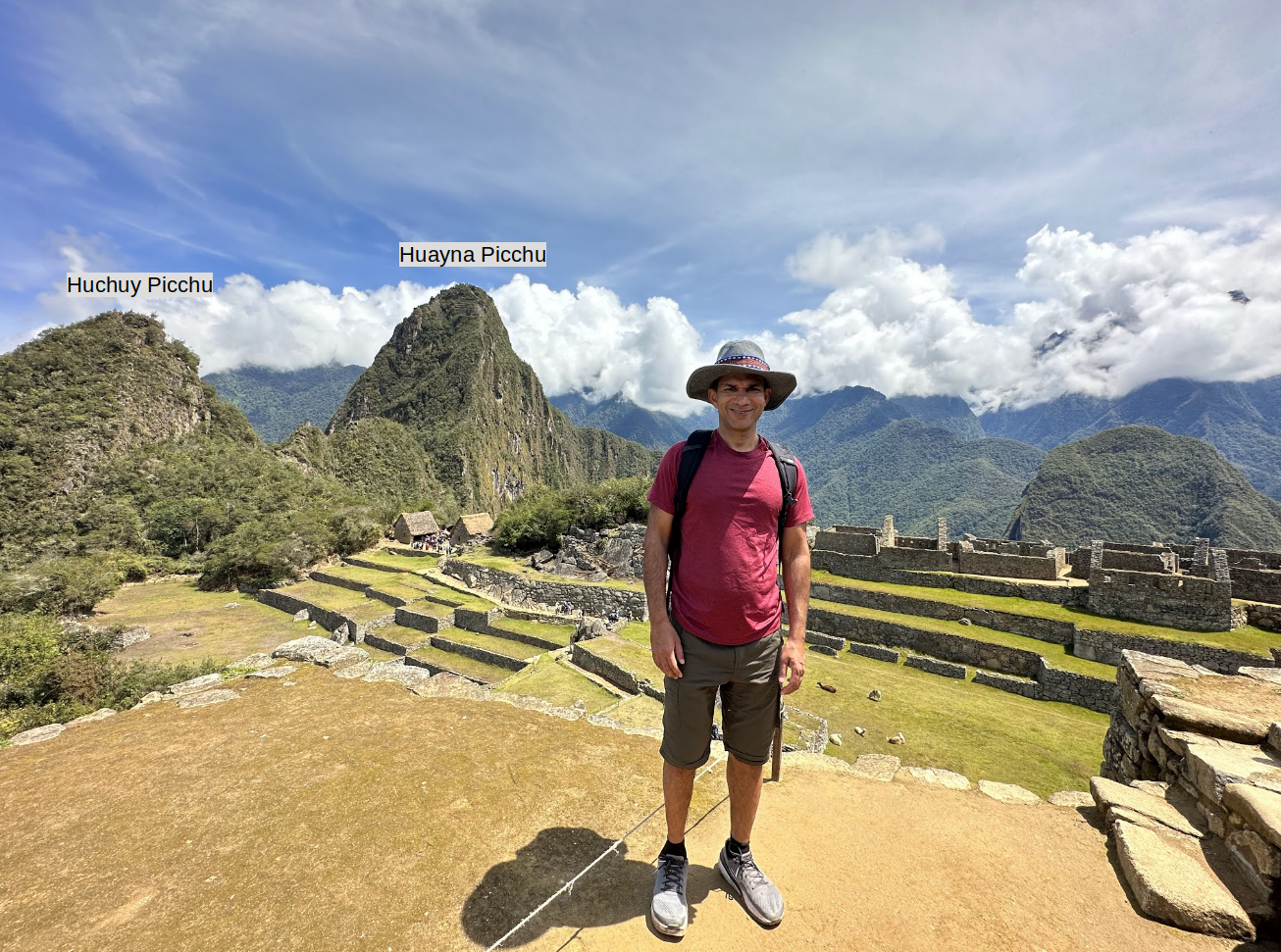
- Which circuit to follow at Machu Picchu, and add-on activities. Before I went to Machu Picchu, I thought one simply walked through the ruins, accompanied by a guide. However, things aren’t quite as simple as that. To better preserve the ruins, the Peruvian government has created circuits (4 at the time of this writing), which are predetermined paths a visitor must follow. Each circuit visits overlapping but somewhat different parts of the ruins. For example, circuit 3 doesn’t include the “Intihuatana” (the stone associated with Inca calendar and astronomy). Once you are on a circuit, you can’t turn back or switch to another circuit. Circuit 2 is the most popular and covers the largest area, including the spot overlooking Machu Picchu popular with photographers, and most of the important archaeological sites. In addition, there are three sites near Machu Picchu–the Inca bridge, Huchuy Picchu (small mountain) and Huyana Picchu (big mountain). The Inca bridge is a small drawbridge about 20 min hike from Machu Picchu (more on it later in this blog). Huchuy Picchu is a small mountain near Macchu Picchu that takes 15-20 min to climb, Huyana Picchu (260 metres higher than Machu Picchu) is a taller mountain that requires climbing a steep and exposed ascent that can take 2-3 hours to climb. This mountain also features “the temple of the moon“, an arbitrarily named Inca ceremonial temple. The tickets for these must be purchased separately. This is a good resource to learn more about these options. I recommend discussing with your tour group which circuit your tour covers, and ask about including the add-ons. Tickets are usually sold out, so it is good to pick the right circuit ahead of time.
- What to do after the Machu Picchu hike. A trek to Machu Picchu will usually take at least 6 days. This includes 2 days in Cusco and Ollantaytambo to get used to the higher elevation, 3-4 days of trekking and a day to get back to Cusco to catch your flight back. If you have more time, there are several options for follow-on activities, such as visiting the Amazon, the Uyuni salt flats in Bolivia etc. Several people in my group were traveling to the Amazon after our Machu Picchu trek.
I love the outdoors, but I’m not a big camping person, mostly because I’m a light sleeper and generally find it difficult to sleep well in a tent. For that reason, I chose to do the Quarry trail, that involved two nights of camping, rather than three. I had also heard horror stories about the toilet facilities on the Inca trail–those were borne out my the people in my group who did the Inca trail. The toilets on the Inca trail are filthy squat toilets. I also didn’t have time to pursue any follow-on activities after Machu Picchu, so I flew straight back home after the trek.
What to bring
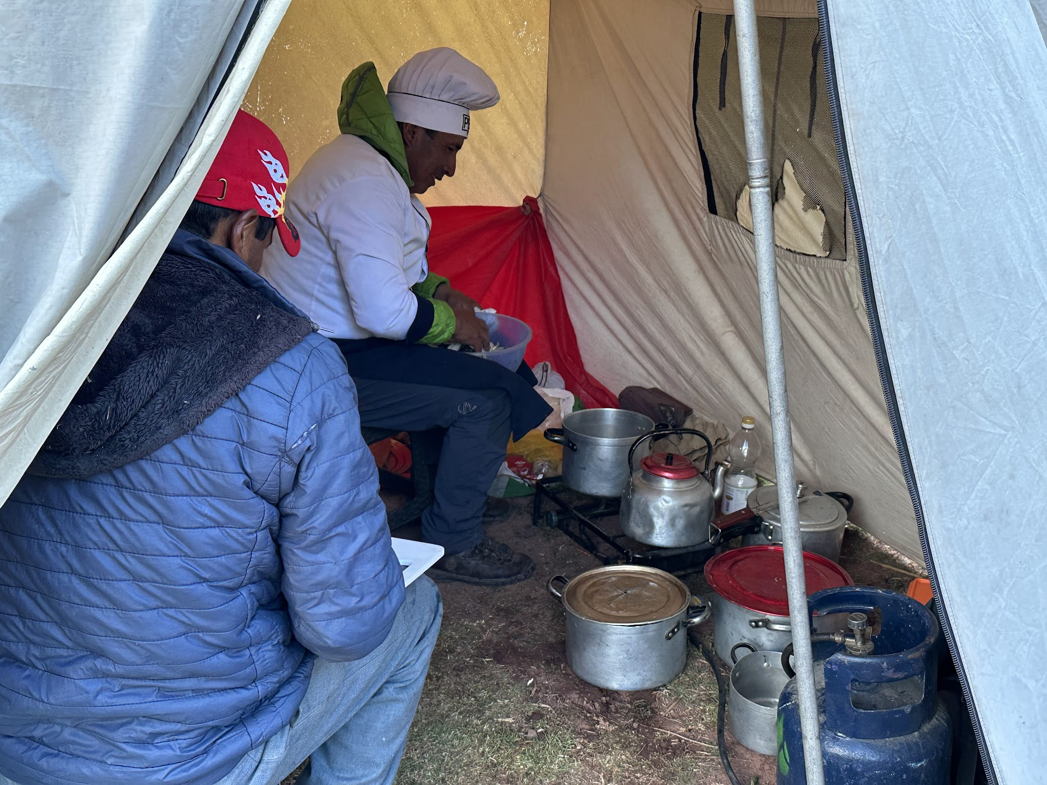
Intrepid has a detailed list of items to bring for the Machu Picchu trek and it was pretty spot-on. I chose to rent the sleeping bag and trekking poles from Intrepid. It CAN get very chilly at night, so make sure to bring a warm vest and socks. I found the air mattress provided by Intrepid barely sufficient (very thin and narrow), so you may want to bring a more comfortable air mattress or inquire about getting an upgrade. If you are traveling during the rainy season (Nov – Mar), bring water proof hiking shoes. I just brought my regular hiking shoes but was lucky that it only rained during the night and not while we were hiking. There were no mosquito or flies on the Quarry trail, but there were lots of flies in Machu Picchu, whose bites left red dots all over my legs that itched badly for more than 2 weeks! So bring mosquito repellent/bug spray.
I’ll now provide an account of the main activities of each day, with lots of pictures and interesting information.
Day 1
Day 2
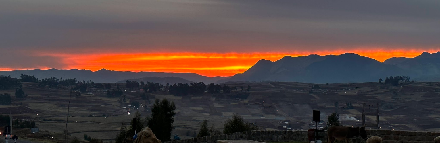
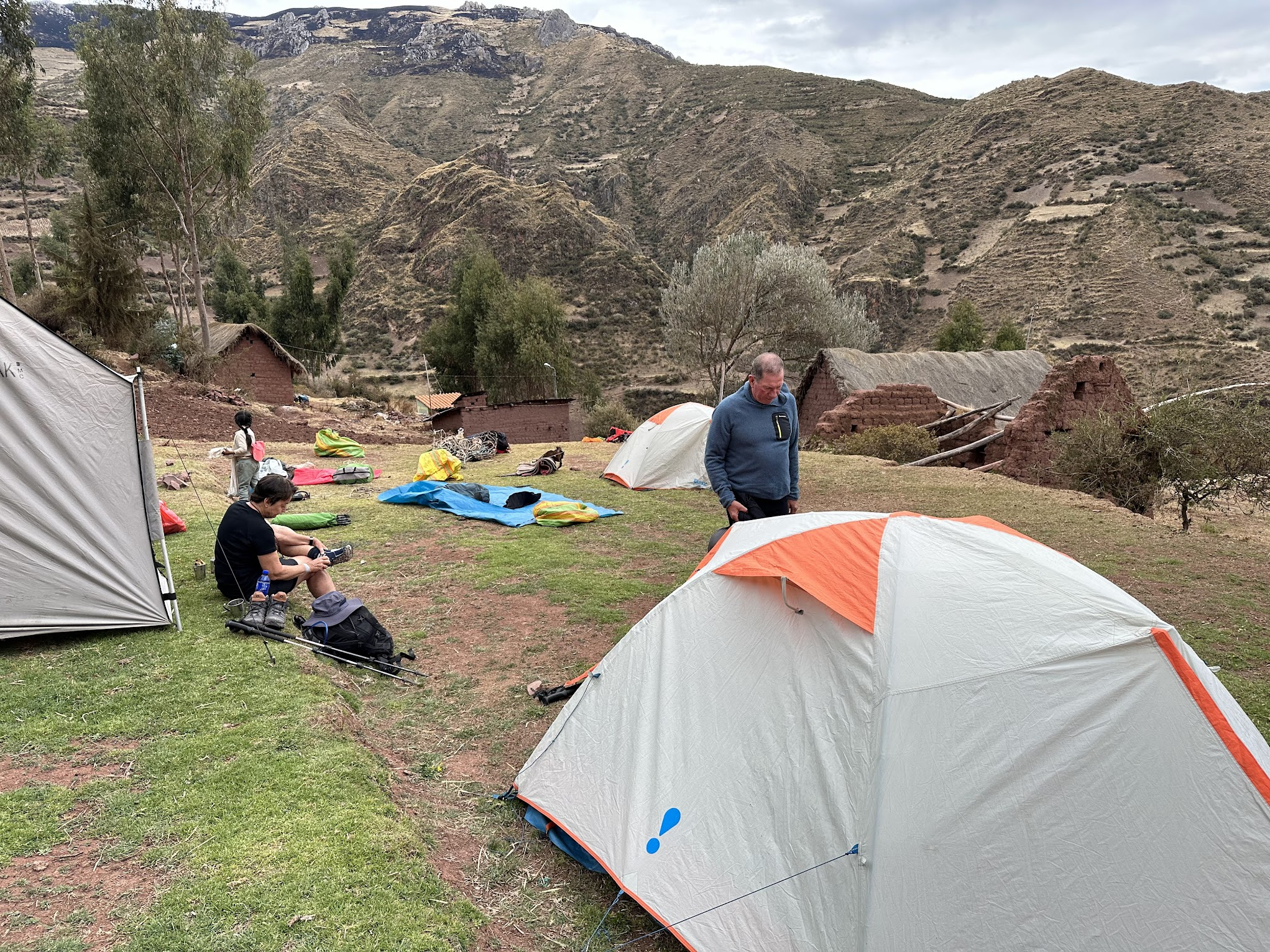
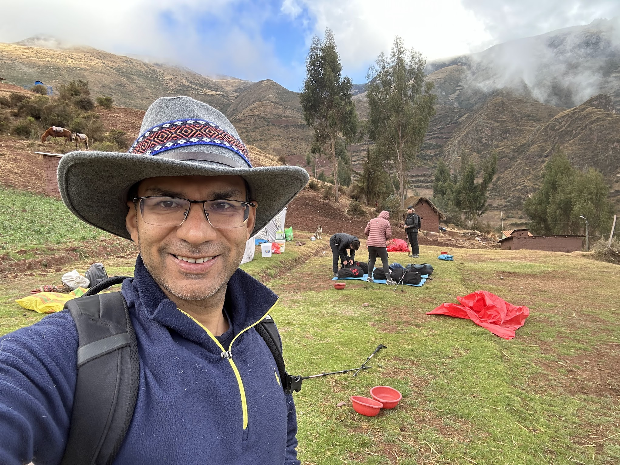
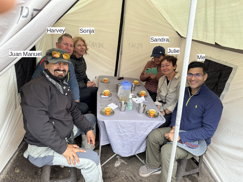
We arrived in Ollantaytambo around 7 PM and checked into our hotel which was nicer than the one in Cusco. After a bit of rest, we walked over to a nearby restaurant for dinner, where we got to know the other people in the group. Most of the people in the group were from England and Australia. There were 3 people from America. Four older Australians and me were doing the Quarry trail, while the rest of the group was doing the Inca trail. I was tempted to switch to doing the Inca trail, and even asked the guide if that was possible, but he told me no.
Day 3
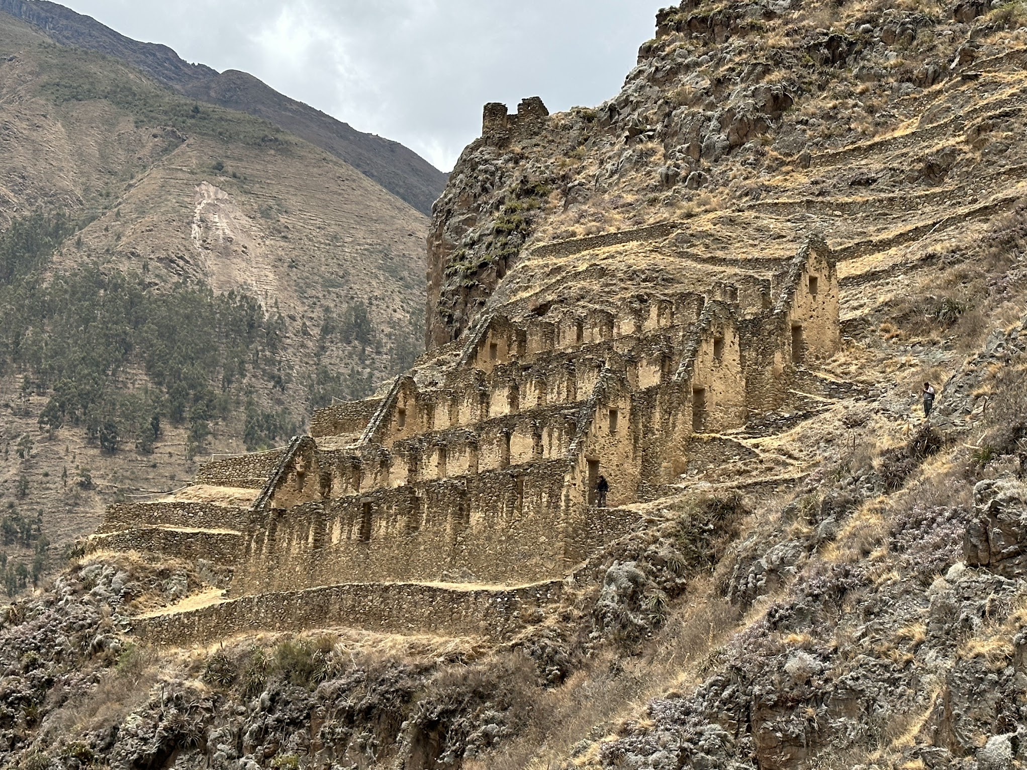
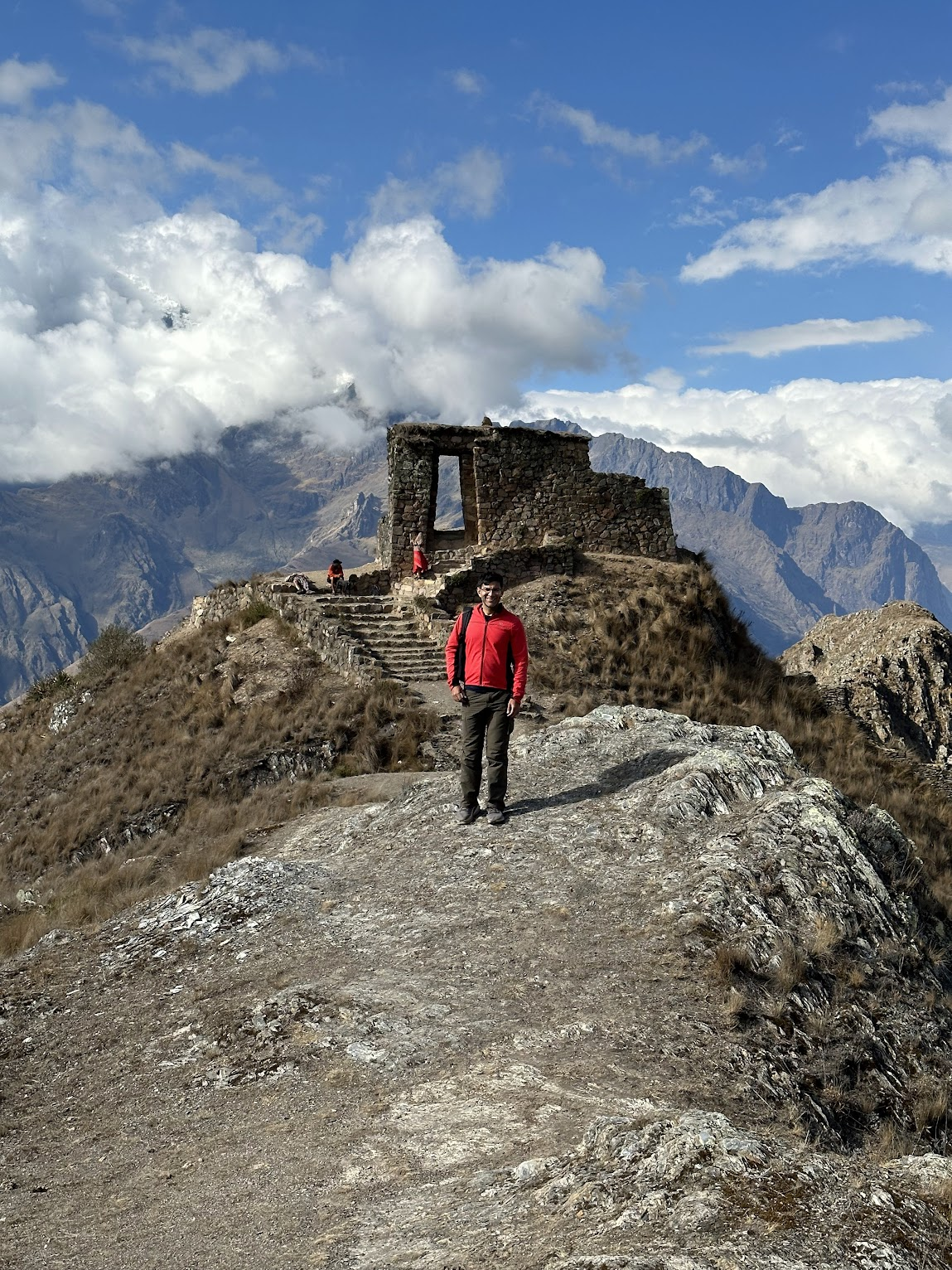
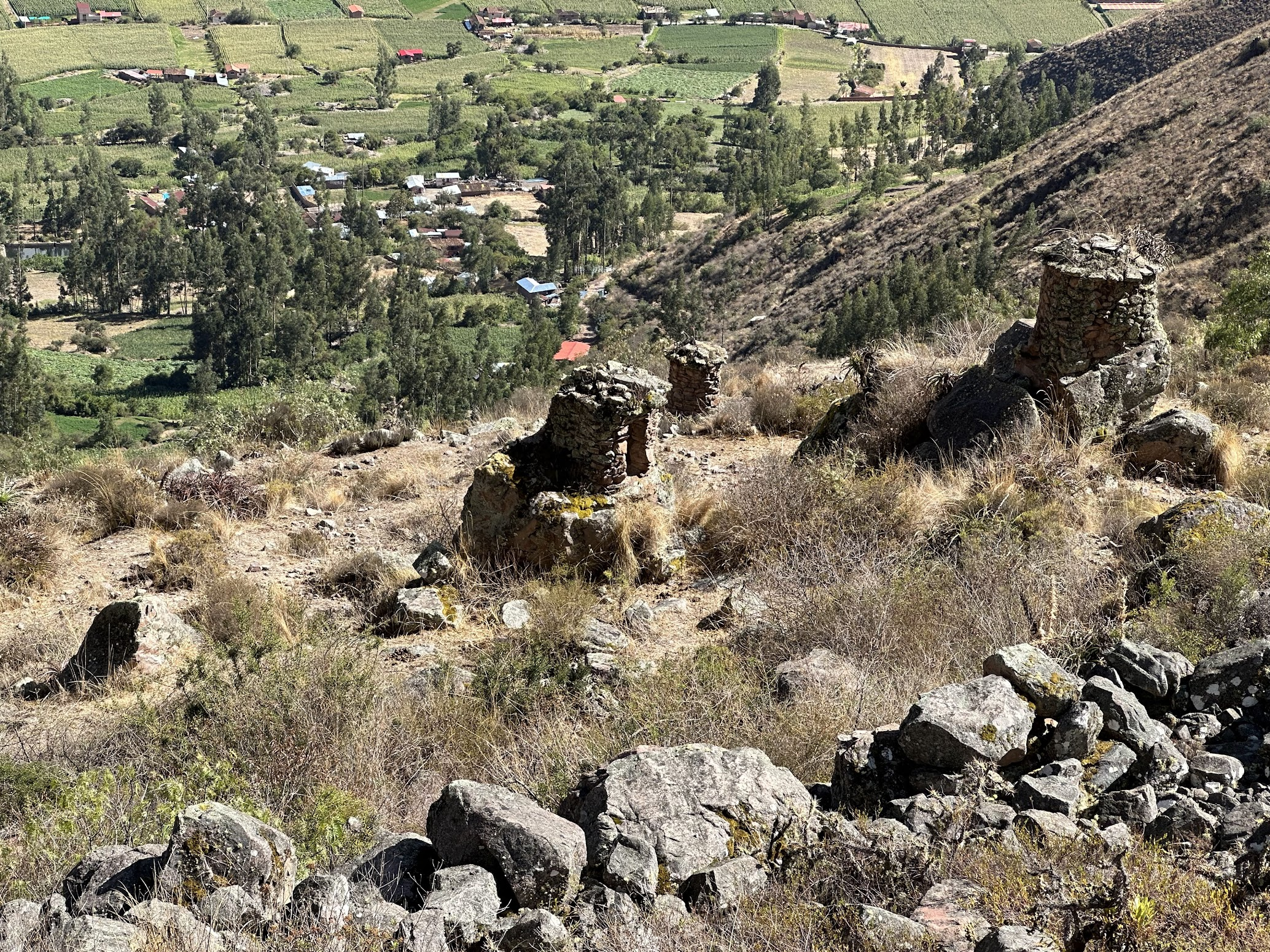
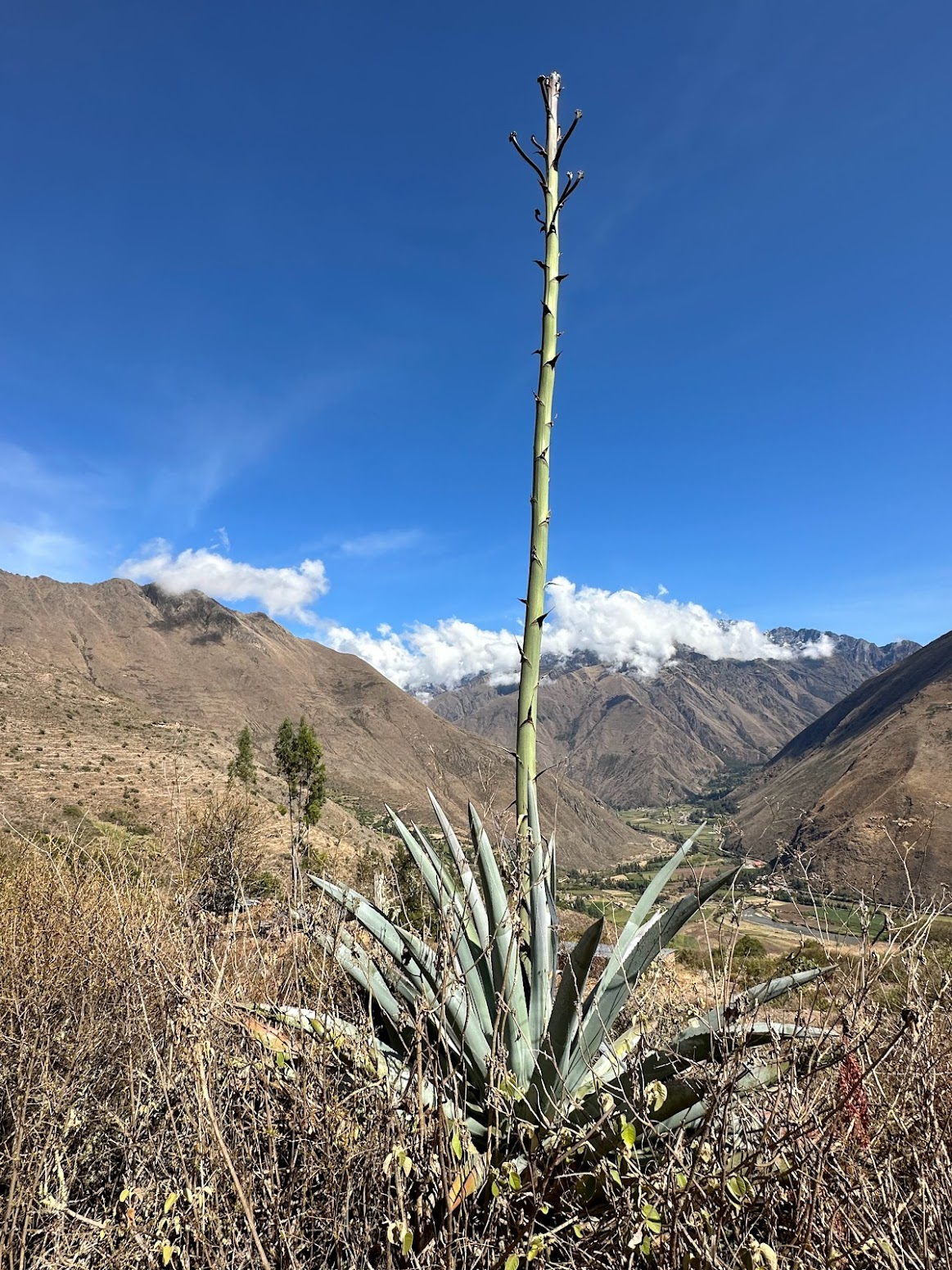
These granaries (also called Qullqas in Quechua, the local language) were a common type of Inca architecture. The Incas stored food and other commodities such as dried potatoes, maize and meat, which could be distributed to their armies, officials, conscripted laborers, and, in times of need, to the populace. These storage facilities were necessary because of the uncertainty of agriculture at high altitudes and because the Incas did not have navigable rivers, wheeled vehicles, or large draft animals. Thousands of such Qullqas have been found. They were built on the windward hill sides and had windows and a channel on the ground to facilitate air movement. Imagine building these relatively large structures without the use of wheeled vehicles or tools made of hard metals such as iron!
Day 4
Day 5

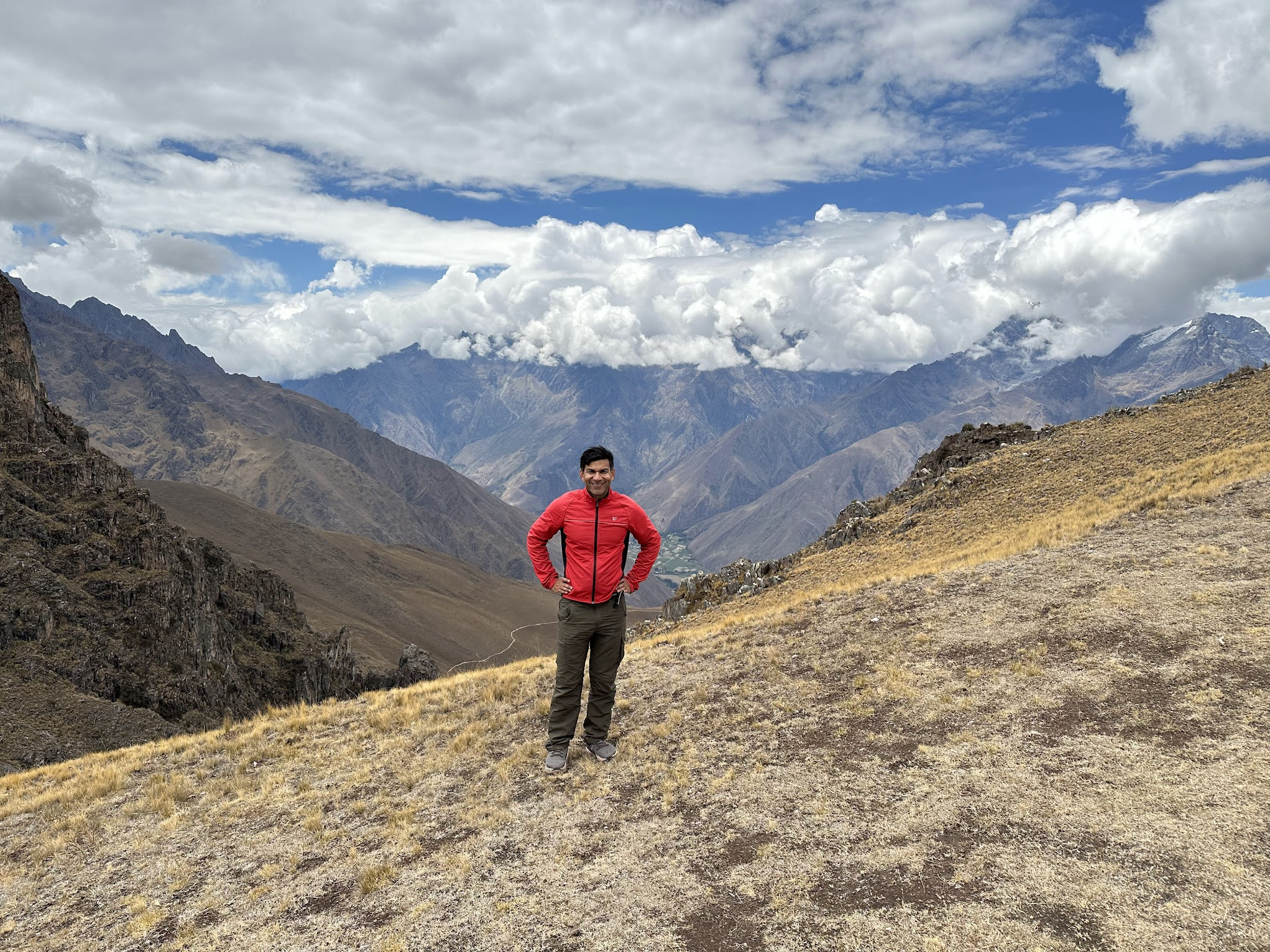
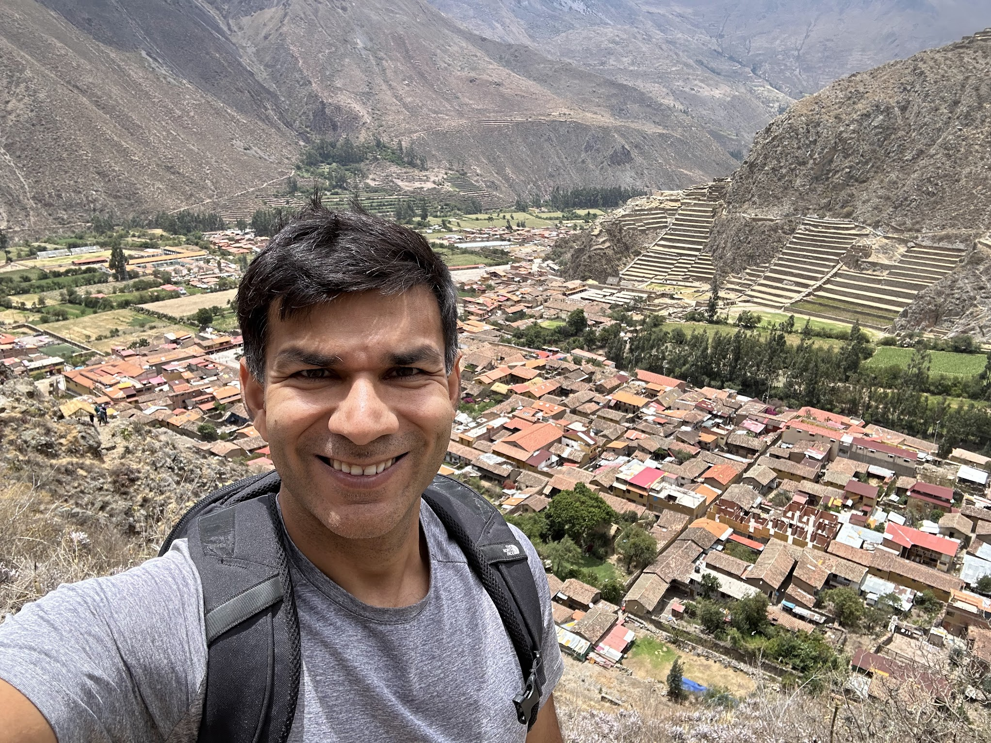
On the way down to the final campsite of the trek, we stopped at Intipunku (“Sun Gate” in Quechua), a spiritual place for the Incas that offers incredible views of Ollantaytambo and the neighboring mountains. Intipunku is about 5.5 miles from Ollantaytambo and a back and forth day hike from Ollantaytambo to Intipunku is becoming a popular hiking option.
From Intipunku, it was about a 20 min trek down to our camp site. The camp site was located at around the same altitude as the campsite the night before, a bit disappointing, because I was hoping for it to be a bit warmer during the night.
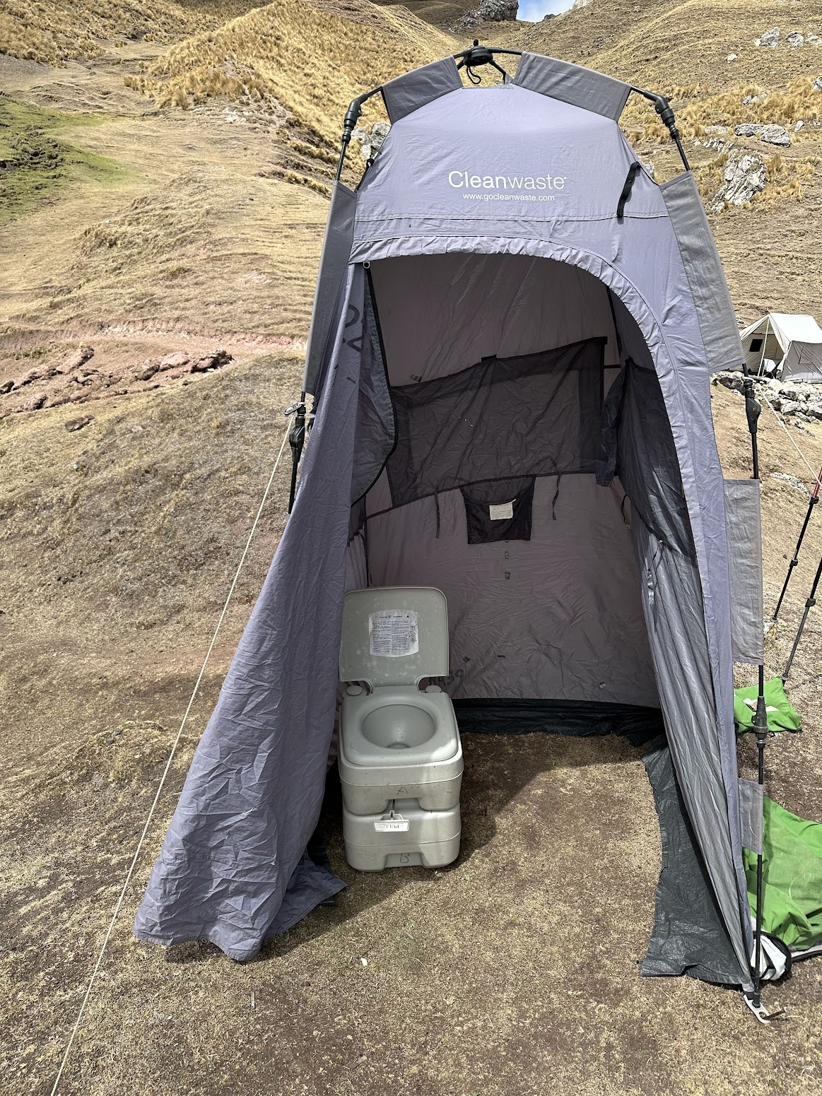
As usual, the mules and help staff had arrived ahead of us and set up the tents, kitchen and bathroom. This campsite wasn’t near any settlement, so there were no toilet facilities. The help staff set up a “chemical toilet” (called Porta-Potty in the US). Suffice it to say that it served the purpose, but wasn’t the cleanest system. I was quite glad this was our last day of camping.
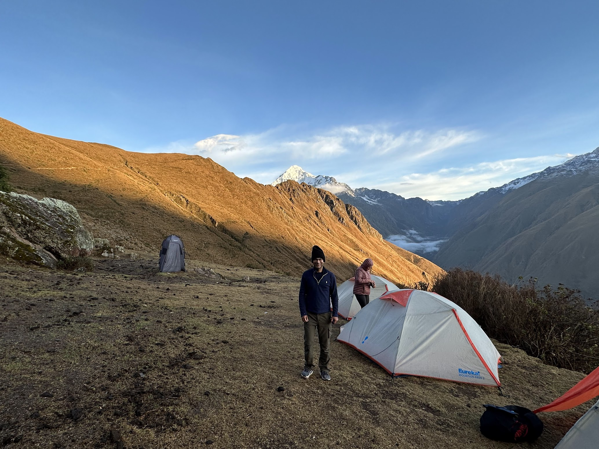
After the whole group had gathered, we had an afternoon snack, rested for a bit and had dinner around 5:30. Just as last night, the wind picked up in the afternoon and it got chilly after sunset. We retired to our tents shortly after dinner. I used the wet wipes to take a “dry shower” in the tent, which felt great. Perhaps because I was very tired and hadn’t slept properly the last two nights, I slept better on the third night.
Just like last night, it rained a lot through the night and the ground was wet when we woke up. Pro-tip – if you leave your shoes outside the tent (which you likely will, because they get smelly after 2-3 days of hiking), make sure they are well under the tent flap so they don’t get wet if it rains!
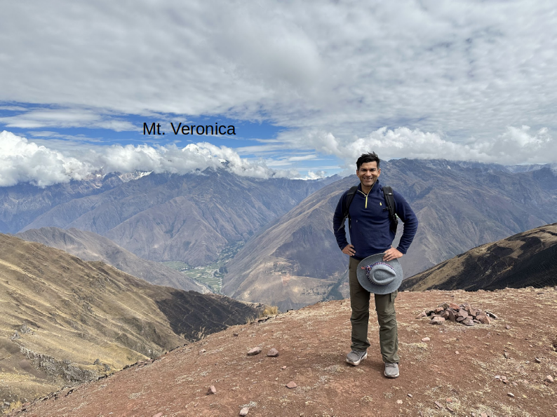
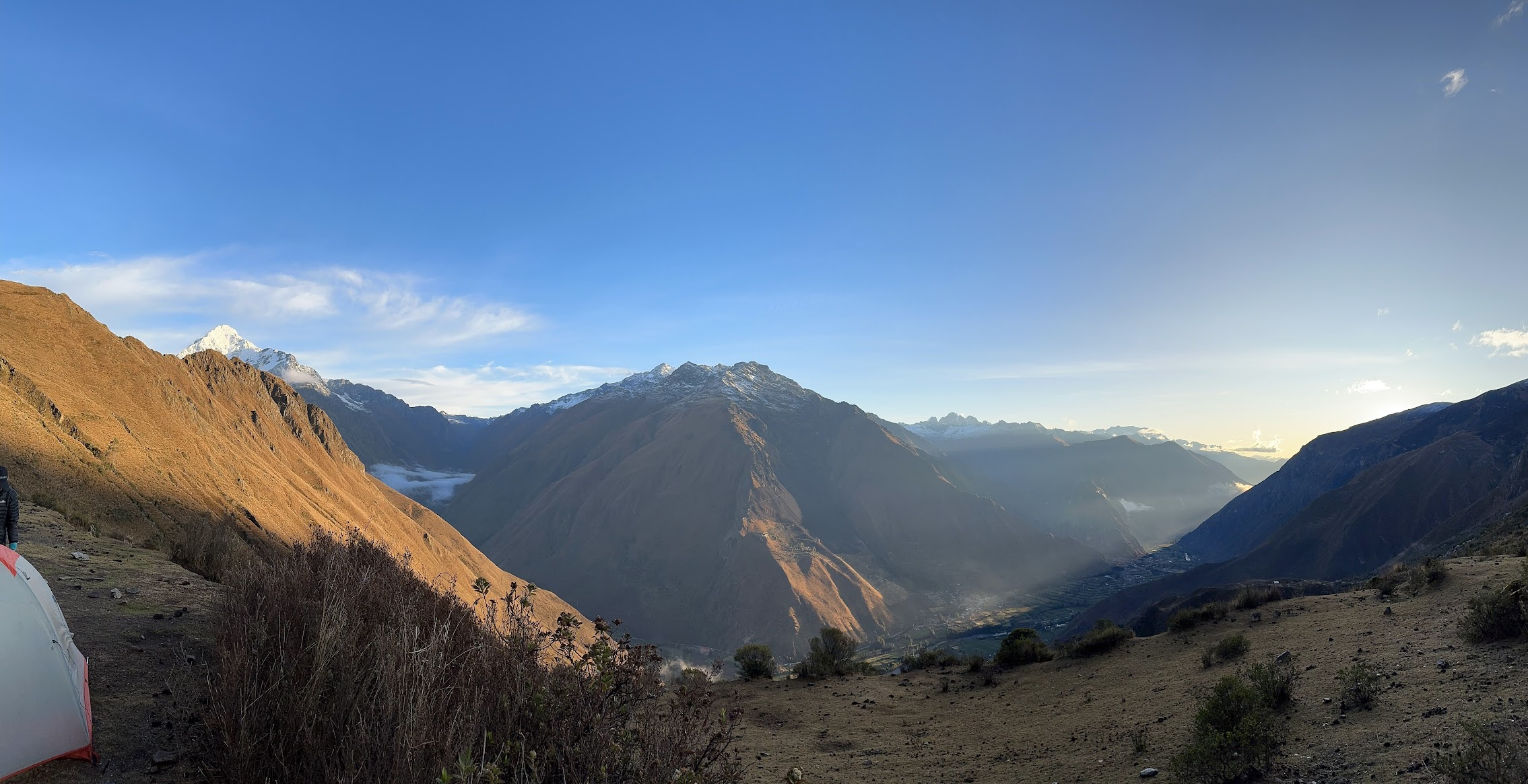
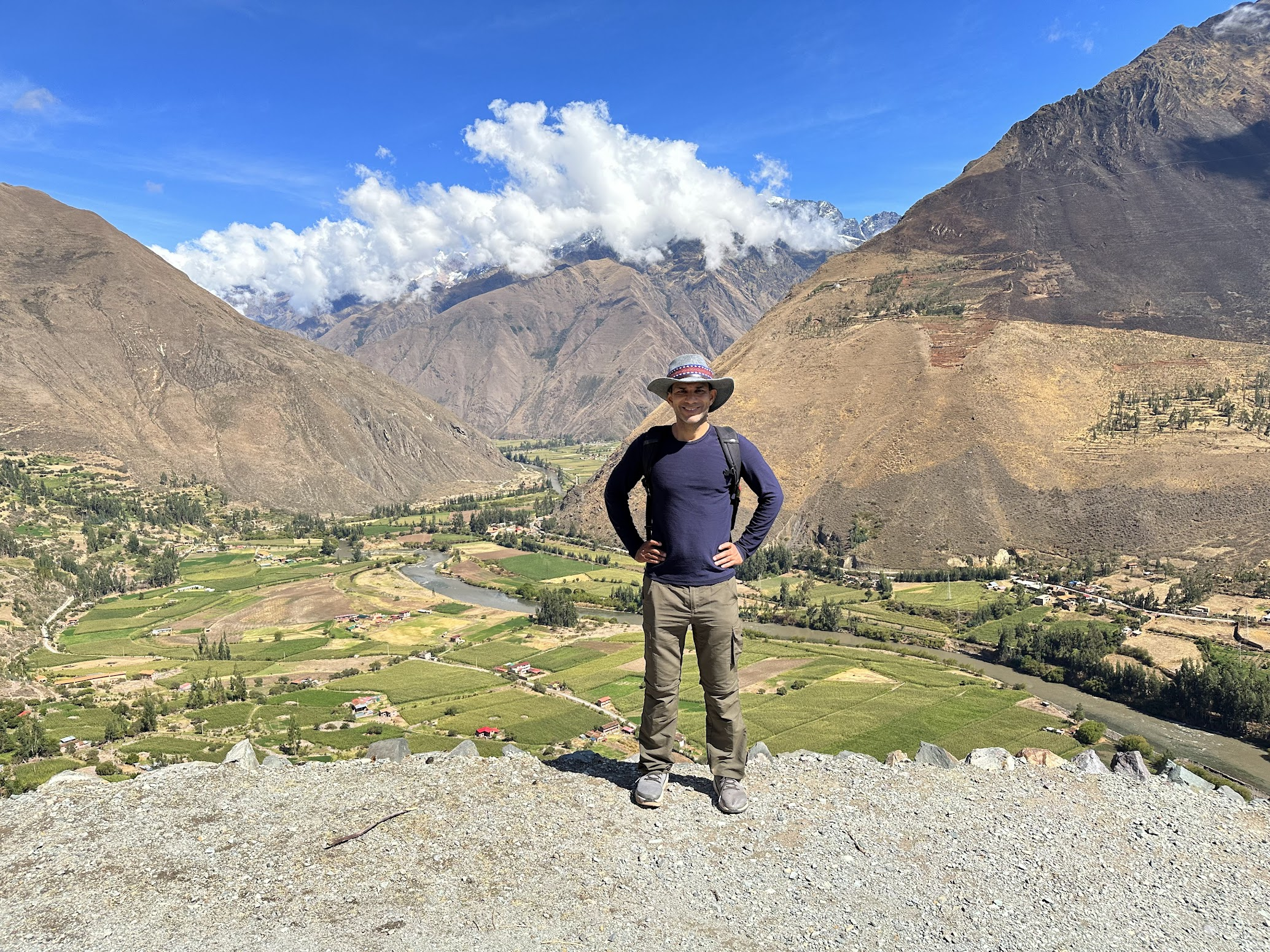
The next morning, the cloud cover that obscured the snow covered peaks of the mountains nearby had cleared out. We were greeted to amazing views of the peaks and valleys nearby, including Mt. Vernonica, the tallest peak in the area.
We had our usual Coco leaves tea and breakfast. On the trip, we made coffee by adding water and powdered milk to coffee concentrate. By this time, there was only some dark sludge left at the bottom of the coffee concentrate container, so the coffee was barely drinkable. The rest of the food continued to be of excellent quality.
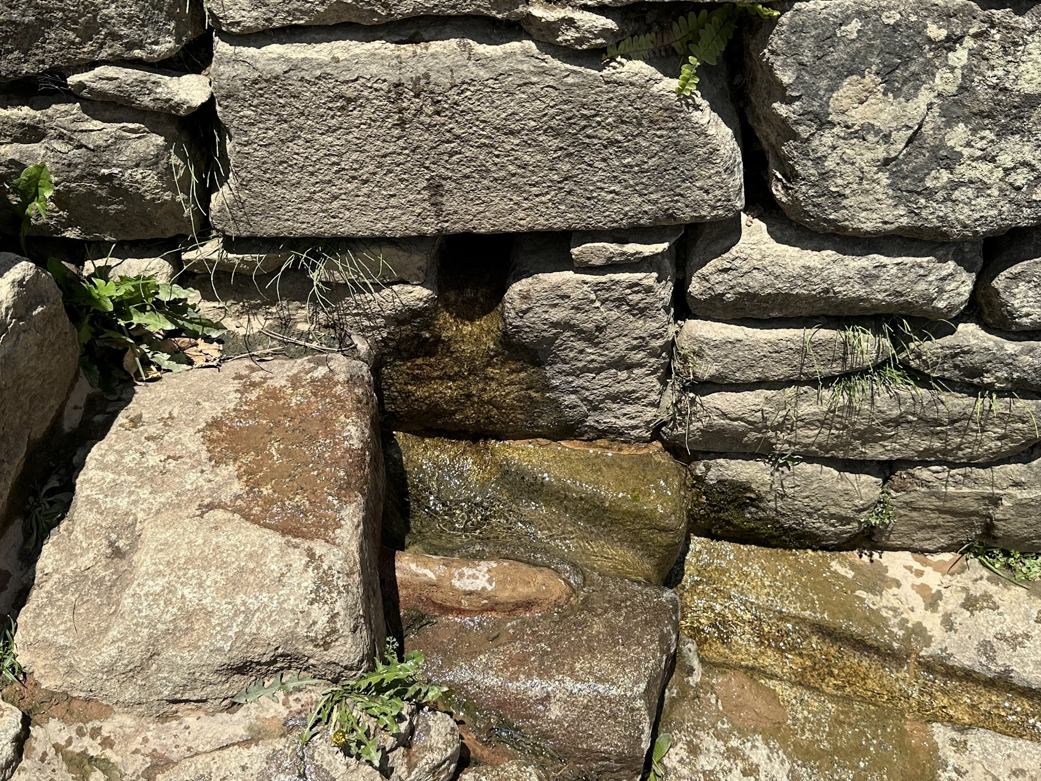
We started our way down to Ollantaytambo around 7 AM. We had about 7 Km to go along a mostly gentle decline that followed in part steps laid down by the Incas so many centuries ago. Along the way, we came across remnants of rock-lined water channels created by the Incas to transport water from mountain streams to their settlements in the valley.
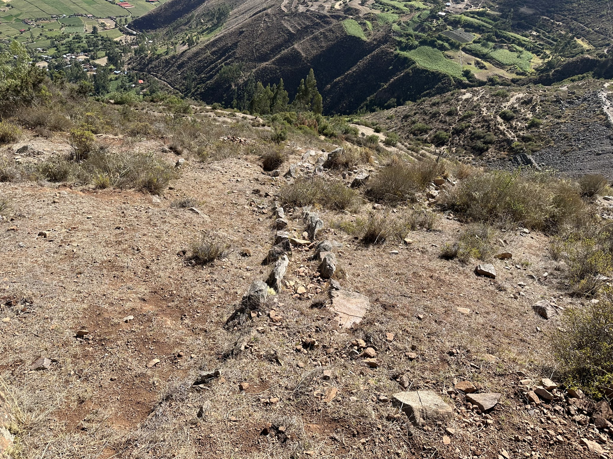
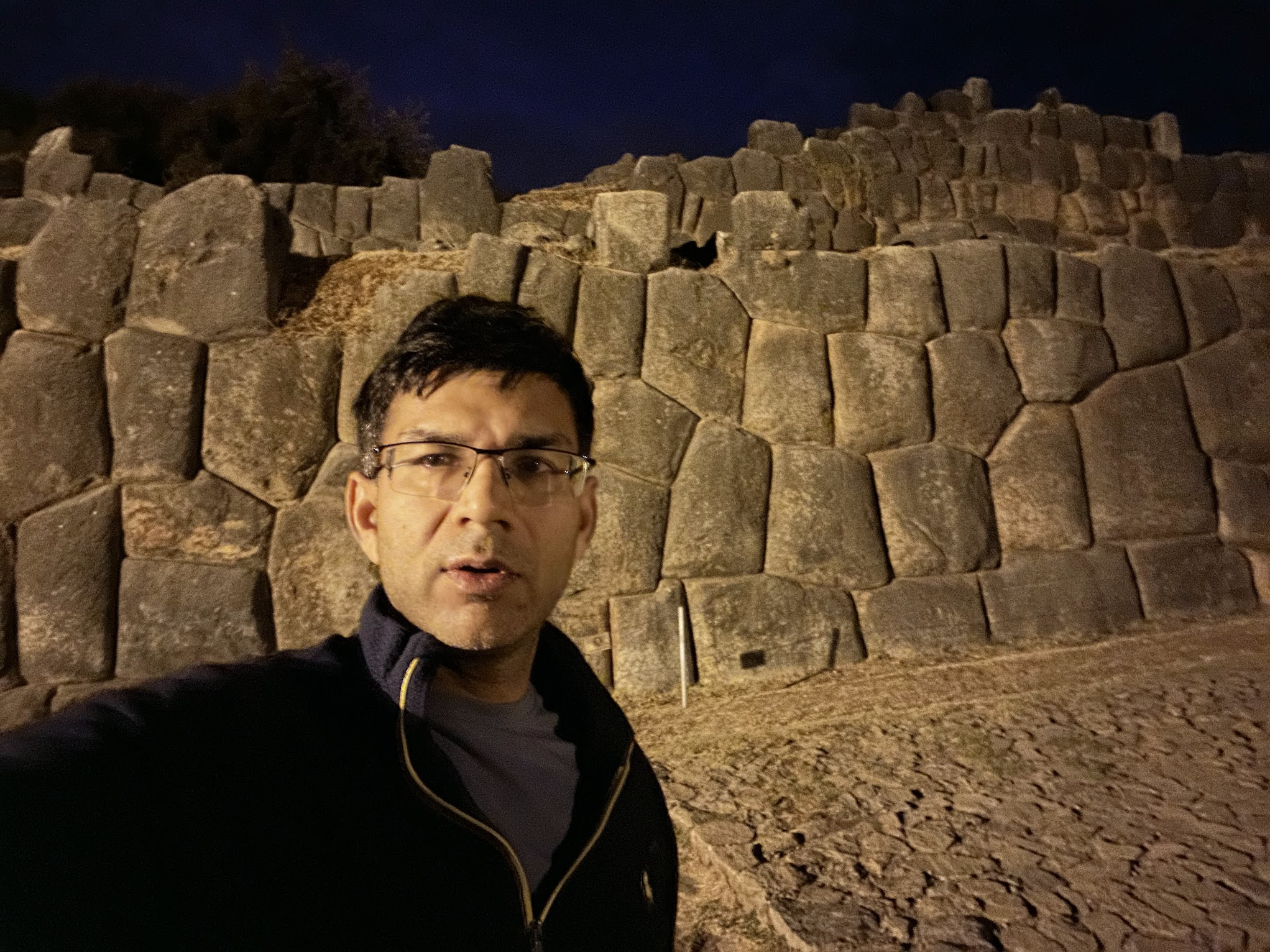
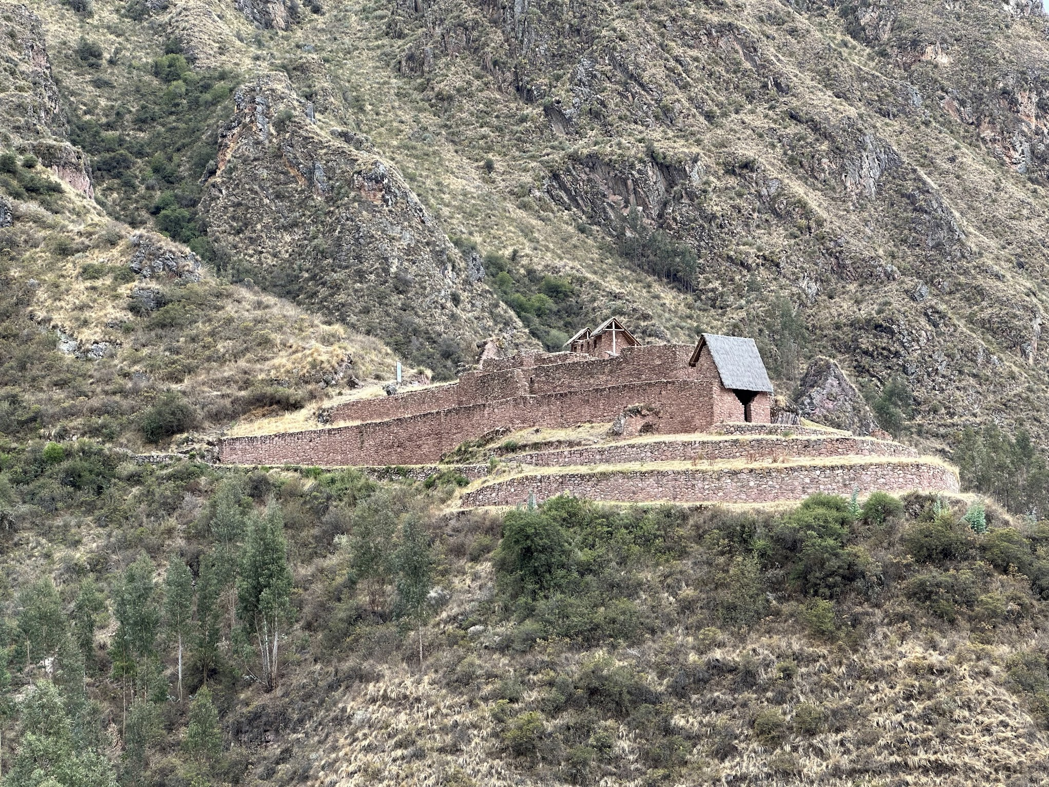
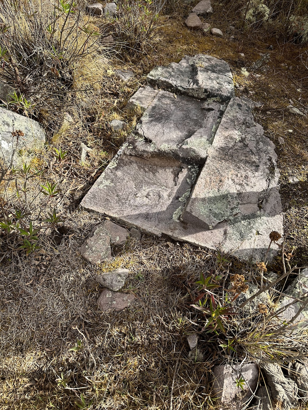
Along the way, we passed by another quarry and a few small Inca archaeological sites. One of them featured a grave that according to our guide, was used to bury workers who died while carrying the heavy stones down the quarry. Our guide also pointed out a granite stone with perpendicular corners, straight edges and straight line incisions. This stone was probably abandoned part way through the process of being carved into shape to be used as a building material.
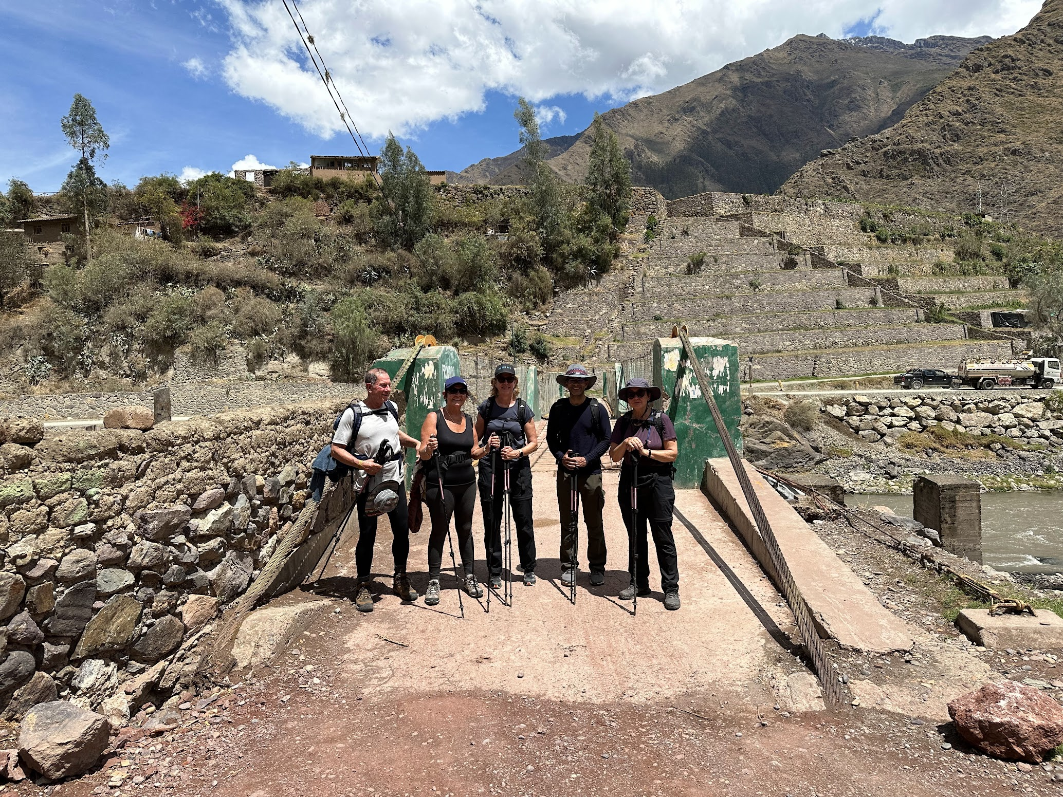
We finally arrived back in Ollantaytambo around 12:30 PM and promptly found a bar and treated ourselves to some beers. I was astonished to learn that Harvey, one of the Australians in our group, had a total knee replacement on both his knees just last year! I would never have guessed from his gait and the pace he maintained throughout the hike. I also have some cartilage damage in the medial compartment of my right knee, due to an ACL injury many years ago, and may need a partial knee replacement at some point in the future.. With some luck, we’d have figured out by then how to coax the body to regrow cartilage, eliminating the need for artificial knees. I was quite gratified that my knees felt absolutely fine, no pain or even strain of any kind. The trekking poles are partly to thank for that. Even a little bit of cushioning and shock absorption over time has a compounding effect in lowering cumulative stress on the knees, specially while hiking long distances.
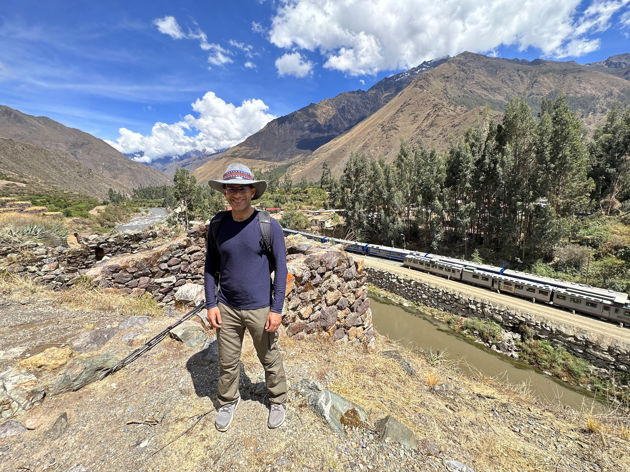
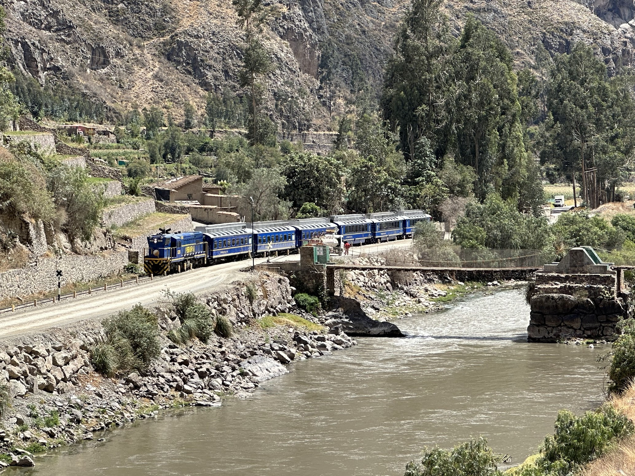
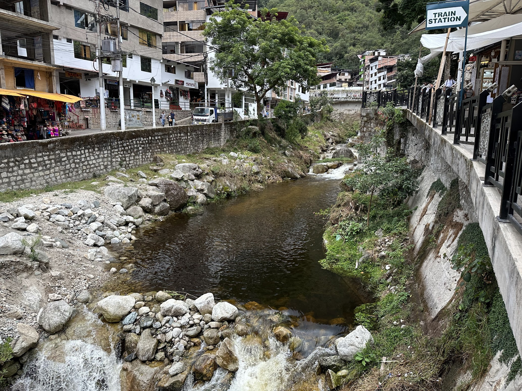
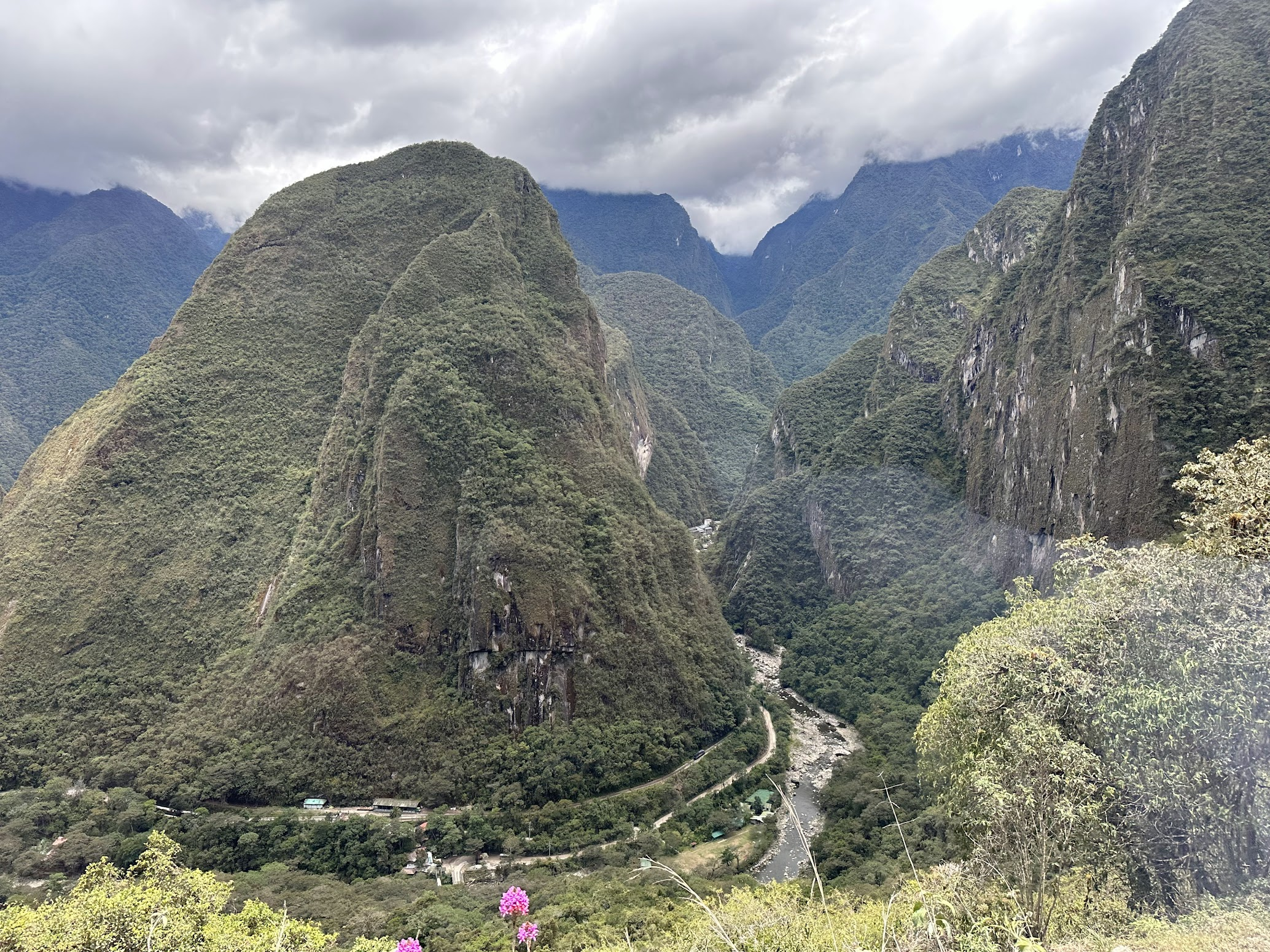
Next up was talking the train to Aguas Calientes, a town at the bottom of the mountain on top of which Machu Picchu is located. Since we were staying at a hotel in Aguas Calientes that night, we didn’t have to pack for camping anymore. So, after lunch at the bar, we walked back to our hotel (where we had stayed before leaving for the Quarry trail), and repacked our backpacks and duffel bags with what we needed to spend the day in Aguas Calientes and the day trip to Machu Picchu the next day. As the name implies, Aguas Calientes features natural hot baths, a popular tourist attraction. So, I made sure to pack my swimming trunks.
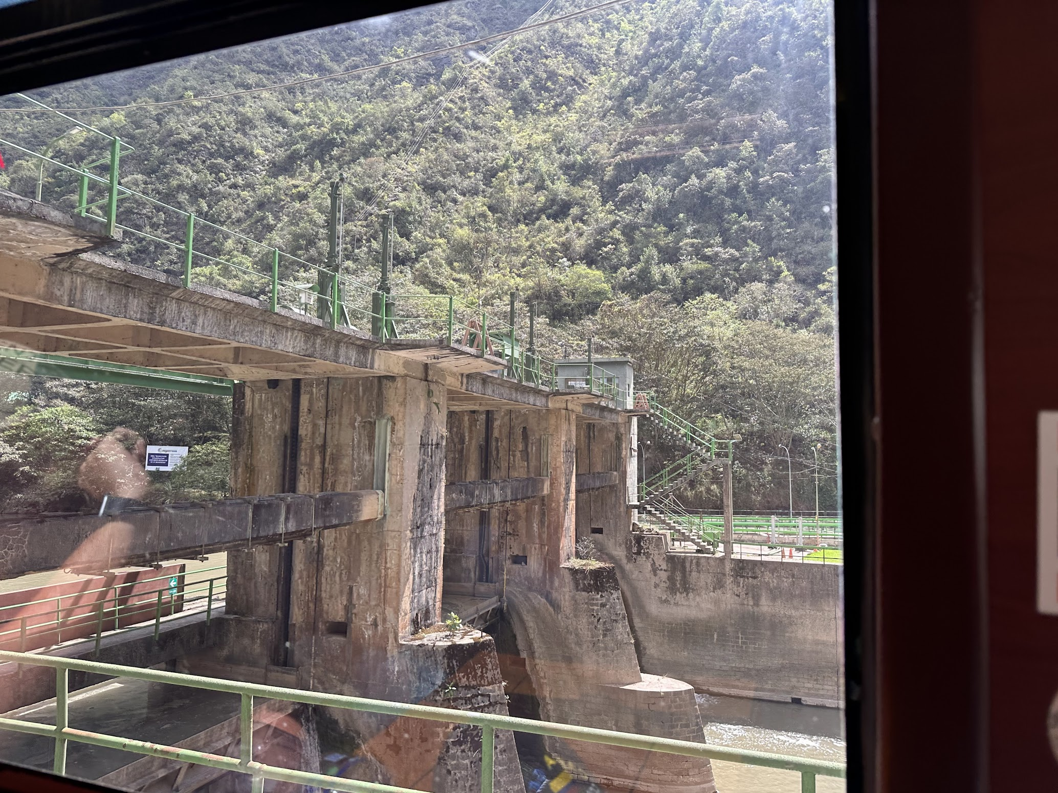
Our tour had already arranged for the train tickets (which are generally sold out, and should be reserved in advance). The train was nice and comfortable and took about 2 hours to arrive in Aguas Calientes. The route follows the Urubamba river and offers superb views of the river valley. We also passed by a hydroelectric dam on the river.
We had the afternoon to ourselves in Aguas Calientes. The town is teeming with tourists and innumerable bars, restaurants and hotels that cater to the tourists. I got lunch and walked over to the thermal baths. The thermal baths feature three pools with temperature varying from 38ºC. (100.4 ° F) to 44ºC. (111.2 ° F). The water is drawn from a natural hot spring nearby. Due to the high sulfur content, the water looks muddy orange in color, which being the same color as body waste, can be a bit uninviting. Towels can be rented at the baths, although it is a good idea to carry a hotel towel in your backpack.
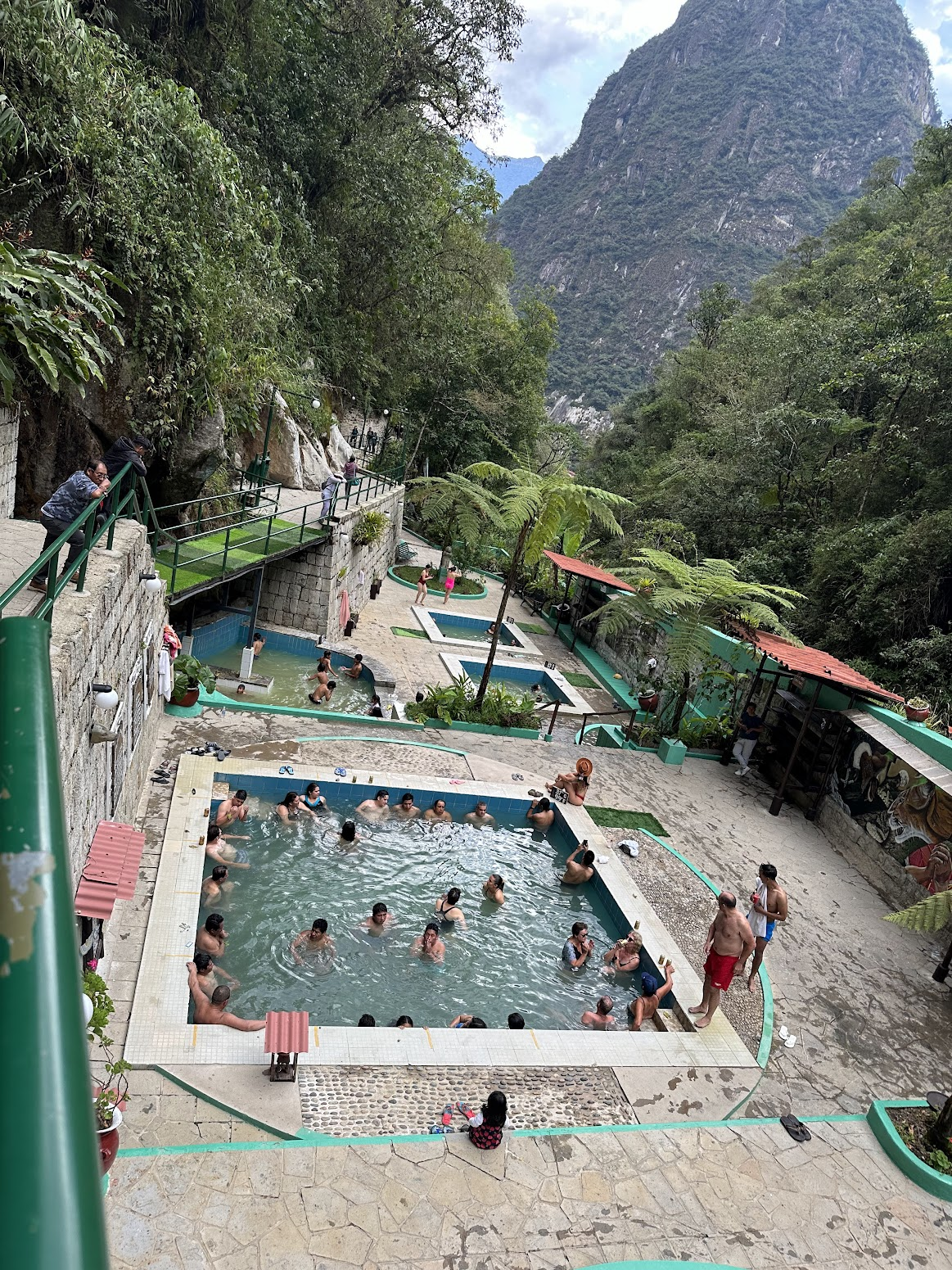
I spent about 30 min in the baths. Next up was getting a massage. The town is full of massage centers catering to the large population of weary hikers. Good quality massages cost about 25-30$. I got one at a massage center near our hotel and really enjoyed it. The masseuse did an amazing job. I highly recommend getting one.
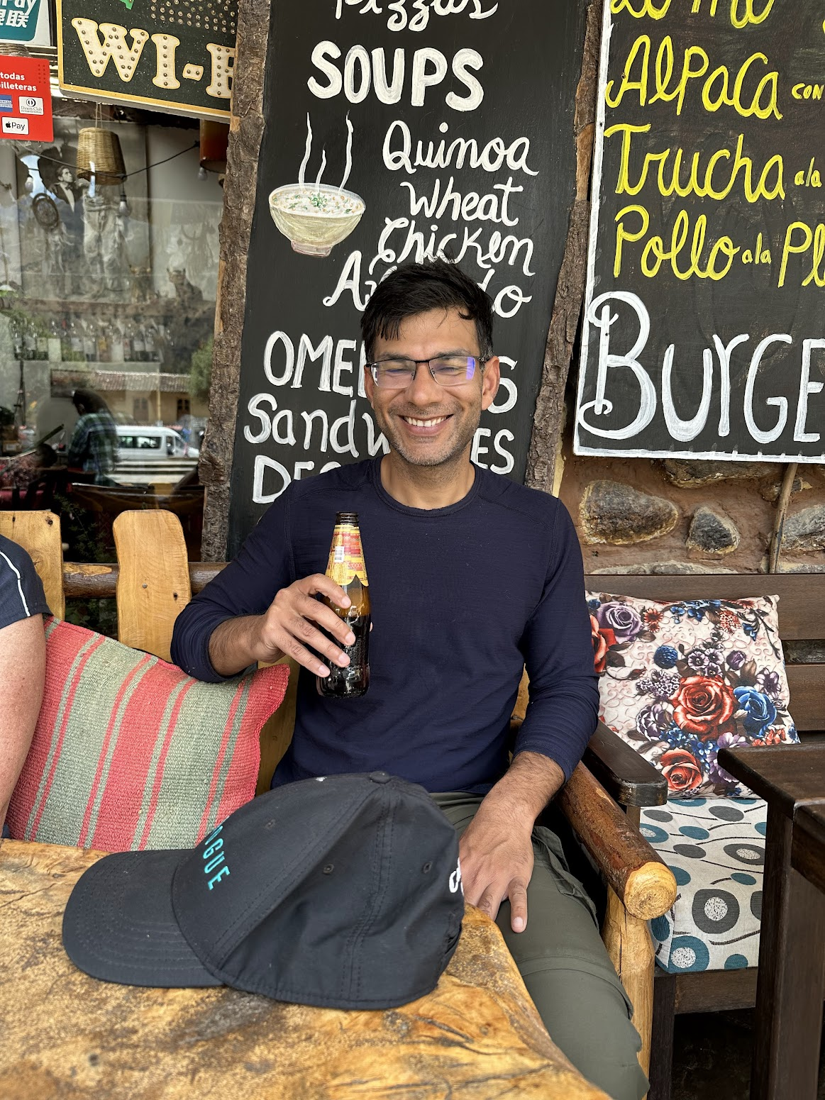
Later in the evening, we had our trip briefing for Machu Picchu and then went for dinner and ate and drank with abandon 🙂
Day 6
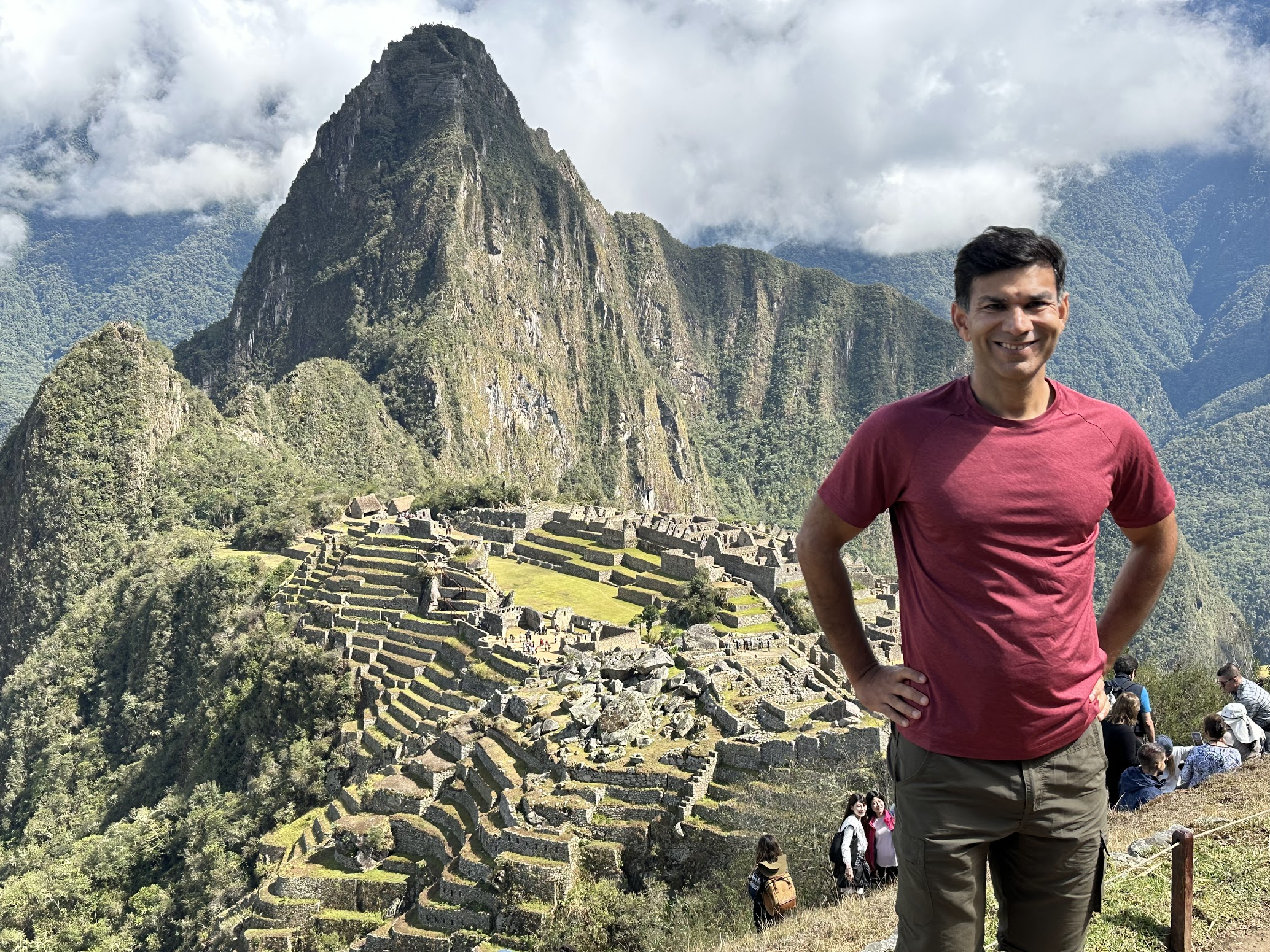
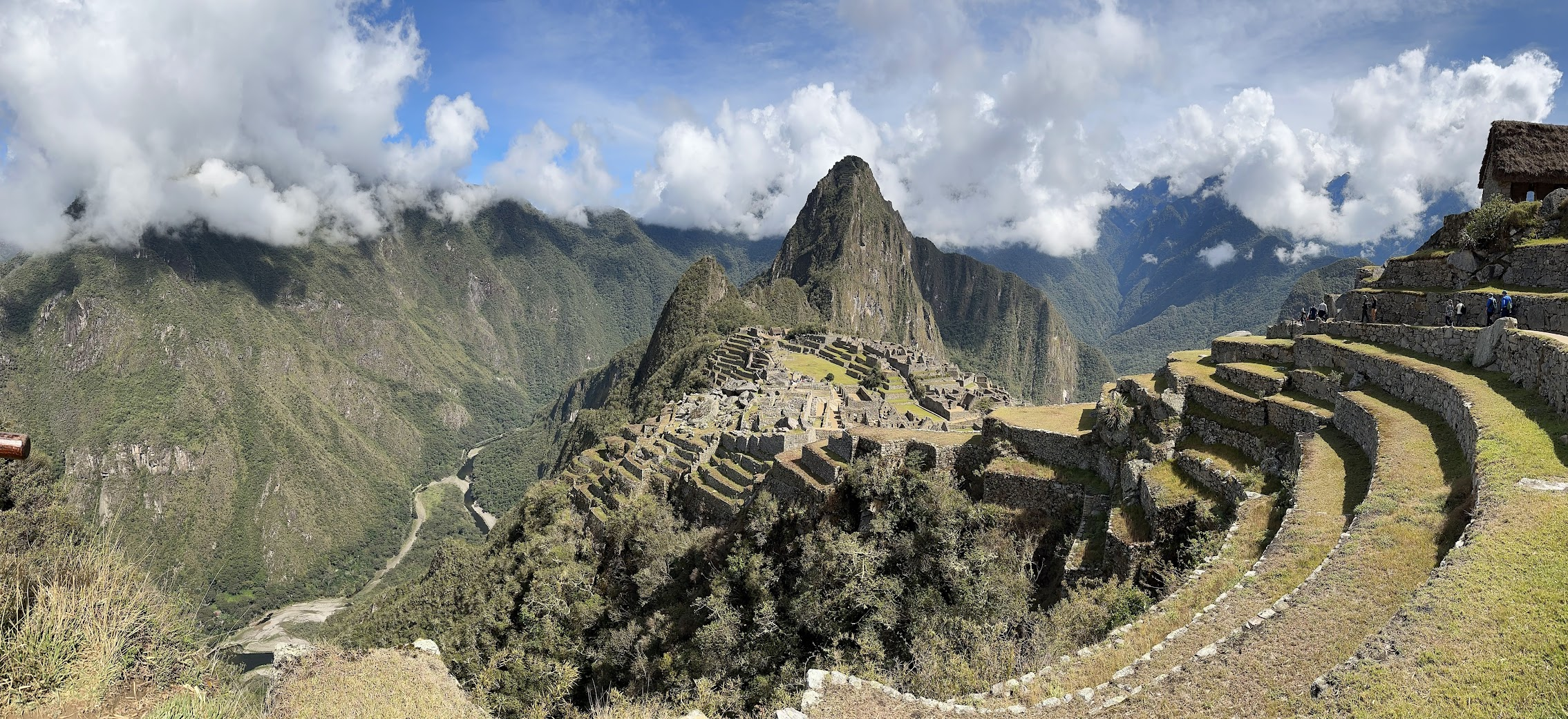
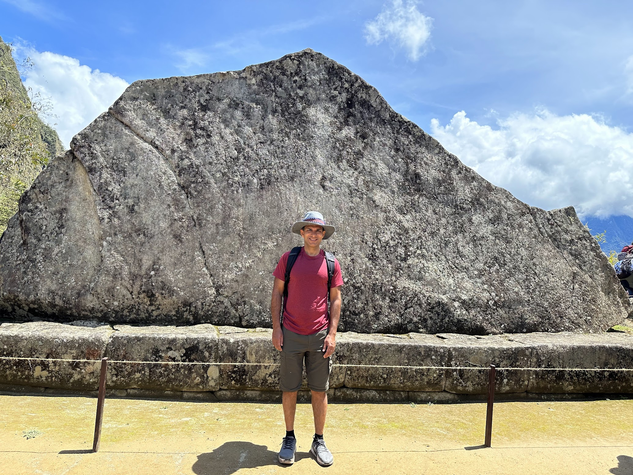
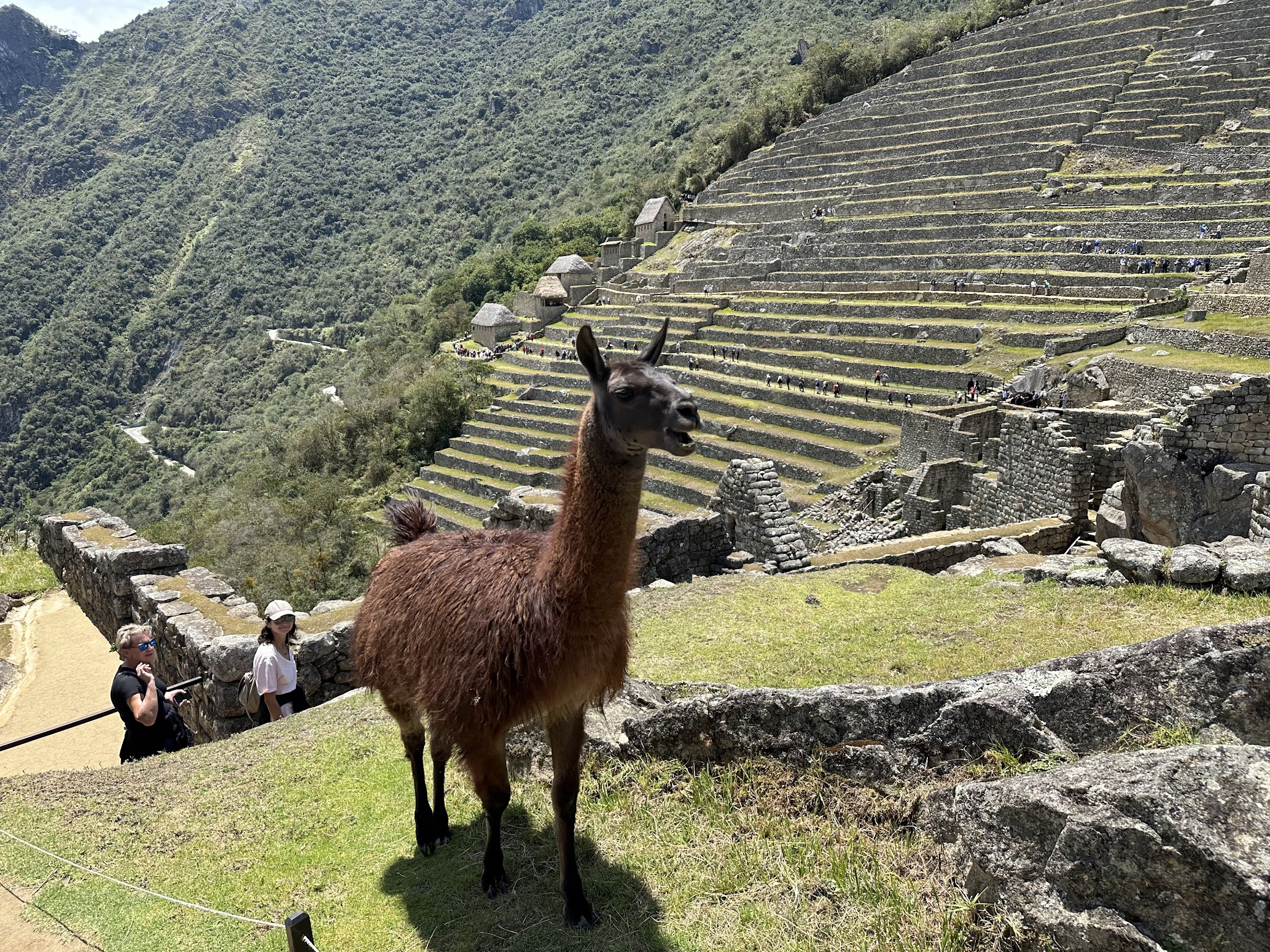
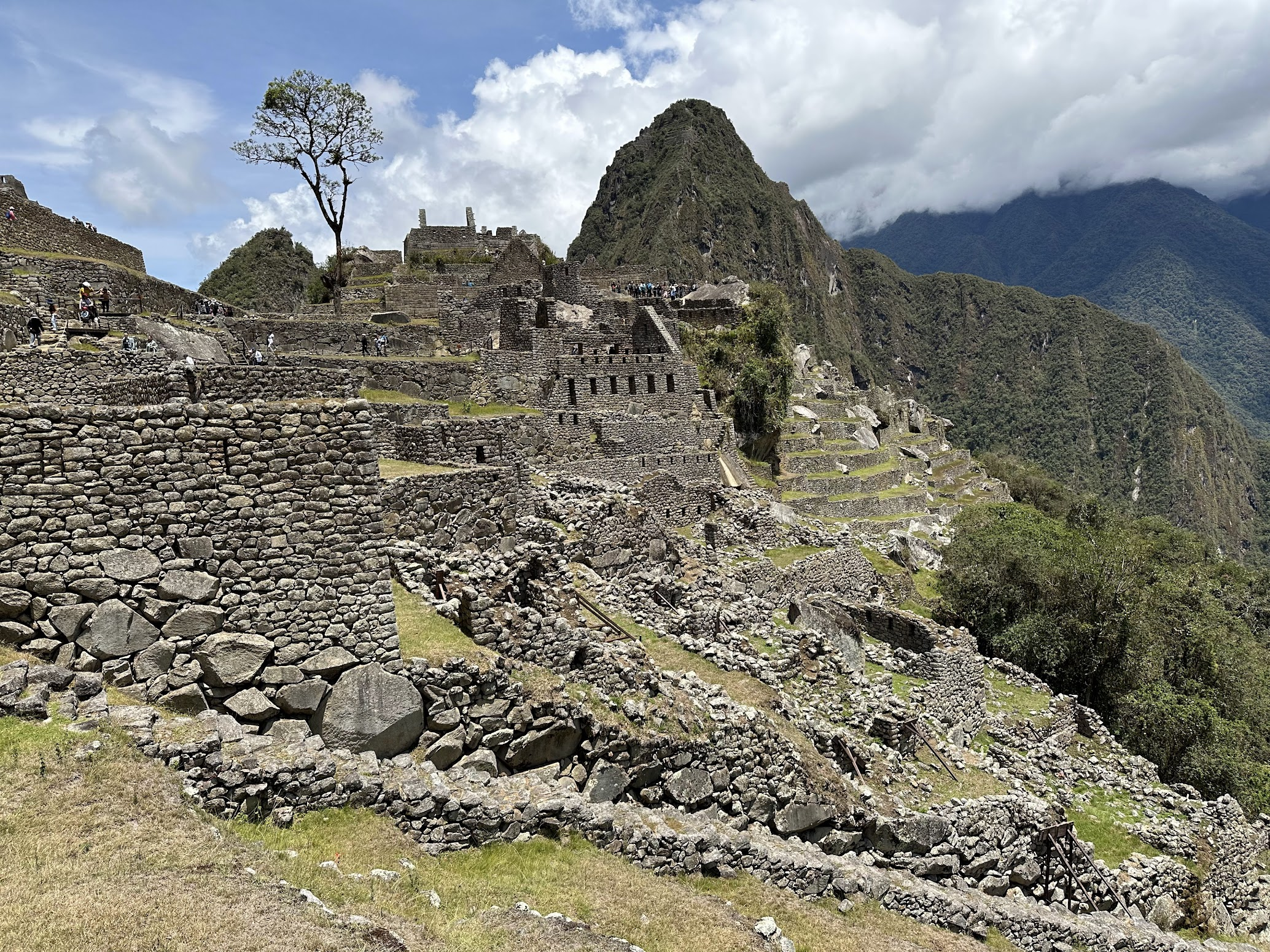
We got up early the next morning to take the bus to Machu Picchu. The bus tickets had already been arranged by our tour. It took about 20 min to arrive at the gates of Machu Picchu. One can also hike up to Machu Picchu from Aguas Calientes, which takes about 2 hours, and is something to consider if I visit Machu Picchu again. As I mentioned earlier, there are 4 circuits that visit different sections of Machu Picchu, along with several add-ons to visit the Inca bridge, Huchuy Picchu (small mountain) and Huyana Picchu (big mountain). I originally had a ticket for circuit 3, but my tour guide was able to persuade the guard at the entrance gate to let us follow circuit 2, which is the most popular and covers the largest number of sites.
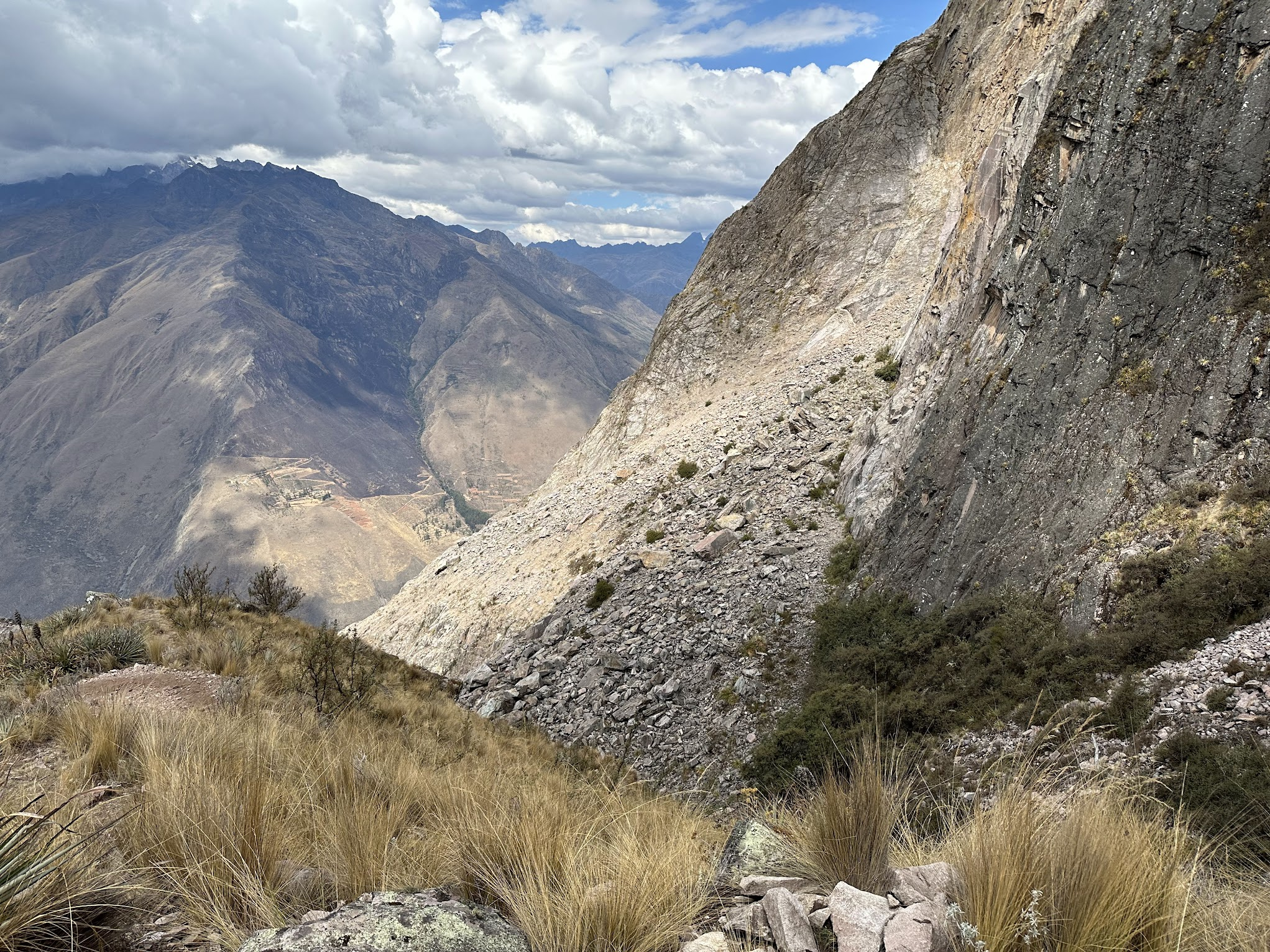
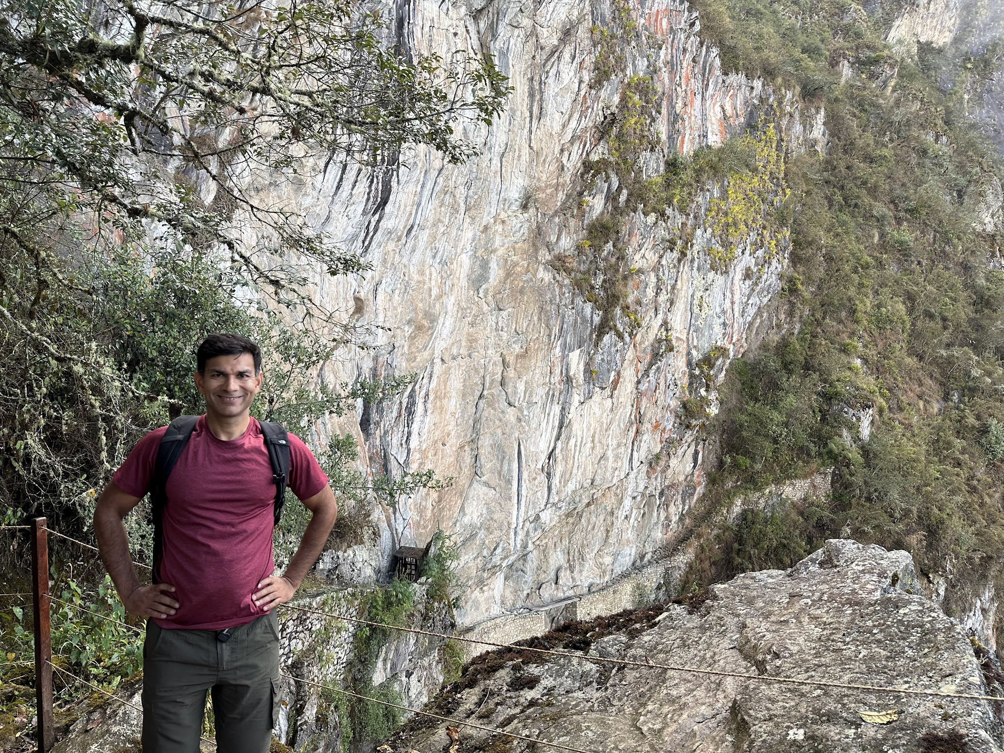
Upon entering the premises, we walked up to a spot overlooking Machu Picchu which is very popular for taking pictures, and for good reason. However, a cloud hung over the city, obscuring much of the view. Along the way, I had seen a sign for the Inca bridge. I asked my guide if we could hike up to the bridge. She said that isn’t possible, because an extra ticket is needed for the bridge. However, we walked up to the entrance to the hike leading to the bridge anyway. There was a lone guard manning the entrance. After some negotiation and promise of exchange of Soles, he kept my passport and let us proceed along the Inca bridge hike. After walking for about 15-20 min along a narrow stone path carved into the cliff face, with incredible views of the mountains, the Inca bridge came into view. At first glance, I was disappointed by what I saw. I had expected to see a massive rope bridge, a marvel of Inca engineering, spanning the distance between two mountains. This is how the bridge looks like:
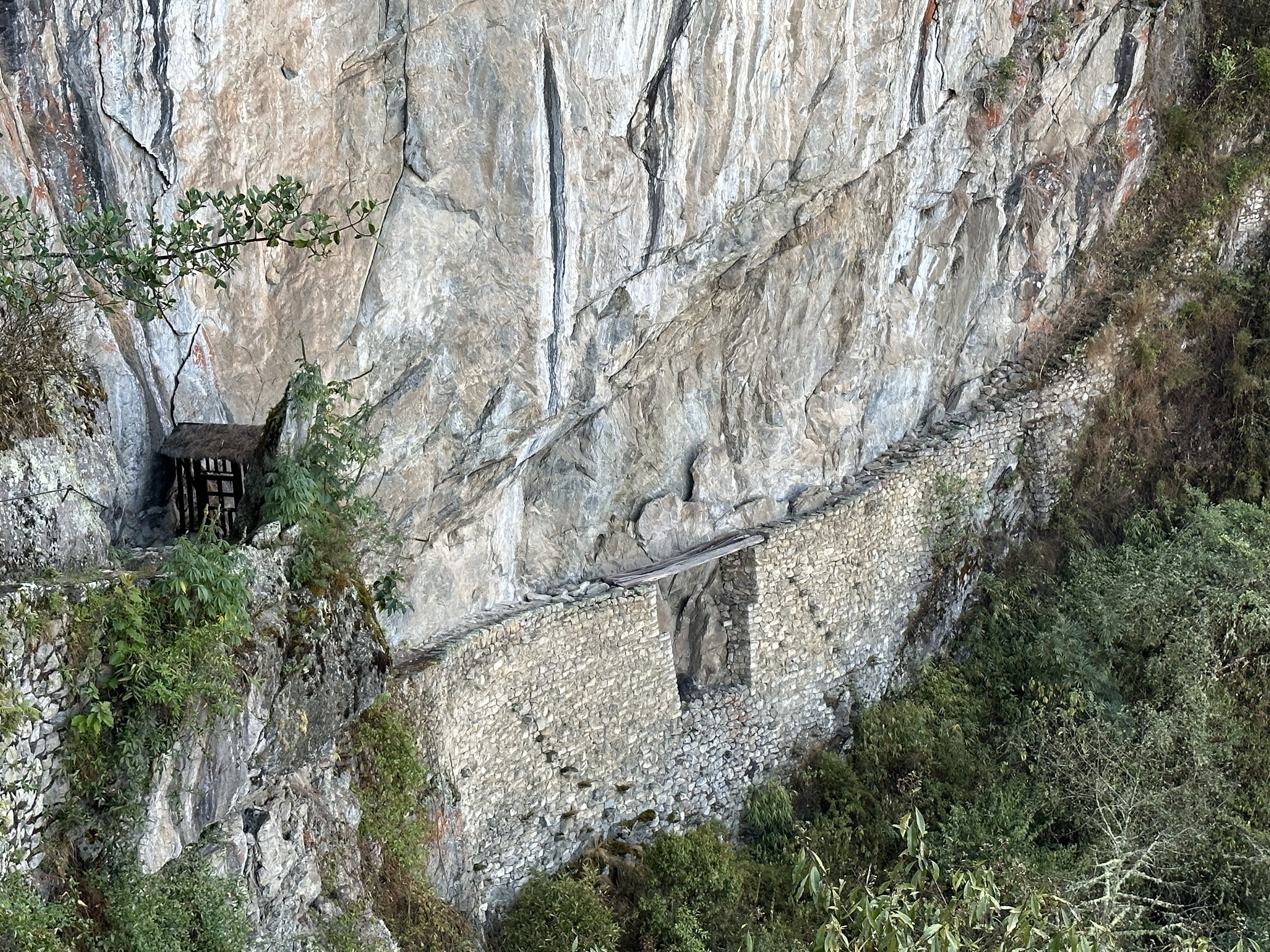
You can see that the bridge fills a gap left on purpose in the stone wall built by the Incas on the cliff face. Later I learnt the reason why. The bridge was intended to be used as a drawbridge to protect Machu Picchu from any invading armies heading that way. Without the bridge, an invader would have to walk down and up the gap, slowing them down and giving Inca sharp shooters (located near where the picture above is taken) time to shoot them down.
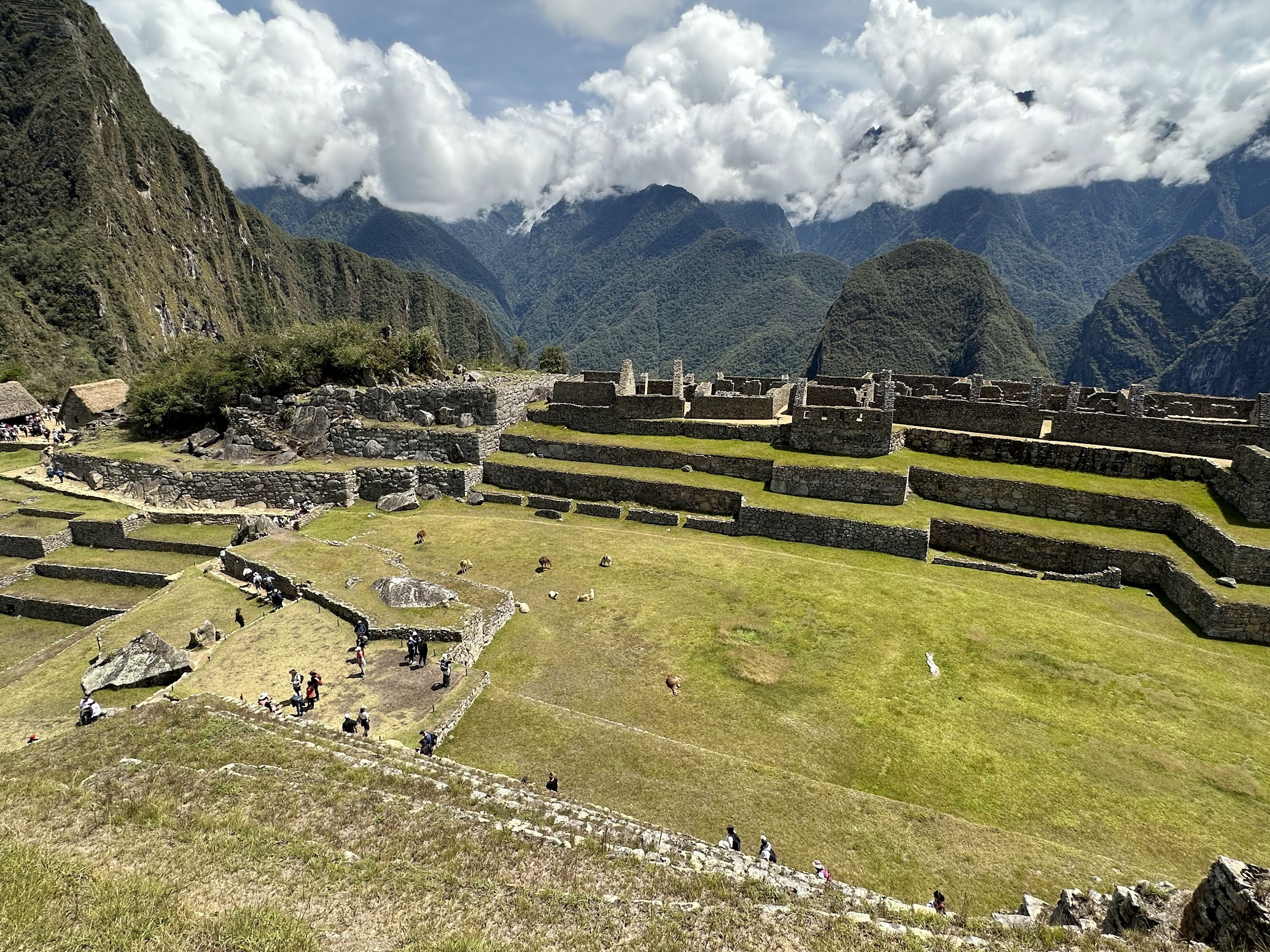
After taking some pictures, we headed back to Machu Picchu. I gave the guard the money he was promised, picked up my passport and walked back to the picture taking spot, hoping the clouds were gone. Indeed they were! After taking a zillion pictures, we slowly wound our way down to the city. In many areas, the authorities have built separate stairways next to the original stairs laid down by the Incas to prevent accelerated wear due to heavy tourist foot traffic.
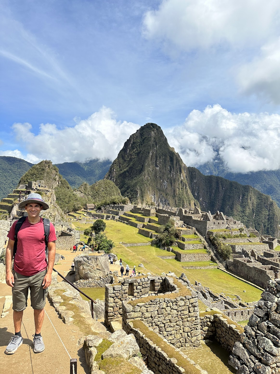
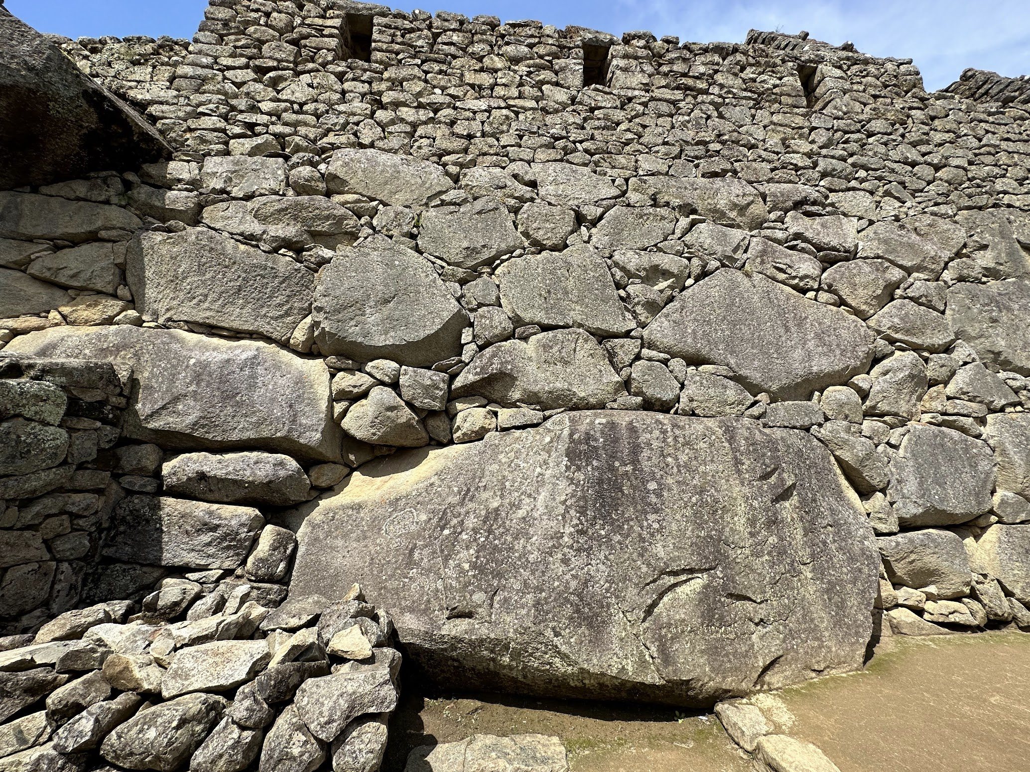
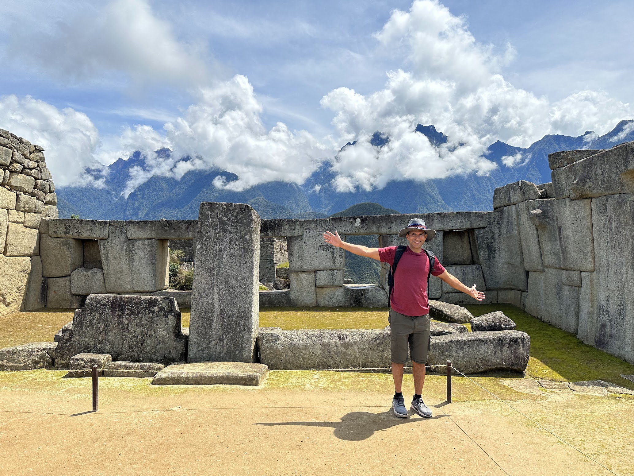
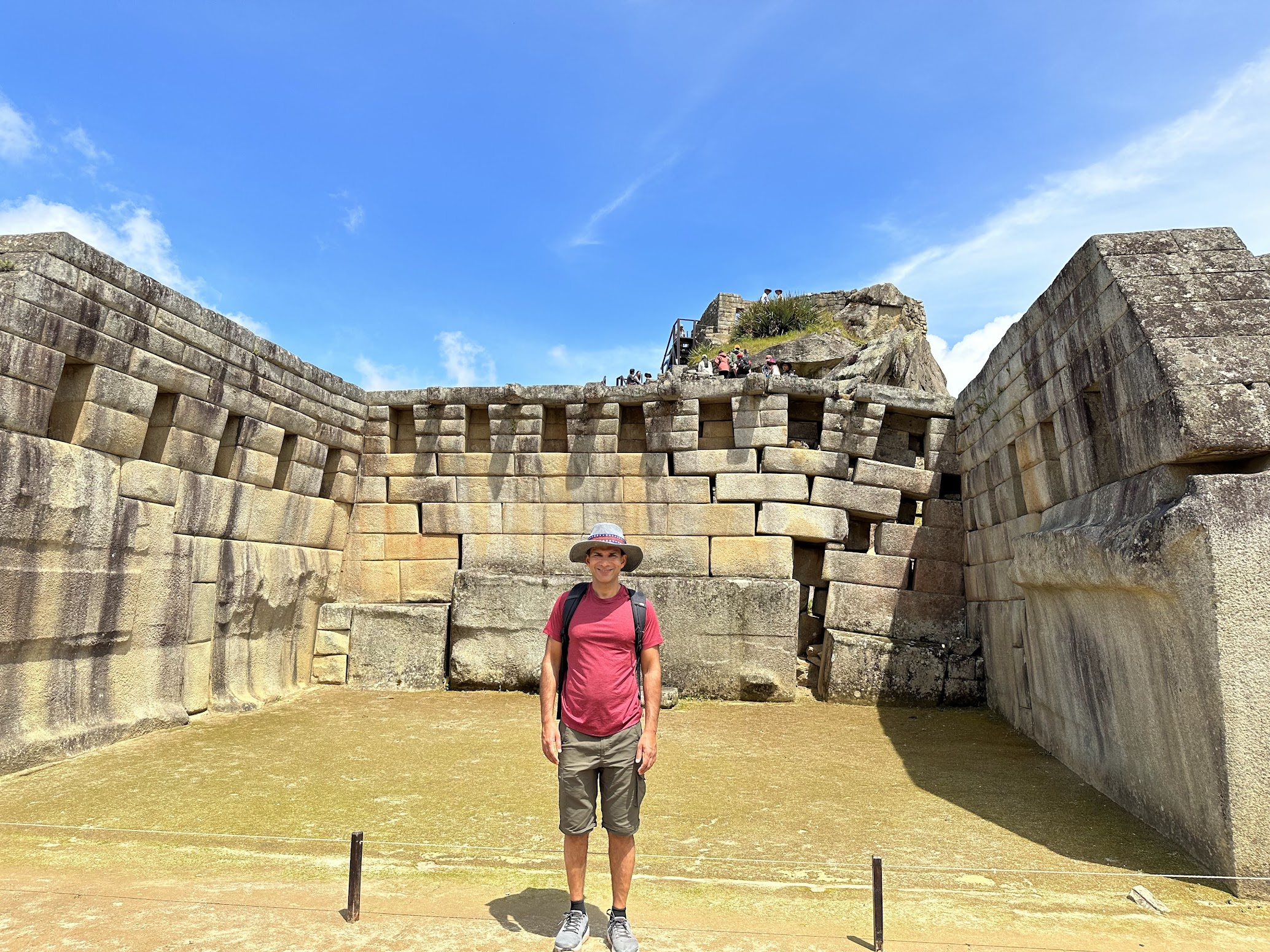
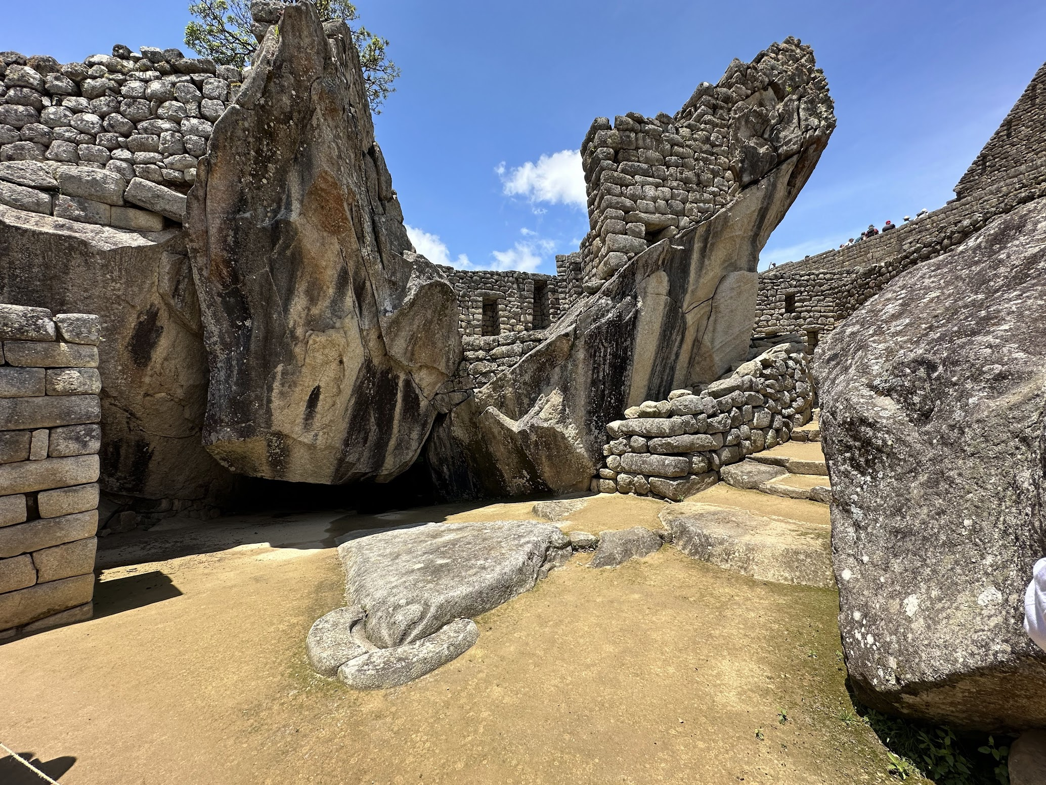
As we continued along the circuit, we passed by several important buildings in Machu Picchu, such as a hotel, apartment buildings, and the main temple..
I couldn’t help thinking how much energy and resources were invested by the Incas on superstition and religious affairs, which ultimately didn’t improve their quality of life. Perhaps if this energy and ingenuity were spent instead on developing new materials and technology such as iron and gunpowder, the Incas may have fought off the Spaniards. Although perhaps without unifying elements such as a widely-held belief in a shared pantheon of gods, and the divine right of the Inca emperor to rule, it would have been impossible to maintain control over a vast empire where news traveled as fast as the human runners who carried it.
I had forgotten to carry bug spray and got bitten pretty badly by tiny flies that are everywhere in Machu Picchu. Their bites caused red bumps, some of which turned into blisters and caused terrible itching for almost 2 weeks! So make sure to wear long pants, carry bug spray (or both).
After about 3 hours touring Machu Picchu, I bid farewell to my tour guide and took the bus back down to Aguas Calientes. Over lunch, I reconnected with the rest of our group that had done the Inca trail. Because of the uncertainty created by the agricultural workers strike, they had ended up losing almost the whole of the first day of hiking on the Inca trail, and had to make up for it on the second day, meaning they hiked around 20 km on the second day. On the last day, they had to get up around 3:30 AM to make their way down to Machu Picchu (the Inca trail leads directly to Machu Picchu, unlike the Quarry trail that makes a loop around Olantaytambo). As an aside, the early wake up time is to give the porters enough time to pack up and catch the 5:30 AM train back to their bases. The group looked surprisingly sprightly given the long and strenuous day they had already! Looking at them, I was filled with a deep pang of regret not having signed up for the Inca trail, but some of the regret dissipated when I heard stories about the unsanitary toilet facilities on the Inca trail.
After lunch, we took the train back to Ollantaytambo, picked up our luggage from the hotel and then took the bus back to Cusco. We treated ourselves to a huge dinner and regaled each other with the stories of our adventures.
Day 7
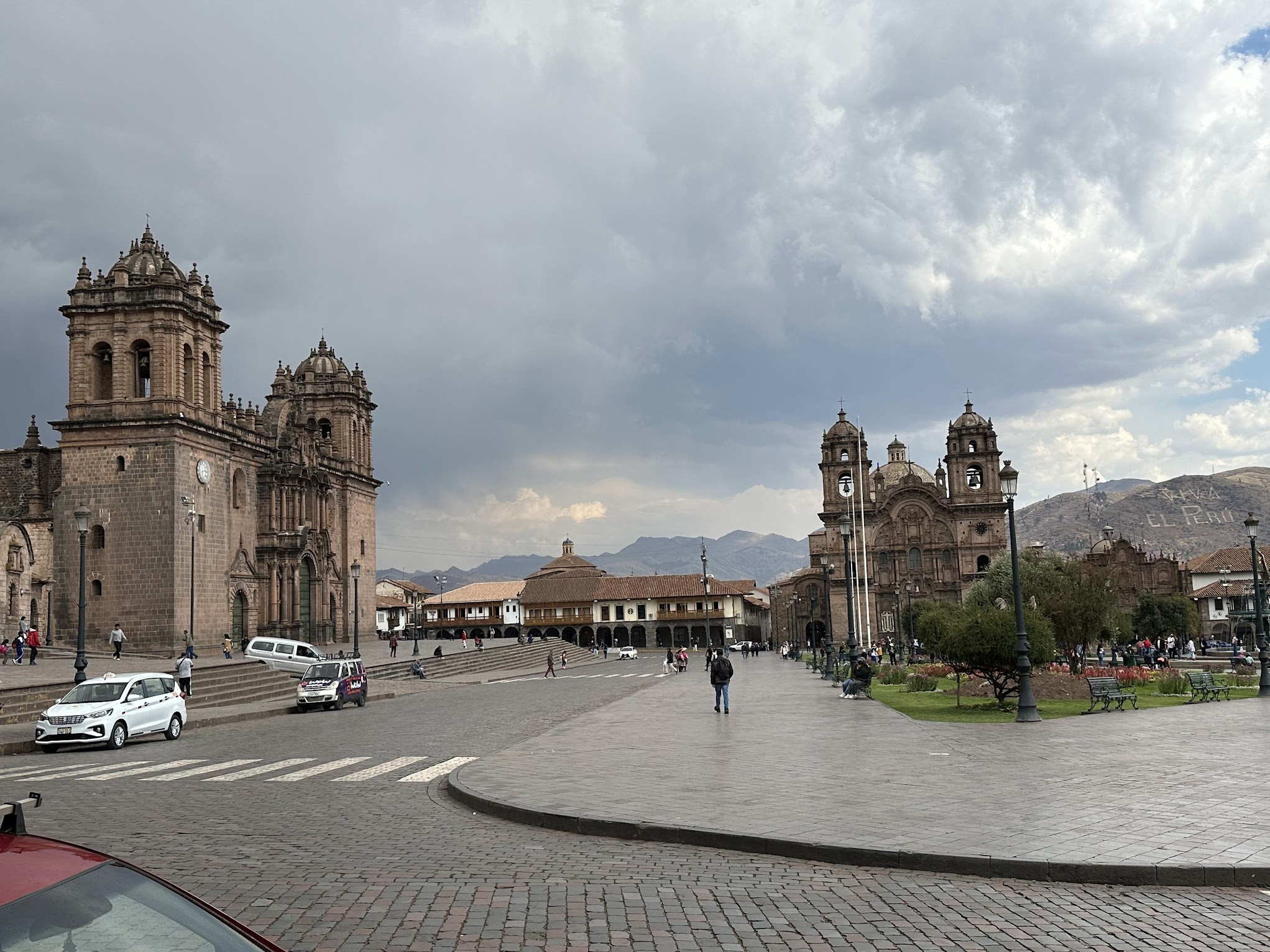
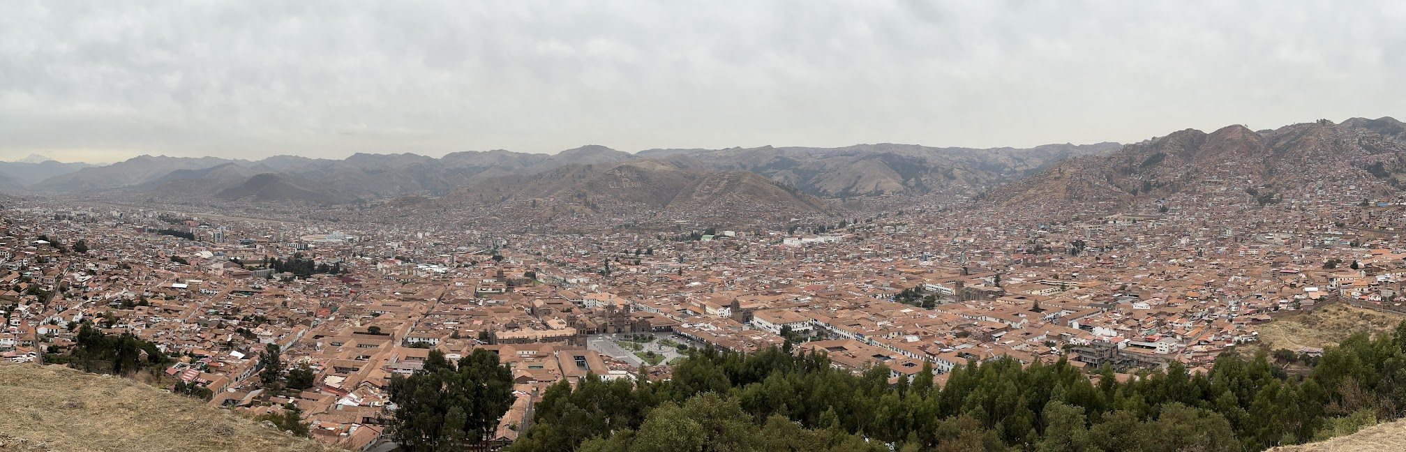
I was scheduled to depart around 9 PM for JFK via Lima, so this was my last day in Cusco. I had already done some sightseeing in Cusco on my first day and half. On this day, I decided to visit some of the museums I had missed earlier and do some shopping.
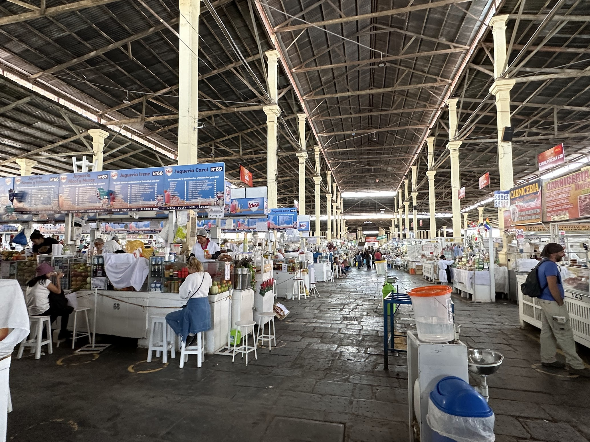
After breakfast, few folks from our tour group and I ambled over to San Pedro market, full of traditional souvenirs, food and fruit juice stalls, accessories for traditional costumes, fabrics, stalls of healers and witchcraft, herbal tinctures, ointments and all sort of knick-knack. We had a huge glass of fruit juice for ~2$.
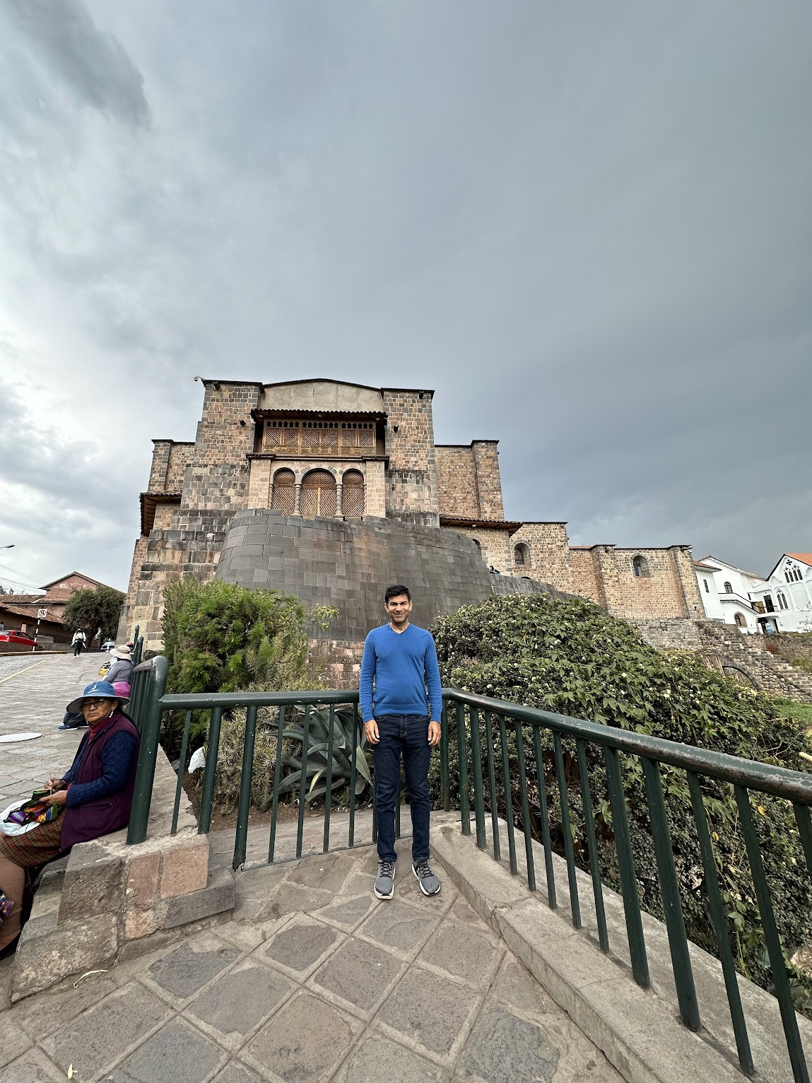
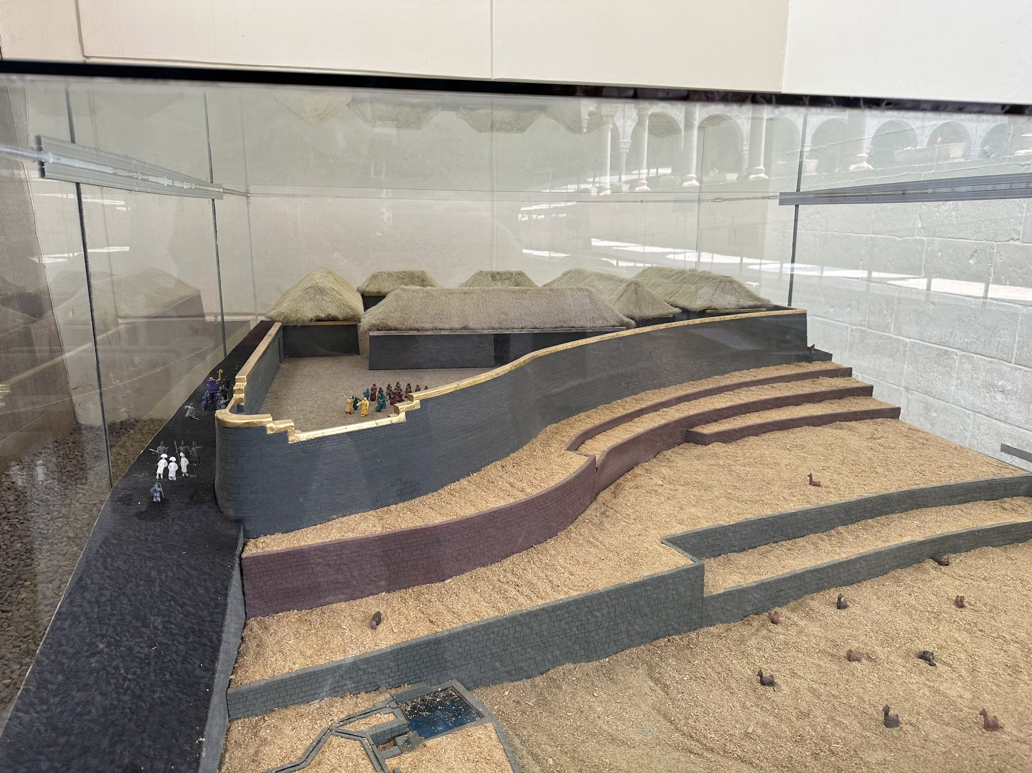
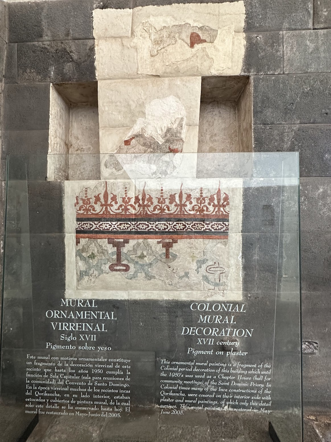
From San Pedro market, I walked over to the Qorikancha museum. The Qorikancha (The Golden Temple,” in Quechua) was the most important temple in the Inca Empire. Most of the temple was destroyed after the Spanish conquest, as settlers took it apart to build their own churches and residences. Much of its stonework was used as the foundation for the seventeenth-century Santo Domingo Convent. Part of the original outer wall of the Qorikancha, with its distinctive carefully carved dark stone can still be seen.
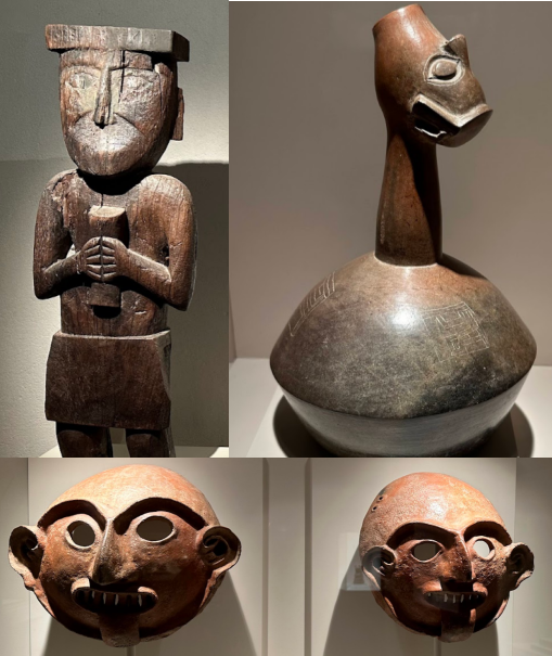
The museum exhibits ceramic fragments and samples of metallurgy, textiles, paintings, sculptures, musical instruments from the Incas and pre-Inca cultures. Two exhibits I found the most interesting were a model of how the Qoricancha originally looked like, and a portion of an original Inca wall partially covered over by plaster and murals by the Spanish.
After the Qoricancha museum, I visited the Archiepiscopal Palace of Cuzco, a colonial mansion converted into a museum that houses several pieces of art, combining European and indigenous art styles with local motifs such as the natural landscape, plants and animals of the region around Peru. I found this depiction of virgin Mary particularly interesting
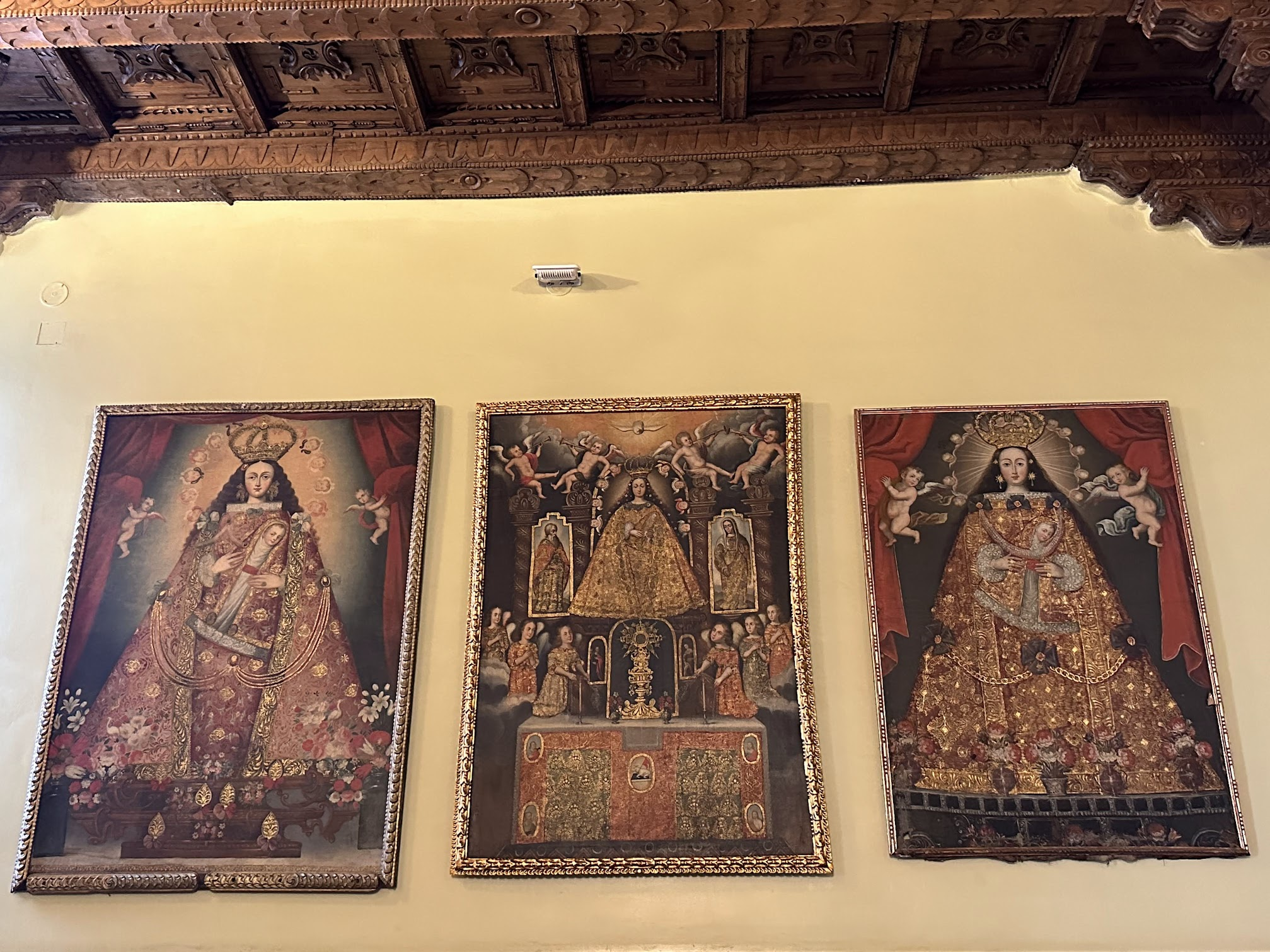
Notice the triangular depiction of her dress, symbolic of mountains. This was an attempt to reconcile Christian ideology with Andean concepts and landscape features to ease the adoption of Christian symbols and imagery.
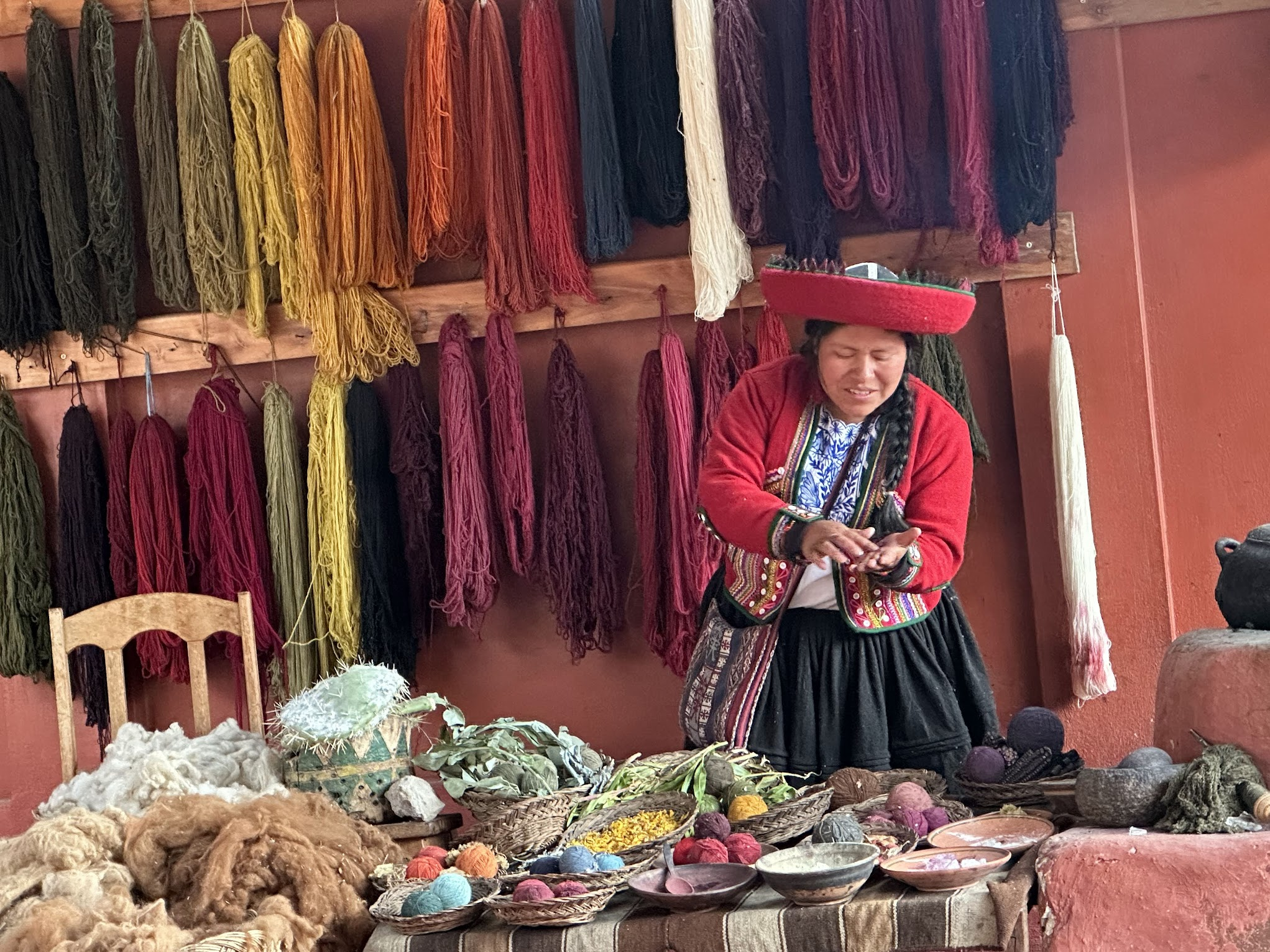
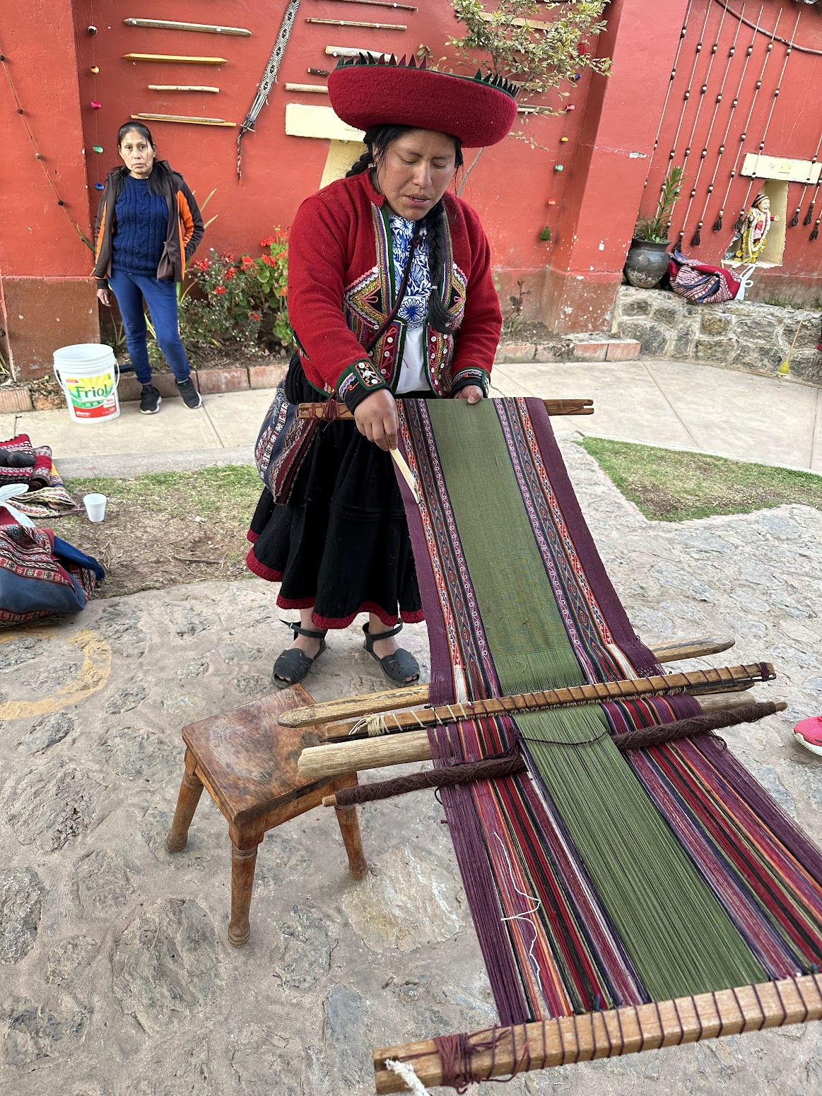
Next up was buying a couple of gift items for friends and family. The streets of Cusco are full of shops selling very cheap Alpaca textiles, that look and feel good to an untrained eye and touch. The same items cost 3-4 times more in more official-looking stores. I couldn’t understand the reason for such a big price difference when the quality seemed similar, although the design and finish of the textiles is noticeable better in the more expensive stores. I ducked into an expensive store that had a sale going on, and asked the store owner the reason for the price difference. She explained it had to do with durability and quality of the material used in the textile. According to her, the cheaper stuff wouldn’t last more than 2-3 rounds of laundry, while the pricier textiles are a lot more durable.
You’ll see young people hawking cheap massages (for as little as $10 for an hour long massage) everywhere on the streets of Cusco. I wondered how these massages compare with the excellent one I got in Aguas Calientes. So, I followed a lad back through some alleys to a “massage parlour”, which was a large room with cubicle like sections along the walls. Each cubicle had a bed with a curtain in front. The lady running the parlor immediately tried to sign me up for a much more expensive massage, however I insisted on getting the bare-bones one being advertised on the street. She reluctantly agreed. The quality of the massage was terrible. It don’t think the girl who gave me the massage had more than a few minutes of training before being let loose on customers. I recommend avoiding the cheap street massages and going to a proper massage parlor. You’ll pay a bit more (~25-30$) for a massage, but it will be worth it.
That was all that I had time for. I said good bye to the people in my group and took a taxi to the Cusco airport. The taxi driver tried to overcharge me, but I negotiated the price down. At Lima, the security check and immigration controls were super chaotic and slow. I would have missed my flight if I hadn’t pleaded with the security people to let me cut ahead in the line.
Overall, I had an incredible time in Peru. I met some lovely people, ate delicious food, challenged myself a bit on a spectacular trek through the Andes, and learnt about the history and culture of the Incas and the civilizations who came before them. Machu Picchu lived up to the hype every bit and then some.
That’s it! Hope you found this useful. Please leave a comment if you did! 🙂
Ankur- so enjoyed reading about your adventures in Peru! Working with a Peruvian CEO who now wants me to send over this blog for more reading! Thanks for sharing!
Thank you very much and glad you enjoyed reading the blog and found it useful!
Wonderful reading. Felt like i was right there. Photographs were great.
Thanks so much Holly!!
What an amazing article about the Quarry Trail and Machu Picchu! I loved how you presented this lesser known but equally impressive alternative to the classic Inca Trail. The detailed descriptions of the landscapes and the hiking experience really make the Quarry Trail seem like a unique adventure, full of natural beauty and history.
What an informative article about the Quarry Trail and its connection to Machu Picchu! I loved how you presented this alternative route, which offers a unique and less crowded experience compared to the Inca Trail. Your descriptions of the breathtaking scenery and the history behind the trek really capture the magic of this journey.